Randonnée Marche Tellin - Balade à Resteigne - Photo

Balade à Resteigne

 Desrumaux
Desrumaux

Utilisateur GUIDE

© OpenStreetMap contributors
Longueur
Longueur
12,6 km
Altitude max
Altitude max
288 m
Dénivelé positif
Dénivelé positif
273 m
Km-Effort
Km-Effort  
16,2 km
Altitude min
Altitude min
169 m
Dénivelé négatif
Dénivelé négatif
273 m
Boucle
Boucle
Oui
Date de création :
2017-05-22 00:00:00.0
Dernière modification :
2017-05-22 00:00:00.0

(1 Avis)

Marche
Marche
3h32
Difficulté : Facile

Scannez ce code QR pour ouvrir la randonnée dans l'application SityTrail

Application GPS de randonnée GRATUITE

Logo SityTrail SityTrail

IGN / Instituts géographiques

Télécharger SityTrail sur l'App Store Télécharger SityTrail sur Google Play

Logo SityTrail SityTrail World

Le monde est à vous

Télécharger SityTrail sur l'App Store Télécharger SityTrail sur Google Play Télécharger SityTrail sur Huawei AppGallery

À propos

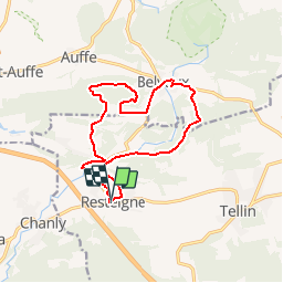
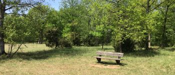
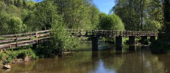
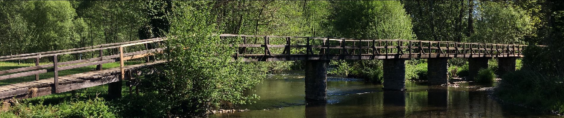
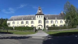
Randonnée Marche de 12,6 km à découvrir à Wallonie, Luxembourg, Tellin. Cette randonnée est proposée par Desrumaux.

Description

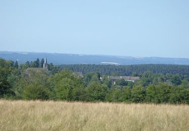
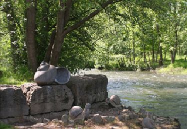
Balade dans la belle entité de Tellin dans la province du Luxembourg.
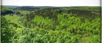
De Resteigne à Belvaux par la réserve naturelle Lesse et Lomme et le point de vue du Rocher qui pic. Départ: église de Resteigne

Profil altimétrique

Photos

Points d'intérêt

Point d'intérêt Tellin - Resteigne - Photo
Desrumaux
TELLIN 
Point d'intérêt Rochefort - Resteigne - Photo
Desrumaux
ROCHEFORT 
Point d'intérêt Rochefort - Resteigne - Photo
Desrumaux
ROCHEFORT 
Point d'intérêt Tellin - Resteigne - Photo
Desrumaux
TELLIN 
Point d'intérêt Tellin - Resteigne - Photo
Desrumaux
TELLIN 

Localisation

Pays :
Belgique
Région :
Wallonie
Département/Province :
Luxembourg
Commune :
Tellin
Localité :
Resteigne
Départ:(Dec)
Départ:(UTM)
655766 ; 5550104 (31U) N.

Commentaires

Veuillez vous connecter pour laisser un commentaire ou une note


Randonnées à proximité

Randonnée Marche Wellin - RB-Lu-25_Wellin - Photo
Marche
PRO

Marche

Très facile
(5)
Wellin, Wallonie, Luxembourg, Belgique
26 km | 33 km-effort
6h 46min
Oui
Randonnée Marche Rochefort - Nature - Le Belvédère de Han-sur-Lesse - Photo
Marche
PRO

Marche

Difficile
(16)
Rochefort, Wallonie, Namur, Belgique
4,8 km | 6,3 km-effort
1h 20min
Oui
Randonnée Marche Tellin - Tellin. Natura 2000, des sites qui valent le détour ! Lx 7 - Photo
Marche
GUIDE+

Marche

Moyen
(6)
Tellin, Wallonie, Luxembourg, Belgique
9,6 km | 11,9 km-effort
1h 30min
Oui
Randonnée Marche Wellin - Wellin - Wéry_Variante (WE 06) - Photo
Marche
GUIDE+

Marche

Difficile
(5)
Wellin, Wallonie, Luxembourg, Belgique
11,4 km | 15,5 km-effort
3h 30min
Oui
Randonnée Marche Rochefort - RB-Na-07_Han-sur-Lesse_via-racc - Photo
Marche
PRO

Marche

Facile
(9)
Rochefort, Wallonie, Namur, Belgique
18,4 km | 24 km-effort
4h 59min
Oui
Randonnée Marche Rochefort - Circuit découverte - La nature autour de Belvaux - Photo
Marche
PRO

Marche

Facile
(8)
Rochefort, Wallonie, Namur, Belgique
6,5 km | 8,4 km-effort
1h 20min
Oui
Randonnée Marche Rochefort - Nature : Belvaux - Les Rouges-Gorges - Photo
Marche
PRO

Marche

Facile
(13)
Rochefort, Wallonie, Namur, Belgique
5,8 km | 7,6 km-effort
1h 20min
Oui
Randonnée Marche Rochefort - Nature - Circuit découverte Han-sur-Lesse - Photo
Marche
PRO

Marche

Très facile
(15)
Rochefort, Wallonie, Namur, Belgique
4,8 km | 5,8 km-effort
1h 15min
Oui
Randonnée Marche Rochefort - Nature : Belvaux - Les Rouges-Gorges - Photo
Marche
PRO

Marche

Facile
(3)
Rochefort, Wallonie, Namur, Belgique
5,8 km | 7,6 km-effort
1h 20min
Oui


Fermer
Mes abonnements