Randonnée Marche Deville - deville monthermé - Photo

deville monthermé

 japy54
japy54

Utilisateur

© OpenStreetMap contributors
Longueur
Longueur
18,8 km
Altitude max
Altitude max
409 m
Dénivelé positif
Dénivelé positif
490 m
Km-Effort
Km-Effort  
25 km
Altitude min
Altitude min
141 m
Dénivelé négatif
Dénivelé négatif
488 m
Boucle
Boucle
Oui
Date de création :
2017-06-01 00:00:00.0
Dernière modification :
2017-06-01 00:00:00.0

(0 Avis)

Marche
Marche
4h53
Difficulté : Difficile

Scannez ce code QR pour ouvrir la randonnée dans l'application SityTrail

Application GPS de randonnée GRATUITE

Logo SityTrail SityTrail

IGN / Instituts géographiques

Télécharger SityTrail sur l'App Store Télécharger SityTrail sur Google Play

Logo SityTrail SityTrail World

Le monde est à vous

Télécharger SityTrail sur l'App Store Télécharger SityTrail sur Google Play Télécharger SityTrail sur Huawei AppGallery

À propos

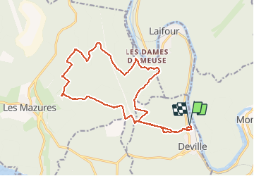
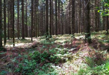
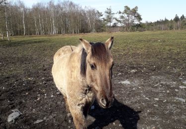
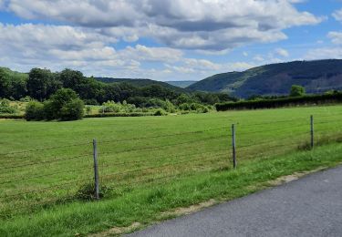
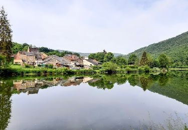
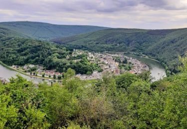
Randonnée Marche de 18,8 km à découvrir à Grand Est, Ardennes, Deville. Cette randonnée est proposée par japy54.

Profil altimétrique

Localisation

Pays :
France
Région :
Grand Est
Département/Province :
Ardennes
Commune :
Deville
Localité :
Unknown
Départ:(Dec)
Départ:(UTM)
622430 ; 5527012 (31U) N.

Randonnées à proximité

Randonnée Marche Monthermé - De Monthermé à Bogny sur Meuse par les sentiers de crêtes - Photo
Marche
tracegps

Marche

Difficile
(2)
Monthermé, Grand Est, Ardennes, France
14,6 km | 23 km-effort
5h 0min
Oui
Randonnée Marche Bogny-sur-Meuse - La promenade du Liry et des Quatre Fils Aymon - Photo
Marche
GUIDE
Desrumaux

Marche

Moyen
(1)
Bogny-sur-Meuse, Grand Est, Ardennes, France
11,4 km | 16,9 km-effort
3h 0min
Oui
Randonnée Marche Revin - Laifour-Montherme - Photo
Marche
Eric_Alu

Marche

Difficile
(1)
Revin, Grand Est, Ardennes, France
21 km | 30 km-effort
8h 8min
Non
Randonnée Marche Monthermé - La roche 7H Monthermé  - Photo
Marche
macrid

Marche

Moyen
Monthermé, Grand Est, Ardennes, France
5,9 km | 9 km-effort
2h 24min
Oui
Randonnée Marche Monthermé - les woiries  mercredi  - Photo
Marche
Nicolesophie08

Marche

Moyen
Monthermé, Grand Est, Ardennes, France
9,6 km | 12,7 km-effort
3h 37min
Non
Randonnée Marche Monthermé - Monthermé 22,7 km tour des rochers  - Photo
Marche
GUIDE
rvapeldo

Marche

Difficile
Monthermé, Grand Est, Ardennes, France
23 km | 36 km-effort
8h 20min
Oui
Randonnée Marche Monthermé - Monthermé - Photo
Marche
mjh

Marche

Moyen
Monthermé, Grand Est, Ardennes, France
16 km | 21 km-effort
3h 46min
Oui
Randonnée Marche Revin - de Layfour à Anchamps - Photo
Marche
jeannine grandjean

Marche

Très difficile
Revin, Grand Est, Ardennes, France
15,2 km | 20 km-effort
4h 1min
Non
Randonnée Marche Monthermé - AUTOUR DE MONTHERMÉ, la boucle de la Meuse - Photo
Marche
jeannine grandjean

Marche

Très difficile
Monthermé, Grand Est, Ardennes, France
14,9 km | 24 km-effort
5h 5min
Oui


Fermer
Mes abonnements