Randonnée Marche Mauzac - Mauzac (la Grange) - Photo
 pidjam
pidjam

Utilisateur

© OpenStreetMap contributors
Longueur
Longueur
11,1 km
Altitude max
Altitude max
286 m
Dénivelé positif
Dénivelé positif
219 m
Km-Effort
Km-Effort  
14,1 km
Altitude min
Altitude min
179 m
Dénivelé négatif
Dénivelé négatif
219 m
Boucle
Boucle
Oui
Date de création :
2017-08-14 00:00:00.0
Dernière modification :
2017-08-14 00:00:00.0

(0 Avis)

Marche
Marche
3h07
Difficulté : Facile

Scannez ce code QR pour ouvrir la randonnée dans l'application SityTrail

Application GPS de randonnée GRATUITE

Logo SityTrail SityTrail

IGN / Instituts géographiques

Télécharger SityTrail sur l'App Store Télécharger SityTrail sur Google Play

Logo SityTrail SityTrail World

Le monde est à vous

Télécharger SityTrail sur l'App Store Télécharger SityTrail sur Google Play Télécharger SityTrail sur Huawei AppGallery

À propos

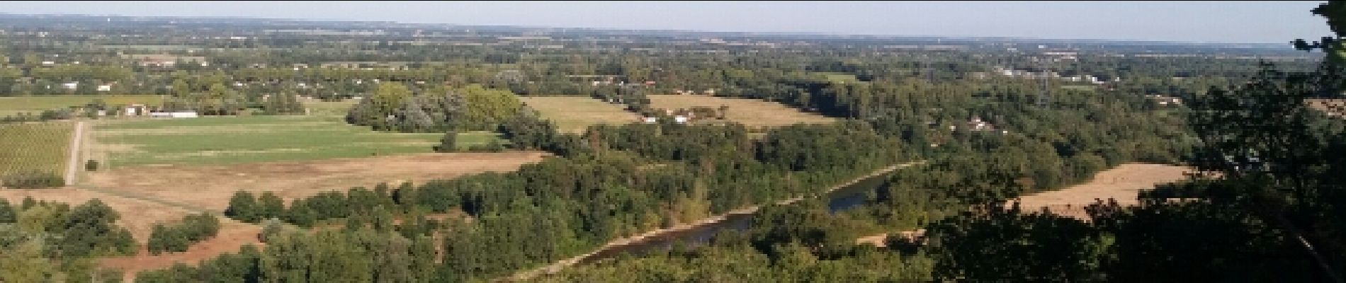
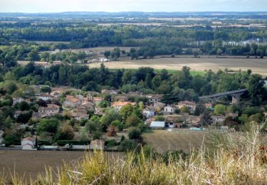
Randonnée Marche de 11,1 km à découvrir à Occitanie, Haute-Garonne, Mauzac. Cette randonnée est proposée par pidjam.

Description

circuit autour de Mauzac (reconnu en aout 2017).
Attention à la descente finale (très pentue et potentiellement glissante bien que ce soit un GR)
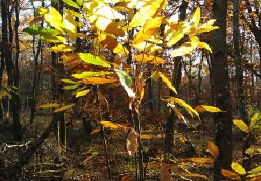
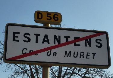
Profil altimétrique

Photos

Localisation

Pays :
France
Région :
Occitanie
Département/Province :
Haute-Garonne
Commune :
Mauzac
Localité :
Unknown
Départ:(Dec)
Départ:(UTM)
361573 ; 4803984 (31T) N.

Randonnées à proximité

Randonnée Marche Muret - Estantens st amans - Photo
Marche
pidjam

Marche

Facile
Muret, Occitanie, Haute-Garonne, France
10,3 km | 13,2 km-effort
2h 8min
Oui
Randonnée Marche Muret - Amans JP un - Photo
Marche
ClubAgeHeureux

Marche

Difficile
Muret, Occitanie, Haute-Garonne, France
9,1 km | 12 km-effort
2h 33min
Oui
Randonnée Marche Eaunes - EAUNES-CHAPELLE ST AMANS en boucle - Photo
Marche
chrisgps

Marche

Facile
Eaunes, Occitanie, Haute-Garonne, France
10,9 km | 14,3 km-effort
2h 49min
Oui
Randonnée Marche Eaunes - EAUNES-CHAPELLE ST AMANS en boucle - Photo
Marche
chrisgps

Marche

Moyen
Eaunes, Occitanie, Haute-Garonne, France
11 km | 14,5 km-effort
2h 34min
Oui
Randonnée V.T.T. Longages - viagarona2 - Photo
V.T.T.
ra2000

V.T.T.

Moyen
Longages, Occitanie, Haute-Garonne, France
50 km | 59 km-effort
7h 40min
Non
Randonnée Marche Mauzac - Mauzac-St Genies - Photo
Marche
pidjam

Marche

Facile
Mauzac, Occitanie, Haute-Garonne, France
10,8 km | 14,3 km-effort
3h 20min
Oui
Randonnée Marche Muret - De l'Aouach à St Amans - Muret - Photo
Marche
tracegps

Marche

Moyen
Muret, Occitanie, Haute-Garonne, France
9,1 km | 12,6 km-effort
2h 30min
Oui
Randonnée Marche Le Fauga - Boucle L'Aouach Estantens - Photo
Marche
tracegps

Marche

Moyen
Le Fauga, Occitanie, Haute-Garonne, France
11,5 km | 15,9 km-effort
3h 30min
Oui
Randonnée Marche Lavernose-Lacasse - De Lavernose à Noé et retour - Photo
Marche
tracegps

Marche

Moyen
Lavernose-Lacasse, Occitanie, Haute-Garonne, France
18,6 km | 20 km-effort
5h 0min
Non


Fermer
Mes abonnements