![](/images/other/stat-length.png)
![Randonnée Marche Rueil-Malmaison - Rueil nature via la coulée verte - Photo](https://media.geolcdn.com/t/1900/400/ext.pjpeg?maxdim=2&url=https%3A%2F%2Fstatic1.geolcdn.com%2Fsiteimages%2Fupload%2Ffiles%2F1553511878bg_sport_marche.png)
Rueil nature via la coulée verte
FRayssac
Utilisateur
![Longueur](/images/other/stat-length.png)
Longueur
8,7 km
![Altitude max](https://static1.geolcdn.com/siteimages/upload/files/1508320355ic_sort_altitude_max_24dp.png)
Altitude max
101 m
![Dénivelé positif](https://static1.geolcdn.com/siteimages/upload/files/1508320355ic_sort_den_pos_24dp.png)
Dénivelé positif
119 m
![Km-Effort](/images/other/stat-length.png)
Km-Effort
10,3 km
![Altitude min](https://static1.geolcdn.com/siteimages/upload/files/1508320355ic_sort_altitude_min_24dp.png)
Altitude min
16 m
![Dénivelé négatif](https://static1.geolcdn.com/siteimages/upload/files/1508320355ic_sort_den_neg_24dp.png)
Dénivelé négatif
119 m
![Boucle](https://static1.geolcdn.com/siteimages/upload/files/16400158638029165_repeat_loop_refresh_sync_direction_icon.png)
Boucle
Oui
Date de création :
2017-09-10 00:00:00.0
Dernière modification :
2017-09-10 00:00:00.0
![Marche](https://static1.geolcdn.com/sitytour/trail-icons/101.png)
1h56
Difficulté : Moyen
![Scannez ce code QR pour ouvrir la randonnée dans l'application SityTrail](https://capi.geolives.com/qq0zvz2zws4bq2lad0pu/sitytour/trails/826674/qr.png?size=200)
Application GPS de randonnée GRATUITE
À propos
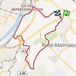
Randonnée Marche de 8,7 km à découvrir à Île-de-France, Hauts-de-Seine, Rueil-Malmaison. Cette randonnée est proposée par FRayssac.
Description
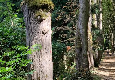
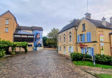
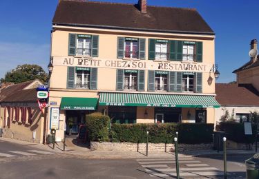
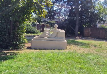
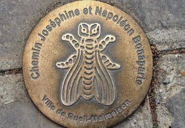
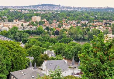
Rueil centre, le Bois Préau, lisière sud nous de Saint Cucufa, chemins de la coulée verte, bords de Seine et retour Rueil Centre.
Localisation
Pays :
France
Région :
Île-de-France
Département/Province :
Hauts-de-Seine
Commune :
Rueil-Malmaison
Localité :
Unknown
Départ:(Dec)
Départ:(UTM)
439983 ; 5414344 (31U) N.
Commentaires
Randonnées à proximité
![Randonnée Marche Bougival - Bougival-Saint-cucufa reel - Photo](https://media.geolcdn.com/t/375/260/ext.jpg?maxdim=2&url=https%3A%2F%2Fmedia.geolcdn.com%2Ff%2Ff8214235-f5e3-4ba5-8084-044ba7cbf132.jpeg)
![Marche Marche](https://static1.geolcdn.com/sitytour/trail-icons/101.png)
Bougival-Saint-cucufa reel
Marche
(1)
Bougival,
Île-de-France,
Yvelines,
France
![](/images/other/stat-length.png)
7,7 km | 10,3 km-effort
2h 29min
![](https://static1.geolcdn.com/siteimages/upload/files/16400158638029165_repeat_loop_refresh_sync_direction_icon.png)
Oui
![Randonnée Marche Boulogne-Billancourt - Parc de St Cloud et forêt de Fausses Reposes - Photo](https://media.geolcdn.com/t/375/260/ext.jpg?maxdim=2&url=https%3A%2F%2Fservices.sitytrail.com%2FGeolivesWS%2FDownloadMedia.ashx%3FTrailID%3D106613%26Media%3D11213_2.jpg)
![Marche Marche](https://static1.geolcdn.com/sitytour/trail-icons/101.png)
Parc de St Cloud et forêt de Fausses Reposes
Marche
Moyen
(1)
Boulogne-Billancourt,
Île-de-France,
Hauts-de-Seine,
France
![](/images/other/stat-length.png)
18,2 km | 23 km-effort
4h 30min
![](https://static1.geolcdn.com/siteimages/upload/files/16400158638029165_repeat_loop_refresh_sync_direction_icon.png)
Non
![Randonnée A pied Rueil-Malmaison - La Seine impressioniste Etape 1 Rueil - Conflans Ste Honorine - Photo](https://media.geolcdn.com/t/375/260/ext.jpg?maxdim=2&url=https%3A%2F%2Fmedia.geolcdn.com%2Ff%2Fc514a42a-e126-47ef-85f0-d75f60d63c7a.jpg)
![A pied A pied](https://static1.geolcdn.com/sitytour/trail-icons/100.png)
La Seine impressioniste Etape 1 Rueil - Conflans Ste Honorine
A pied
Moyen
Rueil-Malmaison,
Île-de-France,
Hauts-de-Seine,
France
![](/images/other/stat-length.png)
32 km | 37 km-effort
8h 22min
![](https://static1.geolcdn.com/siteimages/upload/files/16400158638029165_repeat_loop_refresh_sync_direction_icon.png)
Non
![Randonnée Marche Vaucresson - GRP CV-IDF 01R Vaucresson à L'Étang-la-Ville - Photo](https://media.geolcdn.com/t/375/260/ext.jpg?maxdim=2&url=https%3A%2F%2Fmedia.geolcdn.com%2Ff%2F784469fa-7dc6-44b2-a81d-cfd8e4ef0614.jpg)
![Marche Marche](https://static1.geolcdn.com/sitytour/trail-icons/101.png)
GRP CV-IDF 01R Vaucresson à L'Étang-la-Ville
Marche
Facile
Vaucresson,
Île-de-France,
Hauts-de-Seine,
France
![](/images/other/stat-length.png)
11,9 km | 15,3 km-effort
3h 29min
![](https://static1.geolcdn.com/siteimages/upload/files/16400158638029165_repeat_loop_refresh_sync_direction_icon.png)
Non
![Randonnée Vélo de route Paris - Bois de Boulogne Versaille - Photo](https://media.geolcdn.com/t/375/260/ext.jpg?maxdim=2&url=https%3A%2F%2Fstatic1.geolcdn.com%2Fsiteimages%2Fupload%2Ffiles%2F1524743154velo.jpg)
![Vélo de route Vélo de route](https://static1.geolcdn.com/sitytour/trail-icons/201.png)
Bois de Boulogne Versaille
Vélo de route
Facile
(1)
Paris,
Île-de-France,
Paris,
France
![](/images/other/stat-length.png)
15,2 km | 18,2 km-effort
1h 29min
![](https://static1.geolcdn.com/siteimages/upload/files/16400158638029165_repeat_loop_refresh_sync_direction_icon.png)
Non
![Randonnée Marche La Celle-Saint-Cloud - *De Bougival à Rueil Malmaison - Photo](https://media.geolcdn.com/t/375/260/ext.jpg?maxdim=2&url=https%3A%2F%2Fstatic1.geolcdn.com%2Fsiteimages%2Fupload%2Ffiles%2F1553511878bg_sport_marche.png)
![Marche Marche](https://static1.geolcdn.com/sitytour/trail-icons/101.png)
*De Bougival à Rueil Malmaison
Marche
Difficile
(1)
La Celle-Saint-Cloud,
Île-de-France,
Yvelines,
France
![](/images/other/stat-length.png)
14,4 km | 17,5 km-effort
3h 58min
![](https://static1.geolcdn.com/siteimages/upload/files/16400158638029165_repeat_loop_refresh_sync_direction_icon.png)
Non
![Randonnée Marche Rueil-Malmaison - De Rueil Malmaison aux Serres d'Auteuil via Suresnes - Photo](https://media.geolcdn.com/t/375/260/ext.jpg?maxdim=2&url=https%3A%2F%2Fmedia.geolcdn.com%2Ff%2F69c5aa69-7a4f-4e7d-be07-682d5ba1172b.jpg)
![Marche Marche](https://static1.geolcdn.com/sitytour/trail-icons/101.png)
De Rueil Malmaison aux Serres d'Auteuil via Suresnes
Marche
Très facile
Rueil-Malmaison,
Île-de-France,
Hauts-de-Seine,
France
![](/images/other/stat-length.png)
22 km | 26 km-effort
5h 3min
![](https://static1.geolcdn.com/siteimages/upload/files/16400158638029165_repeat_loop_refresh_sync_direction_icon.png)
Non
![Randonnée Marche Rueil-Malmaison - Domaine Malmaison - Cité jardin Suresnes - Boulogne - Serres d'Auteuil - Photo](https://media.geolcdn.com/t/375/260/ext.jpg?maxdim=2&url=https%3A%2F%2Fmedia.geolcdn.com%2Ff%2Ff35951a9-b213-4c85-9bfa-cc06ec3dd722.jpg)
![Marche Marche](https://static1.geolcdn.com/sitytour/trail-icons/101.png)
Domaine Malmaison - Cité jardin Suresnes - Boulogne - Serres d'Auteuil
Marche
Facile
Rueil-Malmaison,
Île-de-France,
Hauts-de-Seine,
France
![](/images/other/stat-length.png)
22 km | 27 km-effort
4h 54min
![](https://static1.geolcdn.com/siteimages/upload/files/16400158638029165_repeat_loop_refresh_sync_direction_icon.png)
Non
![Randonnée Marche Rueil-Malmaison - De rueil Malmaison à St Germain en Laye - Photo](https://media.geolcdn.com/t/375/260/ext.jpg?maxdim=2&url=https%3A%2F%2Fmedia.geolcdn.com%2Ff%2F2cfb8298-4a88-4640-a039-54786d423968.jpg)
![Marche Marche](https://static1.geolcdn.com/sitytour/trail-icons/101.png)
De rueil Malmaison à St Germain en Laye
Marche
Moyen
Rueil-Malmaison,
Île-de-France,
Hauts-de-Seine,
France
![](/images/other/stat-length.png)
28 km | 32 km-effort
5h 56min
![](https://static1.geolcdn.com/siteimages/upload/files/16400158638029165_repeat_loop_refresh_sync_direction_icon.png)
Non