Randonnée Marche Stoumont - WATER TREK - le Parcours des Ruisseaux - 7. TARGNON - FRANCORCHAMPS - Photo

WATER TREK - le Parcours des Ruisseaux - 7. TARGNON - FRANCORCHAMPS

 aqualis
aqualis

Utilisateur

© OpenStreetMap contributors
Longueur
Longueur
22 km
Altitude max
Altitude max
506 m
Dénivelé positif
Dénivelé positif
794 m
Km-Effort
Km-Effort  
31 km
Altitude min
Altitude min
188 m
Dénivelé négatif
Dénivelé négatif
514 m
Boucle
Boucle
Non
Date de création :
2019-06-13 12:17:50.838
Dernière modification :
2019-12-16 11:20:03.496

(0 Avis)

Marche
Marche
6h29
Difficulté : Difficile

Scannez ce code QR pour ouvrir la randonnée dans l'application SityTrail

Application GPS de randonnée GRATUITE

Logo SityTrail SityTrail

IGN / Instituts géographiques

Télécharger SityTrail sur l'App Store Télécharger SityTrail sur Google Play

Logo SityTrail SityTrail World

Le monde est à vous

Télécharger SityTrail sur l'App Store Télécharger SityTrail sur Google Play Télécharger SityTrail sur Huawei AppGallery

À propos

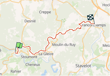
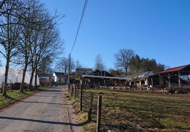
Randonnée Marche de 22 km à découvrir à Wallonie, Liège, Stoumont. Cette randonnée est proposée par aqualis.

Description

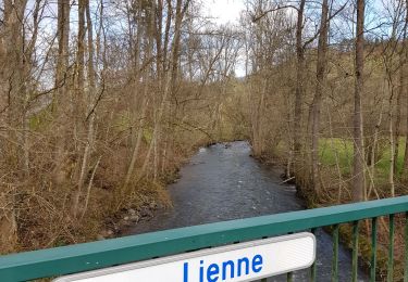
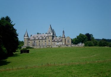
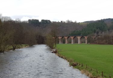
Le parcours est essentiellement tracé sur chemins et sentiers boisés. Vous traverserez plusieurs hameaux dominant la vallée de l’Amblève. Escarpé dans sa première partie, le parcours se présente en dents de scie jusqu’à FRANCORCHAMPS où l’arrivée se situe dans le village, à  /- 1 kilomètre du circuit automobile.

Profil altimétrique

Points d'intérêt

Point d'intérêt Stoumont - KM 01 - Photo
aqualis
STOUMONT 
Point d'intérêt Stoumont - KM 02 - Photo
aqualis
STOUMONT 
Point d'intérêt Stoumont - KM 03 - Photo
aqualis
STOUMONT 
Point d'intérêt Stoumont - KM 04 - Photo
aqualis
STOUMONT 
Point d'intérêt Stoumont - KM 05 - Photo
aqualis
STOUMONT 
Point d'intérêt Stoumont - CROIX - Photo
aqualis
STOUMONT 
Point d'intérêt Stoumont - km 06 - Photo
aqualis
STOUMONT 
Point d'intérêt Stoumont - km 07 - Photo
aqualis
STOUMONT 
Point d'intérêt Stoumont - km 08 - Photo
aqualis
STOUMONT 
Point d'intérêt Stoumont - km 09 - Photo
aqualis
STOUMONT 
Point d'intérêt Stoumont - km 10 - Photo
aqualis
STOUMONT 
Point d'intérêt Stoumont - km 11 - Photo
aqualis
STOUMONT 
Point d'intérêt Stoumont - km 12 - Photo
aqualis
STOUMONT 
Point d'intérêt Stoumont - km 13 - Photo
aqualis
STOUMONT 
Point d'intérêt Stoumont - km 14 - Photo
aqualis
STOUMONT 
Point d'intérêt Stoumont - km 15 - Photo
aqualis
STOUMONT 
Point d'intérêt Stoumont - km 16 - Photo
aqualis
STOUMONT 
Point d'intérêt Stavelot - km 17 - Photo
aqualis
STAVELOT 
Point d'intérêt Stavelot - km 18 - Photo
aqualis
STAVELOT 
Point d'intérêt Stavelot - km 19 - Photo
aqualis
STAVELOT 
Point d'intérêt Stavelot - km 20 - Photo
aqualis
STAVELOT 
Point d'intérêt Stavelot - km 21 - Photo
aqualis
STAVELOT 
Point d'intérêt Stavelot - arrivée - Photo
aqualis
STAVELOT 
Point d'intérêt Stoumont - borgoumont - Photo
aqualis
STOUMONT 
Point d'intérêt Stavelot - barbecue - Photo
aqualis
STAVELOT 
Point d'intérêt Stavelot - logement - Photo
aqualis
STAVELOT 
Point d'intérêt Stavelot - restauration - Photo
aqualis
STAVELOT 
Point d'intérêt Stoumont - restauration - Photo
aqualis
STOUMONT 
Point d'intérêt Stoumont - logement - Photo
aqualis
STOUMONT 
Point d'intérêt Stoumont - château de froidcour - Photo
aqualis
Point d'intérêt Stoumont - chapelle Ste Anne - Photo
aqualis
Point d'intérêt Stoumont - info tourisme - Photo
aqualis
STOUMONT 
Point d'intérêt Stavelot - info tourisme - Photo
aqualis
STAVELOT 

Localisation

Pays :
Belgique
Région :
Wallonie
Département/Province :
Liège
Commune :
Stoumont
Localité :
Lorcé
Départ:(UTM)
697338 ; 5588320 (31U) N.

Randonnées à proximité

Randonnée Marche Stoumont - Lorcé, Natura 2000 - Des sites qui valent le détour, Lg13 - Photo
Marche
GUIDE+

Marche

Facile
(6)
Stoumont, Wallonie, Liège, Belgique
6,1 km | 8,9 km-effort
1h 57min
Oui
Randonnée Marche Stoumont - RB-Lg-14_Chevron_via-racc - Photo
Marche
PRO

Marche

Très difficile
(5)
Stoumont, Wallonie, Liège, Belgique
17 km | 24 km-effort
5h 28min
Oui
Randonnée Marche Stoumont - RB-Lg-13_Stoumont - Photo
Marche
PRO

Marche

Très difficile
(11)
Stoumont, Wallonie, Liège, Belgique
23 km | 32 km-effort
7h 19min
Oui
Randonnée Marche Stoumont - Stoumont - P14 Promenade des sommets de la Lienne - Photo
Marche
GUIDE
mumu.larandonneuse

Marche

Moyen
(2)
Stoumont, Wallonie, Liège, Belgique
16,1 km | 23 km-effort
5h 11min
Oui
Randonnée Marche Stoumont - RB-PN-08B - La Gleise - Raccourcis 1 et 2 - Photo
Marche
PRO

Marche

Moyen
(2)
Stoumont, Wallonie, Liège, Belgique
13,9 km | 19,8 km-effort
4h 30min
Oui
Randonnée Marche Stoumont - La Gleize - P3 - Tour du Mont Saint-Victor - Photo
Marche
GUIDE
mumu.larandonneuse

Marche

Moyen
(2)
Stoumont, Wallonie, Liège, Belgique
15,8 km | 22 km-effort
5h 2min
Oui
Randonnée Marche Stoumont - RB-Lg-14_Chevron - Photo
Marche
PRO

Marche

Très difficile
(4)
Stoumont, Wallonie, Liège, Belgique
22 km | 30 km-effort
6h 53min
Oui
Randonnée Marche Stoumont - Tour Lorcé Chevron - Photo
Marche
fabrice.delfosse

Marche

Moyen
(1)
Stoumont, Wallonie, Liège, Belgique
16,7 km | 23 km-effort
3h 53min
Oui
Randonnée Marche Stoumont - lorcé  . suf la lienne  . Chevron . lorcé  - Photo
Marche
stef789

Marche

Très facile
(1)
Stoumont, Wallonie, Liège, Belgique
15,9 km | 22 km-effort
5h 41min
Oui


Fermer
Mes abonnements