Randonnée Marche Léau - Koesterburenwandeling - 6km (paarse wandelroute) - Photo

Koesterburenwandeling - 6km (paarse wandelroute)

 KristofDM
KristofDM

Utilisateur

© OpenStreetMap contributors
Longueur
Longueur
5,3 km
Altitude max
Altitude max
34 m
Dénivelé positif
Dénivelé positif
41 m
Km-Effort
Km-Effort  
5,8 km
Altitude min
Altitude min
21 m
Dénivelé négatif
Dénivelé négatif
40 m
Boucle
Boucle
Oui
Date de création :
2019-03-14 17:05:54.18
Dernière modification :
2019-03-14 17:05:54.204

(0 Avis)

Marche
Marche
1h18
Difficulté : Facile

Scannez ce code QR pour ouvrir la randonnée dans l'application SityTrail

Application GPS de randonnée GRATUITE

Logo SityTrail SityTrail

IGN / Instituts géographiques

Télécharger SityTrail sur l'App Store Télécharger SityTrail sur Google Play

Logo SityTrail SityTrail World

Le monde est à vous

Télécharger SityTrail sur l'App Store Télécharger SityTrail sur Google Play Télécharger SityTrail sur Huawei AppGallery

À propos

Randonnée Marche de 5,3 km à découvrir à Flandre, Brabant flamand, Léau. Cette randonnée est proposée par KristofDM.

Description

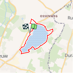
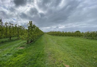
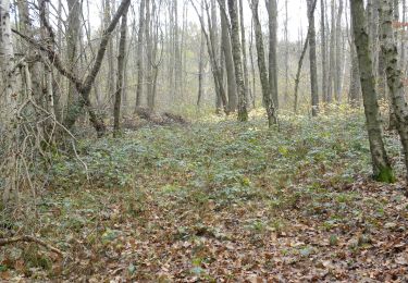
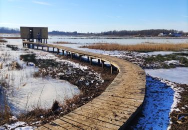
Wandeling in en rond het Provinciaal Domein Het Vinne.
Tijdens deze wandeling ontdek je de verschillende biotopen van Het Vinne en welke dieren en planten hier het liefst vertoeven. Herken je de afgebeelde dieren op de boomstammen, dan maak je elke maand kans op een leuke prijs! Een plannetje of wedstrijdformulier vind je in de inkomhal van de bistro of het bezoekerscentrum.

Profil altimétrique

Points d'intérêt

Point d'intérêt Léau - Uitkijktoren - Photo
KristofDM
Point d'intérêt Léau - Vogelkijkhut - Photo
KristofDM
Point d'intérêt Léau - Vogelkijkhut - Photo
KristofDM
Point d'intérêt Léau - Picknickhut - Photo
KristofDM
Point d'intérêt Léau - Campingplaats - Photo
KristofDM
Point d'intérêt Léau - Picknickhut - Photo
KristofDM
Point d'intérêt Léau - Picknickhut - Photo
KristofDM
Point d'intérêt Léau - Picknickhut - Photo
KristofDM
Point d'intérêt Léau - Picknickhut - Photo
KristofDM
Point d'intérêt Léau - Picknickhut - Photo
KristofDM
Point d'intérêt Léau - Bistro Het Vinne - Photo
KristofDM
Point d'intérêt Léau - Info - Photo
KristofDM
LÉAU 

Localisation

Pays :
Belgique
Région :
Flandre
Département/Province :
Brabant flamand
Commune :
Léau
Localité :
Léau
Départ:(Dec)
Départ:(UTM)
649525 ; 5634396 (31U) N.

Randonnées à proximité

Randonnée Marche Léau - Zoutleeuw 16 km - Photo
Marche
GUIDE
rvapeldo

Marche

Très facile
(1)
Léau, Flandre, Brabant flamand, Belgique
15,6 km | 16,5 km-effort
3h 59min
Oui
Randonnée A pied Saint-Trond - Staaien rode driehoek - Photo
A pied
PRO

A pied

Facile
Saint-Trond, Flandre, Limbourg, Belgique
9,4 km | 10,1 km-effort
2h 18min
Oui
Randonnée A pied Saint-Trond - Staaien oranje bol - Photo
A pied
PRO

A pied

Facile
Saint-Trond, Flandre, Limbourg, Belgique
6,4 km | 7 km-effort
1h 35min
Oui
Randonnée Marche Linter - Melkwezer Haspengouw GroteGetewandeling - 11 km RT - Photo
Marche
wandelroutes

Marche

Très facile
(1)
Linter, Flandre, Brabant flamand, Belgique
10,9 km | 11,8 km-effort
Inconnu
Oui
Randonnée Marche Léau - S-GR Hageland : Terhagen - Diest - Photo
Marche
dauzata

Marche

Moyen
Léau, Flandre, Brabant flamand, Belgique
25 km | 28 km-effort
6h 18min
Non
Randonnée A pied Nieuwerkerken - Gelukswandeling - Photo
A pied
PRO

A pied

Facile
Nieuwerkerken, Flandre, Limbourg, Belgique
9,1 km | 9,9 km-effort
2h 15min
Oui
Randonnée Marche Léau - Promenade romantique dans la Vallée de la Gette - Photo
Marche
GUIDE+

Marche

Facile
Léau, Flandre, Brabant flamand, Belgique
4,3 km | 4,7 km-effort
1h 4min
Oui
Randonnée Marche Saint-Trond - Saint-Trond - Photo
Marche
dyfy

Marche

Très facile
Saint-Trond, Flandre, Limbourg, Belgique
4,7 km | 5,1 km-effort
1h 28min
Oui
Randonnée Marche Saint-Trond - Fruitvalleiwandeling - bloesem - Photo
Marche
KristofDM

Marche

Moyen
(1)
Saint-Trond, Flandre, Limbourg, Belgique
10,2 km | 11 km-effort
2h 27min
Oui


Fermer
Mes abonnements