Randonnée Moteur Crozon-sur-Vauvre - 2011-12-04 12h38m20 - Photo
 xneb6gex
xneb6gex

Utilisateur

© OpenStreetMap contributors
Longueur
Longueur
90 km
Altitude max
Altitude max
448 m
Dénivelé positif
Dénivelé positif
1592 m
Km-Effort
Km-Effort  
111 km
Altitude min
Altitude min
245 m
Dénivelé négatif
Dénivelé négatif
1593 m
Boucle
Boucle
Oui
Date de création :
2014-12-10 00:00:00.0
Dernière modification :
2014-12-10 00:00:00.0

(0 Avis)

Moteur
Moteur
3h48
Difficulté : Difficile

Scannez ce code QR pour ouvrir la randonnée dans l'application SityTrail

Application GPS de randonnée GRATUITE

Logo SityTrail SityTrail

IGN / Instituts géographiques

Télécharger SityTrail sur l'App Store Télécharger SityTrail sur Google Play

Logo SityTrail SityTrail World

Le monde est à vous

Télécharger SityTrail sur l'App Store Télécharger SityTrail sur Google Play Télécharger SityTrail sur Huawei AppGallery

À propos

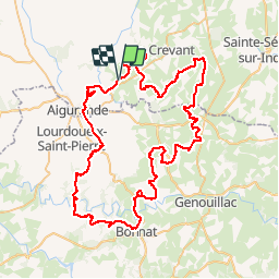
Randonnée Moteur de 90 km à découvrir à Centre-Val de Loire, Indre, Crozon-sur-Vauvre. Cette randonnée est proposée par xneb6gex.

Profil altimétrique

Localisation

Pays :
France
Région :
Centre-Val de Loire
Département/Province :
Indre
Commune :
Crozon-sur-Vauvre
Localité :
Unknown
Départ:(Dec)
Départ:(UTM)
414259 ; 5145714 (31T) N.

Randonnées à proximité

Randonnée Marche Crozon-sur-Vauvre - Circuit pédestre
Marche
fanthou

Marche

Facile
Crozon-sur-Vauvre, Centre-Val de Loire, Indre, France
11,3 km | 14,1 km-effort
3h 11min
Oui
Randonnée Marche Crevant - Circuit pédestre des croix et des châtaigniers - Photo
Marche
fanthou

Marche

Facile
Crevant, Centre-Val de Loire, Indre, France
6 km | 7,5 km-effort
1h 41min
Oui
Randonnée Marche Aigurande - Circuit pédestre
Marche
fanthou

Marche

Moyen
Aigurande, Centre-Val de Loire, Indre, France
7,7 km | 9,3 km-effort
2h 7min
Oui
Randonnée Marche Aigurande - SityTrail - Aigurande  - la Vauvre - Photo
Marche
GUIDE
jeanmarcMasson

Marche

Difficile
Aigurande, Centre-Val de Loire, Indre, France
12,3 km | 15,4 km-effort
3h 30min
Oui
Randonnée Marche Aigurande - Nature, verdure, bouchures - Photo
Marche
fanthou

Marche

Facile
Aigurande, Centre-Val de Loire, Indre, France
4,3 km | 5,4 km-effort
1h 13min
Oui
Randonnée Marche La Forêt-du-Temple - variante- Circuit des templiers - Photo
Marche
fanthou

Marche

Facile
La Forêt-du-Temple, Nouvelle-Aquitaine, Creuse, France
6,5 km | 7,8 km-effort
1h 45min
Oui
Randonnée Marche Aigurande - REDUIT_ aigurande - la Vauvre - Photo
Marche
fanthou

Marche

Facile
Aigurande, Centre-Val de Loire, Indre, France
5,6 km | 6,9 km-effort
1h 33min
Oui
Randonnée A pied La Forêt-du-Temple - Circuit FDT2 : Les Loups - Photo
A pied
fanthou

A pied

Facile
La Forêt-du-Temple, Nouvelle-Aquitaine, Creuse, France
11 km | 12,8 km-effort
2h 55min
Oui
Randonnée Marche La Forêt-du-Temple - Circuit des templiers - Photo
Marche
fanthou

Marche

Facile
La Forêt-du-Temple, Nouvelle-Aquitaine, Creuse, France
7,9 km | 9,3 km-effort
2h 7min
Oui


Fermer
Mes abonnements