Trail Walking Braine-l’Alleud - Braine-l’Alleud et de sa région - Photo

Braine-l’Alleud et de sa région

© OpenStreetMap contributors
Length
Length
7 km
Max alt
Max alt
117 m
Uphill gradient
Uphill gradient
100 m
Km-Effort
Km-Effort  
8.3 km
Min alt
Min alt
75 m
Downhill gradient
Downhill gradient
100 m
Boucle
Boucle
Yes
Creation date :
2019-01-15 16:25:55.057
Updated on :
2019-01-15 16:25:55.057

(0 Reviews)

Walking
Walking
1h47
Difficulty : Easy

Scan this QR Code to open this trail in the SityTrail application

FREE GPS app for hiking

Logo SityTrail SityTrail

IGN / Geographical institutes

Download SityTrail from the App Store Download SityTrail from Google Play

Logo SityTrail SityTrail World

The world is yours!

Download SityTrail from the App Store Download SityTrail from Google Play Download SityTrail on Huawei AppGallery

About

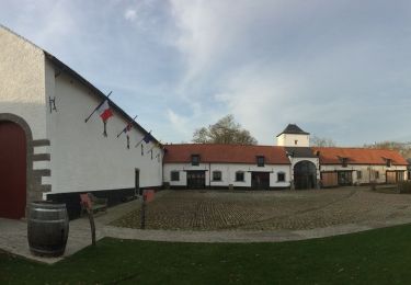
Trail Walking of 7 km to be discovered at Wallonia, Walloon Brabant, Braine-l’Alleud. This trail is proposed by henriantoine.

Description

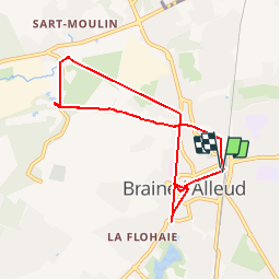
Départ (et arrivée) de la gare de Braine-l’Alleud, direction vers le viaduc et l’ancienne ligne 115 qui reliait Braine-l’Alleud à Tubize- Clabecq, environ 4 kilomètres sans danger sur un sentier avec un panorama unique.

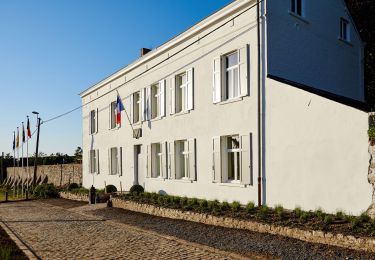
Ensuite, passage devant la maison Petroons, inventeur du cimorné  (crépi utilisé pour protéger les façades, dans ce crépi, des grenailles de marbrite, verre laiteux)

Ensuite Sart-Moulin: et à l’époque la production du bleu indigo (étoffes bleues)

Ensuite la gare de Sart-Moulin qui a inspiré Hergé ; château de Moulinsart (Sart-Moulin à l’envers)
Passage par le centre de Braine-l’Alleud, la Grand-Place, l’église Saint-Etienne, l’ancien Hôtel communal en style néo-gothique et retour vers la gare.

Elevation profile

Photos

21 photos in total. Please click on a photo to see them all in the gallery.

Positioning

Country:
Belgium
Region :
Wallonia
Department/Province :
Walloon Brabant
Municipality :
Braine-l’Alleud
Location:
Braine-l’Alleud
Start:(UTM)
597158 ; 5615642 (31U) N.

Trails nearby

Trail Walking Braine-l’Alleud - RB-Bw-13_Braine-l'Alleud - Photo
Walking
PRO

Walking

Very difficult
(5)
Braine-l’Alleud, Wallonia, Walloon Brabant, Belgium
21 km | 27 km-effort
6h 2min
Yes
Trail Walking Braine-l’Alleud - RB-Bw-13 - Raccourci - Le Hain entre deux Braines - Photo
Walking
PRO

Walking

Difficult
(6)
Braine-l’Alleud, Wallonia, Walloon Brabant, Belgium
14.8 km | 18.8 km-effort
4h 16min
Yes
Trail Mountain bike Braine-l’Alleud - O2bikers_58_Waterloo - Photo
Mountain bike
GUIDE+

Mountain bike

Very easy
(5)
Braine-l’Alleud, Wallonia, Walloon Brabant, Belgium
30 km | 37 km-effort
4h 11min
Yes
Trail Mountain bike Lasne - VTT a plancenoit - Photo
Mountain bike
GUIDE
pascalou73

Mountain bike

Difficult
(1)
Lasne, Wallonia, Walloon Brabant, Belgium
28 km | 34 km-effort
2h 20min
Yes
Trail Mountain bike Waterloo - De Waterloo à la forêt de Soignes - Photo
Mountain bike
GUIDE
pascalou73

Mountain bike

Medium
(1)
Waterloo, Wallonia, Walloon Brabant, Belgium
39 km | 47 km-effort
3h 1min
Yes
Trail Walking Braine-l’Alleud - #221003 - Braine-l'Alleud, Timpe et Tard et Bois du Foriest, Parc et Lac du Paradis*** - Photo
Walking
Randos Ouvertes

Walking

Medium
(1)
Braine-l’Alleud, Wallonia, Walloon Brabant, Belgium
8.1 km | 9.8 km-effort
2h 13min
Yes
Trail Walking Lasne - RB 11 Plancenoit - Lasnes - Photo
Walking
jregin

Walking

Easy
(1)
Lasne, Wallonia, Walloon Brabant, Belgium
12.8 km | 15.6 km-effort
2h 42min
Yes
Trail Cycle Waterloo - Du Domaine Solvay (Château de La Hulpe + Fondation Folon) à la Butte du Lion - Photo
Cycle
Waterloo Tourisme

Cycle

Very easy
(2)
Waterloo, Wallonia, Walloon Brabant, Belgium
28 km | 32 km-effort
Unknown
No
Trail Walking Braine-l’Alleud - Promenade 1815 - Photo
Walking
Waterloo Tourisme

Walking

Difficult
(3)
Braine-l’Alleud, Wallonia, Walloon Brabant, Belgium
14.4 km | 16.7 km-effort
3h 39min
Yes


Close
My subscriptions