Trail Mountain bike Hyères - Site VTT FFC Hyères - les Îles d'Or - Tour de la Potence - Photo

Site VTT FFC Hyères - les Îles d'Or - Tour de la Potence

 tracegps
tracegps

User

© OpenStreetMap contributors
Length
Length
5.4 km
Max alt
Max alt
164 m
Uphill gradient
Uphill gradient
178 m
Km-Effort
Km-Effort  
7.8 km
Min alt
Min alt
66 m
Downhill gradient
Downhill gradient
175 m
Boucle
Boucle
Yes
Creation date :
2014-12-10 00:00:00.0
Updated on :
2014-12-10 00:00:00.0

(0 Reviews)

Mountain bike
Mountain bike
1h00
Difficulty : Difficult

Scan this QR Code to open this trail in the SityTrail application

FREE GPS app for hiking

Logo SityTrail SityTrail

IGN / Geographical institutes

Download SityTrail from the App Store Download SityTrail from Google Play

Logo SityTrail SityTrail World

The world is yours!

Download SityTrail from the App Store Download SityTrail from Google Play Download SityTrail on Huawei AppGallery

About

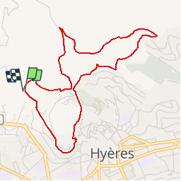
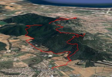
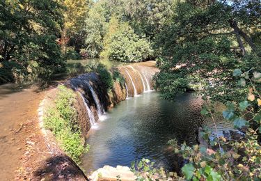
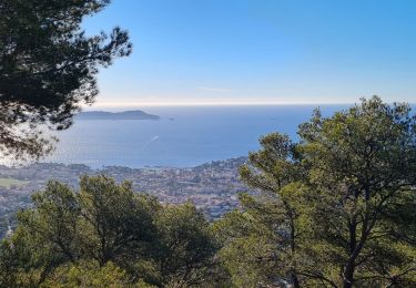
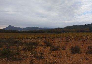
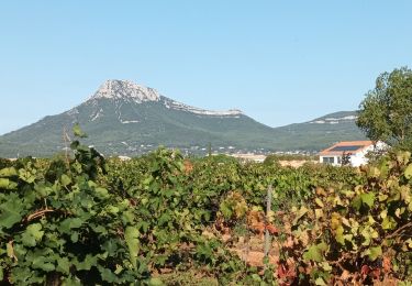
Trail Mountain bike of 5.4 km to be discovered at Provence-Alpes-Côte d'Azur, Var, Hyères. This trail is proposed by tracegps.

Description

Site VTT FFC Hyères - les Îles d’Or - Tour de la Potence Circuit officiel labellisé par la Fédération Française de Cyclisme. • Couleur de parcours : Rouge (difficile) • Distance : 5,4 km • Dénivelé positif : 237 m • Départ du parking situé à proximité de l’esplanade du château, traverser la route et prendre le sentier du paradis. Descriptif : Circuit pour crosseur averti possédant une bonne technique. Sur ce parcours on retrouve tout les ingrédients d’un circuit de cross country, montée technique et piégeuse, partie roulante pour « envoyer» du braquet, descente rapide, single track (petite trace). Circuit où les points de vue sur la ville de Hyères, mais aussi du massif des Maurettes sont tout simplement magnifiques. Cette boucle vous fera découvrir les ruelles du Hyères médiéval.

Elevation profile

Photos

Positioning

Country:
France
Region :
Provence-Alpes-Côte d'Azur
Department/Province :
Var
Municipality :
Hyères
Location:
Unknown
Start:(UTM)
265695 ; 4778818 (32T) N.

Trails nearby

Trail Walking La Crau - fenouillet Daniel Louis - Photo
Walking
cdanielrando

Walking

Medium
(1)
La Crau, Provence-Alpes-Côte d'Azur, Var, France
18.1 km | 25 km-effort
4h 36min
Yes
Trail Walking La Crau - le fenouillet un après-midi d'automne  - Photo
Walking
le.noceur

Walking

Easy
(2)
La Crau, Provence-Alpes-Côte d'Azur, Var, France
7.6 km | 10.7 km-effort
1h 48min
Yes
Trail Walking La Crau - Fenouillet - Chateau de Hyères - retour par les vignes - Photo
Walking
GUIDE
affinetataille

Walking

Medium
(2)
La Crau, Provence-Alpes-Côte d'Azur, Var, France
14.1 km | 19.7 km-effort
5h 0min
Yes
Trail Walking Solliès-Ville - Domaine de la Castille- Solliès-Pont-08-09-23 - Photo
Walking
Christiancordin

Walking

Easy
Solliès-Ville, Provence-Alpes-Côte d'Azur, Var, France
6.8 km | 7.7 km-effort
2h 30min
Yes
Trail Walking La Crau - fenouillet plan du pont - Photo
Walking
cdanielrando

Walking

Very difficult
La Crau, Provence-Alpes-Côte d'Azur, Var, France
16.2 km | 24 km-effort
5h 24min
Yes
Trail Walking Carqueiranne - la grotte du paradis  - Photo
Walking
cdanielrando

Walking

Easy
Carqueiranne, Provence-Alpes-Côte d'Azur, Var, France
3.9 km | 6.6 km-effort
1h 35min
Yes
Trail Walking Hyères - Ayguade plage port - Photo
Walking
001659.1362f64359af4990b089f4e6d026b710.1503

Walking

Easy
Hyères, Provence-Alpes-Côte d'Azur, Var, France
13.4 km | 14.7 km-effort
2h 32min
Yes
Trail Trail La Crau - Le Fenouillet et château d' Hyères  - Photo
Trail
nadd73

Trail

Medium
La Crau, Provence-Alpes-Côte d'Azur, Var, France
13.1 km | 18.8 km-effort
2h 9min
No
Trail Walking La Crau - château d Hyères-16-09-22  - Photo
Walking
Christiancordin

Walking

Medium
La Crau, Provence-Alpes-Côte d'Azur, Var, France
13.3 km | 19.6 km-effort
3h 41min
Yes


Close
My subscriptions