Trail Walking Beauvallon - CHASSAGNY 3/19 BJC - Photo
© OpenStreetMap contributors
Length
Length
10.1 km
Max alt
Max alt
330 m
Uphill gradient
Uphill gradient
218 m
Km-Effort
Km-Effort  
13 km
Min alt
Min alt
217 m
Downhill gradient
Downhill gradient
217 m
Boucle
Boucle
Yes
Creation date :
2019-05-06 22:47:25.75
Updated on :
2023-08-06 15:26:03.384

(0 Reviews)

Walking
Walking
3h00
Difficulty : Medium

Scan this QR Code to open this trail in the SityTrail application

FREE GPS app for hiking

Logo SityTrail SityTrail

IGN / Geographical institutes

Download SityTrail from the App Store Download SityTrail from Google Play

Logo SityTrail SityTrail World

The world is yours!

Download SityTrail from the App Store Download SityTrail from Google Play Download SityTrail on Huawei AppGallery

About

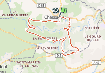
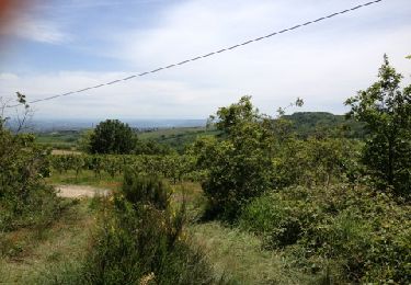
Trail Walking of 10.1 km to be discovered at Auvergne-Rhône-Alpes, Rhône, Beauvallon. This trail is proposed by Clubléorando.

Description

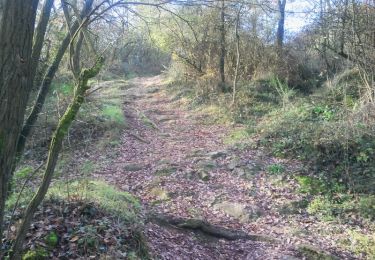
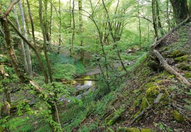
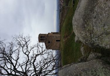
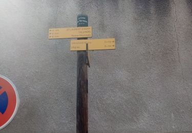
Balade en boucle au départ du parking de la mairie de Chassagny. Prendre un chemin plein sud puis ouest jusqu'à la côte 285. Passer par l'étang de Gas puis traverser les hameaux des Farges et la Forestière. Amorcer le retour par une boucle dans le bois de Montrond puis traverser le ru du Mornantet et regagner la D83. Prendre à gauche cette D83, passer devant le château de Chassagny et regagner le parking de la mairie

Elevation profile

Positioning

Country:
France
Region :
Auvergne-Rhône-Alpes
Department/Province :
Rhône
Municipality :
Beauvallon
Location:
Chassagny
Start:(UTM)
635215 ; 5051709 (31T) N.

Trails nearby

Trail Mountain bike Taluyers - De Taluyers aux landes de Montagny - Photo
Mountain bike
tracegps

Mountain bike

Medium
(1)
Taluyers, Auvergne-Rhône-Alpes, Rhône, France
23 km | 27 km-effort
2h 15min
Yes
Trail Walking Loire-sur-Rhône - 69-Loire-sur-Rhone-17km-480m-avr22 - Photo
Walking
SyMA

Walking

Medium
Loire-sur-Rhône, Auvergne-Rhône-Alpes, Rhône, France
16.7 km | 23 km-effort
5h 9min
Yes
Trail Other activity Saint-Laurent-d'Agny - st Laurent d agny - Photo
Other activity
novop

Other activity

Very easy
Saint-Laurent-d'Agny, Auvergne-Rhône-Alpes, Rhône, France
7.8 km | 9.8 km-effort
2h 6min
Yes
Trail Walking Millery - Exercice trace - Photo
Walking
Jean-Marc Gally

Walking

Easy
(1)
Millery, Auvergne-Rhône-Alpes, Rhône, France
2.1 km | 2.5 km-effort
33min
No
Trail Walking Saint-Laurent-d'Agny - boucle St Laurent d'Agny, Orlienas, Soucieu en Jarrest,  - Photo
Walking
mimi69670

Walking

Easy
Saint-Laurent-d'Agny, Auvergne-Rhône-Alpes, Rhône, France
17 km | 20 km-effort
3h 51min
No
Trail Walking Saint-Laurent-d'Agny - chapelle st vincent - Photo
Walking
dan69390

Walking

Very easy
Saint-Laurent-d'Agny, Auvergne-Rhône-Alpes, Rhône, France
9.3 km | 11.9 km-effort
2h 45min
Yes
Trail Walking Montagny - De Montagny à Chassagny  - Photo
Walking
tracegps

Walking

Medium
(1)
Montagny, Auvergne-Rhône-Alpes, Rhône, France
10 km | 12.9 km-effort
2h 30min
Yes
Trail Walking Beauvallon - chassagny2023 - Photo
Walking
cacrhone

Walking

Medium
Beauvallon, Auvergne-Rhône-Alpes, Rhône, France
7.8 km | 10 km-effort
2h 53min
No
Trail Walking Loire-sur-Rhône - Loire 8.8 - Photo
Walking
cacrhone

Walking

Medium
Loire-sur-Rhône, Auvergne-Rhône-Alpes, Rhône, France
8 km | 10.9 km-effort
3h 12min
Yes


Close
My subscriptions