Trail Walking Sampigny-lès-Maranges - Sampigny les maranges  - Photo
© OpenStreetMap contributors
Length
Length
12.6 km
Max alt
Max alt
409 m
Uphill gradient
Uphill gradient
331 m
Km-Effort
Km-Effort  
17 km
Min alt
Min alt
231 m
Downhill gradient
Downhill gradient
332 m
Boucle
Boucle
Yes
Creation date :
2019-05-06 23:30:39.257
Updated on :
2024-03-21 17:43:34.831

(4 Reviews)

Walking
Walking
3h51
Difficulty : Difficult

Scan this QR Code to open this trail in the SityTrail application

FREE GPS app for hiking

Logo SityTrail SityTrail

IGN / Geographical institutes

Download SityTrail from the App Store Download SityTrail from Google Play

Logo SityTrail SityTrail World

The world is yours!

Download SityTrail from the App Store Download SityTrail from Google Play Download SityTrail on Huawei AppGallery

About

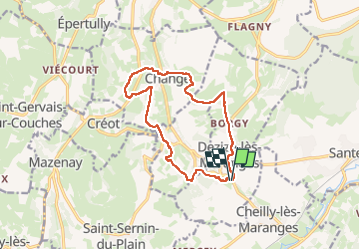
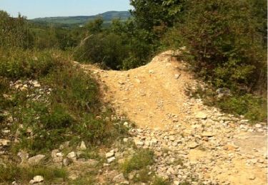
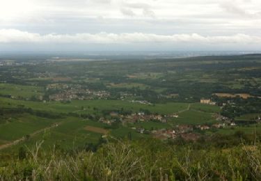
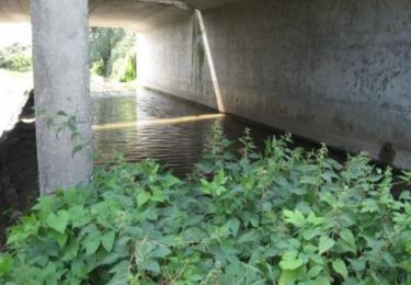
Trail Walking of 12.6 km to be discovered at Bourgogne-Franche-Comté, Saône-et-Loire, Sampigny-lès-Maranges. This trail is proposed by grasgilbert.

Description

Les Balcons de la Cozanne

Elevation profile

Positioning

Country:
France
Region :
Bourgogne-Franche-Comté
Department/Province :
Saône-et-Loire
Municipality :
Sampigny-lès-Maranges
Location:
Unknown
Start:(UTM)
626146 ; 5195954 (31T) N.

Comments

Please log in to post a review or rate the element


très bien


Trails nearby

Trail Walking Saint-Maurice-lès-Couches - Saint Maurice les Couches  GRS (gde) - Photo
Walking
Malice0093

Walking

Difficult
(1)
Saint-Maurice-lès-Couches, Bourgogne-Franche-Comté, Saône-et-Loire, France
11.5 km | 15.3 km-effort
3h 29min
Yes
Trail On foot Santenay - Circuit des Crêtes - Photo
On foot
PRO

On foot

Easy
Santenay, Bourgogne-Franche-Comté, Côte-d'Or, France
11 km | 16.2 km-effort
3h 40min
Yes
Trail Walking Saint-Sernin-du-Plain - Mazenay les deux monts page 17 - Photo
Walking
grasgilbert

Walking

Very difficult
(1)
Saint-Sernin-du-Plain, Bourgogne-Franche-Comté, Saône-et-Loire, France
13.5 km | 19.4 km-effort
4h 24min
Yes
Trail Walking Santenay - Santenay Le Moulin de Santenay page 165 - Photo
Walking
grasgilbert

Walking

Difficult
Santenay, Bourgogne-Franche-Comté, Côte-d'Or, France
12.5 km | 17.2 km-effort
3h 53min
Yes
Trail Walking Saint-Aubin - Saint-Aubin - Photo
Walking
pensionisten71

Walking

Medium
Saint-Aubin, Bourgogne-Franche-Comté, Côte-d'Or, France
21 km | 29 km-effort
4h 53min
Yes
Trail Mountain bike Chassey-le-Camp - bouzeron aubigny rully remigny  - Photo
Mountain bike
slpop1

Mountain bike

Very easy
Chassey-le-Camp, Bourgogne-Franche-Comté, Saône-et-Loire, France
19 km | 24 km-effort
1h 54min
No
Trail Mountain bike Remigny - remigny chassagne 3 croix - Photo
Mountain bike
slpop1

Mountain bike

Medium
Remigny, Bourgogne-Franche-Comté, Saône-et-Loire, France
18.1 km | 23 km-effort
2h 4min
Yes
Trail Mountain bike Dennevy - Bourges (18) - Breurey lès Faverney (70) - Etape 4/6 - De Dennevy à Echigey - Photo
Mountain bike
tracegps

Mountain bike

Medium
Dennevy, Bourgogne-Franche-Comté, Saône-et-Loire, France
80 km | 88 km-effort
6h 0min
No
Trail Walking Santenay - Santenay  les 3 Croix  Santenay  - Photo
Walking
pensionisten71

Walking

Difficult
Santenay, Bourgogne-Franche-Comté, Côte-d'Or, France
10.8 km | 15.6 km-effort
3h 32min
Yes


Close
My subscriptions