


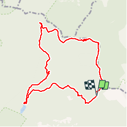

10.4 km | 17.5 km-effort


User


FREE GPS app for hiking
 SityTrail
IGN / Geographical institutes
SityTrail World
The world is yours!
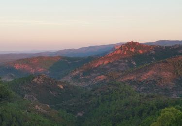
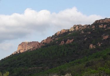
Trail Walking of 10.4 km to be discovered at Provence-Alpes-Côte d'Azur, Var, Saint-Raphaël. This trail is proposed by aeroseb84.
depuis le col notre dame, col decla cadiere et retour par le gr51
Walking

Walking

Walking

Walking
Walking

Walking

Walking
Walking

On foot