Trail Walking Orcival - Guery-PDuLoup-Banne-PGros_T - Photo

Guery-PDuLoup-Banne-PGros_T

 force
force

User

© OpenStreetMap contributors
Length
Length
14.3 km
Max alt
Max alt
1476 m
Uphill gradient
Uphill gradient
503 m
Km-Effort
Km-Effort  
21 km
Min alt
Min alt
1243 m
Downhill gradient
Downhill gradient
504 m
Boucle
Boucle
Yes
Creation date :
2017-08-13 00:00:00.0
Updated on :
2017-08-13 00:00:00.0

(0 Reviews)

Walking
Walking
4h12
Difficulty : Medium

Scan this QR Code to open this trail in the SityTrail application

FREE GPS app for hiking

Logo SityTrail SityTrail

IGN / Geographical institutes

Download SityTrail from the App Store Download SityTrail from Google Play

Logo SityTrail SityTrail World

The world is yours!

Download SityTrail from the App Store Download SityTrail from Google Play Download SityTrail on Huawei AppGallery

About

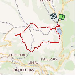
Trail Walking of 14.3 km to be discovered at Auvergne-Rhône-Alpes, Puy-de-Dôme, Orcival. This trail is proposed by force.

Description

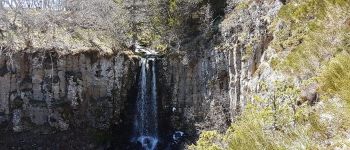
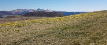
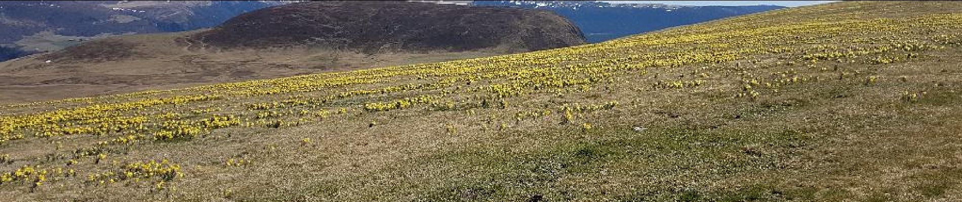
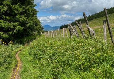
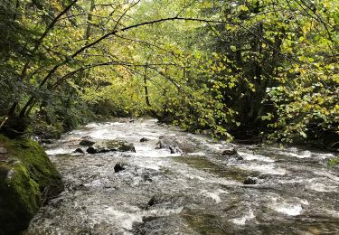
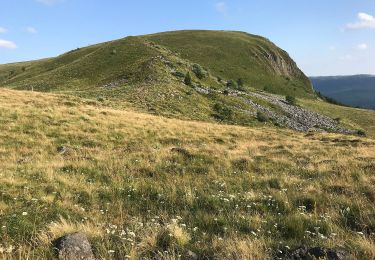
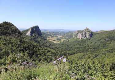
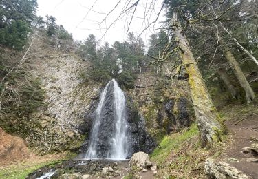
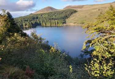
Balade à l'Est du Lac de Guéry, sur le plateau dominant le Mont Dore et La Bourboule. Départ sur le parking du lac de Guéry. Montée au Puy Loup, passage à la borne "des quatre Seigneurs", montée à la fameuse et incontournable banne d'Ordanche et le Puy Gros. Le retour au parking emprunte, sur le bord Est du lac, un chemin récemment aménagé par le Parc des Volcans. L'itinéraire est déconseillé par temps de brouillard et en hiver

Elevation profile

Photos

Points of interest

Point of interest Murat-le-Quaire - Point 2 - Photo
force
MURAT-LE-QUAIRE 
Point of interest Mont-Dore - Point Cacade - Photo
force
MONT-DORE 
Point of interest Murat-le-Quaire - 4 Seigneurs - Photo
force
MURAT-LE-QUAIRE 
Point of interest Murat-le-Quaire - Pilote Planeur - Photo
force
MURAT-LE-QUAIRE 
Point of interest Murat-le-Quaire - STLaurent - Photo
force
MURAT-LE-QUAIRE 

Positioning

Country:
France
Region :
Auvergne-Rhône-Alpes
Department/Province :
Puy-de-Dôme
Municipality :
Orcival
Location:
Unknown
Start:(UTM)
486005 ; 5052001 (31T) N.

Trails nearby

Trail Walking Orcival - Lac de Servières à partir du Café du Lac - Photo
Walking
Dalma Chuck

Walking

Medium
(1)
Orcival, Auvergne-Rhône-Alpes, Puy-de-Dôme, France
6.6 km | 9.5 km-effort
2h 9min
Yes
Trail Walking Mont-Dore - Le puy de la tache, le lacs servières et guèry par la cascade du Queureuilh depuis l'Escalidou.  - Photo
Walking
loloetienne

Walking

Difficult
(3)
Mont-Dore, Auvergne-Rhône-Alpes, Puy-de-Dôme, France
34 km | 50 km-effort
10h 16min
Yes
Trail Walking Perpezat - Le lac de Guéry - Photo
Walking
tracegps

Walking

Difficult
(2)
Perpezat, Auvergne-Rhône-Alpes, Puy-de-Dôme, France
15 km | 22 km-effort
4h 0min
Yes
Trail On foot Mont-Dore - Le Puy Gros - Photo
On foot
PRO

On foot

Easy
(1)
Mont-Dore, Auvergne-Rhône-Alpes, Puy-de-Dôme, France
8.1 km | 13.7 km-effort
3h 6min
Yes
Trail On foot Murat-le-Quaire - La Banne d'Ordanche - Photo
On foot
PRO

On foot

Easy
Murat-le-Quaire, Auvergne-Rhône-Alpes, Puy-de-Dôme, France
8.2 km | 13.9 km-effort
3h 9min
Yes
Trail On foot Mont-Dore - Le plateau du Guery - Photo
On foot
PRO

On foot

Easy
Mont-Dore, Auvergne-Rhône-Alpes, Puy-de-Dôme, France
12.2 km | 18.4 km-effort
4h 11min
No
Trail On foot Mont-Dore - Les Cascades - Photo
On foot
PRO

On foot

Medium
Mont-Dore, Auvergne-Rhône-Alpes, Puy-de-Dôme, France
15.7 km | 27 km-effort
6h 8min
Yes
Trail Walking Chambon-sur-Lac - Boucle du col de la croix Morand - Photo
Walking
zefreefly

Walking

Easy
Chambon-sur-Lac, Auvergne-Rhône-Alpes, Puy-de-Dôme, France
22 km | 35 km-effort
6h 24min
Yes
Trail Walking Saulzet-le-Froid - Lac de Guery - Puy Gros - Photo
Walking
damien7307

Walking

Medium
Saulzet-le-Froid, Auvergne-Rhône-Alpes, Puy-de-Dôme, France
11.8 km | 17.5 km-effort
3h 50min
Yes


Close
My subscriptions