Trail Walking Le Dévoluy - R46   Le col du Noyer - Photo

Les Hautes Alpes à découvrir ! GUIDE+

© OpenStreetMap contributors
Length
Length
6 km
Max alt
Max alt
1716 m
Uphill gradient
Uphill gradient
359 m
Km-Effort
Km-Effort  
10.8 km
Min alt
Min alt
1486 m
Downhill gradient
Downhill gradient
359 m
Boucle
Boucle
Yes
Creation date :
2018-03-23 05:40:57.401
Updated on :
2019-05-14 04:47:36.051

(1 Reviews)

Walking
Walking
2h18
Difficulty : Easy

Scan this QR Code to open this trail in the SityTrail application

FREE GPS app for hiking

Logo SityTrail SityTrail

IGN / Geographical institutes

Download SityTrail from the App Store Download SityTrail from Google Play

Logo SityTrail SityTrail World

The world is yours!

Download SityTrail from the App Store Download SityTrail from Google Play Download SityTrail on Huawei AppGallery

About

Trail Walking of 6 km to be discovered at Provence-Alpes-Côte d'Azur, Hautes-Alpes, Le Dévoluy. This trail is proposed by Camping Les Rives du Lac.

Description

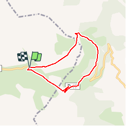
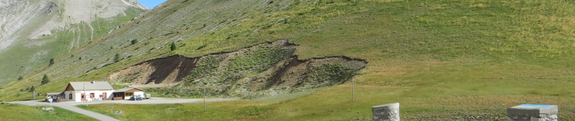
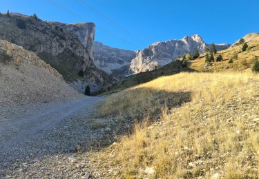
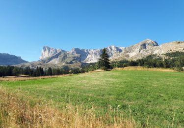
This well-known cycling pass (among others the Tour de France) offers a breathtaking view of the Champsaur, the access road is very good and you can hydrate at the refuge of the pass.
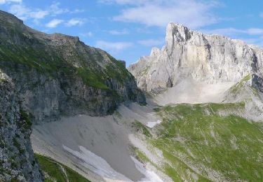
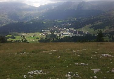
We offer this little hike from the pass or just before. (The hike takes a little road). Two hours of walking that will allow you to go up the Sauce valley to the neck of the same name (beware of the pass, go down on the other side and do not take right immediately the path that goes up and goes towards the head of the Tourneau), to then take a path in balcony offering a magnificent view. Climb to the Walnut Pass before joining the car.

Elevation profile

Photos

Positioning

Country:
France
Region :
Provence-Alpes-Côte d'Azur
Department/Province :
Hautes-Alpes
Municipality :
Le Dévoluy
Location:
Unknown
Start:(UTM)
735670 ; 4953651 (31T) N.

Comments

Please log in to post a review or rate the element


nice first 3km, last 3km is on the paved road unfortunately


Trails nearby

Trail Walking Le Dévoluy - R29   La crete des Beaumes - Photo
Walking
GUIDE+

Walking

Medium
(2)
Le Dévoluy, Provence-Alpes-Côte d'Azur, Hautes-Alpes, France
9 km | 16 km-effort
3h 17min
Yes
Trail Walking Le Dévoluy - R28   Le Col de Rabou - Photo
Walking
GUIDE+

Walking

Medium
(1)
Le Dévoluy, Provence-Alpes-Côte d'Azur, Hautes-Alpes, France
10.6 km | 17.9 km-effort
3h 52min
Yes
Trail Walking Le Dévoluy - R27   Les gorges du Rif - Photo
Walking
GUIDE+

Walking

Easy
(1)
Le Dévoluy, Provence-Alpes-Côte d'Azur, Hautes-Alpes, France
7.5 km | 11.5 km-effort
2h 27min
Yes
Trail Walking Le Dévoluy - Tour du Dévoluy - Superdévoluy à Lachaup - Photo
Walking
tracegps

Walking

Medium
(1)
Le Dévoluy, Provence-Alpes-Côte d'Azur, Hautes-Alpes, France
8.3 km | 12.5 km-effort
3h 0min
No
Trail Mountain bike Le Dévoluy - VTT31 - Col de Rabou - Photo
Mountain bike
GUIDE+

Mountain bike

Medium
Le Dévoluy, Provence-Alpes-Côte d'Azur, Hautes-Alpes, France
19.7 km | 31 km-effort
1h 55min
Yes
Trail Walking Le Dévoluy - R26   Le tour de la crête d'âne - Photo
Walking
GUIDE+

Walking

Medium
Le Dévoluy, Provence-Alpes-Côte d'Azur, Hautes-Alpes, France
10.5 km | 19.7 km-effort
3h 58min
Yes
Trail Walking Le Dévoluy - crête des baumes - Photo
Walking
timothee60

Walking

Easy
(1)
Le Dévoluy, Provence-Alpes-Côte d'Azur, Hautes-Alpes, France
9.4 km | 14.1 km-effort
3h 11min
Yes
Trail Walking Le Dévoluy - pic de Bure - Photo
Walking
tchoua

Walking

Difficult
Le Dévoluy, Provence-Alpes-Côte d'Azur, Hautes-Alpes, France
16.6 km | 34 km-effort
4h 48min
Yes
Trail Walking Le Dévoluy - Plateau et Pic de Bure par Combe ratin - Photo
Walking
GrouGary

Walking

Very difficult
Le Dévoluy, Provence-Alpes-Côte d'Azur, Hautes-Alpes, France
21 km | 40 km-effort
9h 9min
Yes


Close
My subscriptions