Avio, Provincia di Trento: Top van de beste wandelroutes, trajecten, tochten en wandelingen

Avio: Ontdek de beste tochten: 8 te voet. Al deze tochten, trajecten, routes en outdoor activiteiten zijn beschikbaar in onze SityTrail-apps voor smartphones en tablets.


De beste trajecten (8)
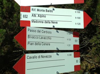
Tocht Te voet Avio - Sentiero Bovi - Photo
Te voet 3.369
Km
PRO

Te voet

Gemakkelijk
Avio, Trento-Zuid-Tirol, Provincia di Trento, Italy
3,4 km | 9,2 km-effort
2h 5min
581 m
2 m
Neen
SityTrail - itinéraires balisés pédestres

• Trail created by Club Alpino Italiano Sezione di Verona. Symbol: 652 on white red flag
Tocht Te voet Avio - IT-O652 - Photo
Te voet 8.014
Km
PRO

Te voet

Medium
Avio, Trento-Zuid-Tirol, Provincia di Trento, Italy
8 km | 21 km-effort
4h 49min
1297 m
66 m
Neen
SityTrail - itinéraires balisés pédestres

• Trail created by Società degli Alpinisti Tridentini. Website: http://www.sat.tn.it/
Tocht Te voet Avio - IT-O653 - Photo
Te voet 12.591
Km
PRO

Te voet

Medium
Avio, Trento-Zuid-Tirol, Provincia di Trento, Italy
12,6 km | 23 km-effort
5h 8min
875 m
379 m
Neen
SityTrail - itinéraires balisés pédestres

• Trail created by Società degli Alpinisti Tridentini. Website: http://www.sat.tn.it/
Tocht Te voet Avio - Strada della Selva - Photo
Te voet 9.784
Km
PRO

Te voet

Gemakkelijk
Avio, Trento-Zuid-Tirol, Provincia di Trento, Italy
9,8 km | 15,5 km-effort
3h 31min
519 m
170 m
Neen
SityTrail - itinéraires balisés pédestres

• Trail created by Società degli Alpinisti Tridentini. Symbol: 661 on white red flag Website: http://www.sat.tn.it/
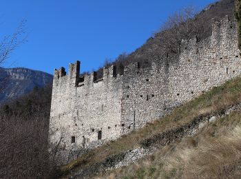
Tocht Te voet Avio - IT-O687 - Photo
Te voet 7.038
Km
PRO

Te voet

Gemakkelijk
Avio, Trento-Zuid-Tirol, Provincia di Trento, Italy
7 km | 18,4 km-effort
4h 11min
1084 m
165 m
Neen
SityTrail - itinéraires balisés pédestres

• Trail created by Società degli Alpinisti Tridentini. Website: http://www.sat.tn.it/

Tocht Te voet Avio - IT-O686 - Photo
Te voet 5.141
Km
PRO

Te voet

Gemakkelijk
Avio, Trento-Zuid-Tirol, Provincia di Trento, Italy
5,1 km | 15,4 km-effort
3h 30min
1024 m
19 m
Neen
SityTrail - itinéraires balisés pédestres

• Trail created by Società degli Alpinisti Tridentini. Website: http://www.sat.tn.it/
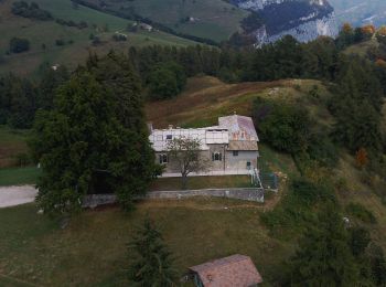
Tocht Te voet Avio - Giro delle Malghe - variante breve - Photo
Te voet 3.251
Km
PRO

Te voet

Gemakkelijk
Avio, Trento-Zuid-Tirol, Provincia di Trento, Italy
3,3 km | 6,2 km-effort
1h 25min
281 m
56 m
Neen
SityTrail - itinéraires balisés pédestres

Tocht Te voet Avio - Giro delle Malghe - Photo
Te voet 16.579
Km
PRO

Te voet

Medium
Avio, Trento-Zuid-Tirol, Provincia di Trento, Italy
16,6 km | 25 km-effort
5h 42min
608 m
740 m
Neen
SityTrail - itinéraires balisés pédestres

8 tochten weergegeven op 8

Gratisgps-wandelapplicatie

Logo SityTrail SityTrail

IGN / Geografische instituten

SityTrail uit de App Store downloaden SityTrail uit Google Play downloaden

Logo SityTrail SityTrail World

De wereld gaat voor u open

SityTrail uit de App Store downloaden SityTrail uit Google Play downloaden SityTrail op Huawei AppGallery downloaden

Activiteiten

Sluiten
Mijn abonnementen