Home
World
NEW
Premium
Winkel
tochten
Artikels
Help - ondersteuning
Français
English
Nederlands
Español
Italiano
Deutsch
Aansluiting
Home
World
Premium
Winkel
tochten
Artikels
Help - ondersteuning
SityTrail
>
POI's
>
burons hauts
SityTrail
>
POI's
>
burons hauts
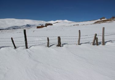
burons hauts
Beschrijving
Le Bourg Haut
Foto's
Ontdek burons hauts met de volgende tochten...
tracegps
Le Puy de la Jambe et le bourg de Prat de Bouc
Sneeuwschoenen
Medium
Paulhac, Auvergne-Rhône-Alpes, Cantal, France
8,3 km | 13,2 km-effort
3h 49min
Ja
tracegps
Gebruiker
©
OpenStreetMap
contributors
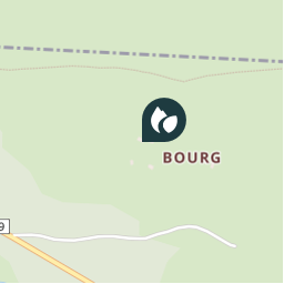
Plaatsbepaling
Land:
France
Regio :
Auvergne-Rhône-Alpes
Departement/Provincie :
Cantal
Gemeente :
Paulhac
Locatie:
Unknown
Plaatsbepaling
45.0477862 / 2.8145814
Datum van aanmaak :
2018-04-09 10:57:51.332
Laatste wijziging
2018-04-09 10:57:51.332
(0 Bericht)
Opmerkingen
Gelieve in te loggen om een commentaar of een beoordeling achter te laten
POI's in de buurt
tracegps
2
PAULHAC
tracegps
Ruines
PAULHAC
tracegps
Ruines
PAULHAC
tracegps
3
ALBEPIERRE-BREDONS
tracegps
1
ALBEPIERRE-BREDONS
tracegps
attention
ALBEPIERRE-BREDONS
tracegps
départ
ALBEPIERRE-BREDONS
tracegps
départ
PAULHAC
Sluiten
Mijn abonnementen