Home
World
NEW
Premium
Winkel
tochten
Artikels
Help - ondersteuning
Français
English
Nederlands
Español
Italiano
Deutsch
Aansluiting
Home
World
Premium
Winkel
tochten
Artikels
Help - ondersteuning
SityTrail
>
POI's
>
GCW1C2
SityTrail
>
POI's
>
GCW1C2
GCW1C2
Beschrijving
La Cheminée by micka38, Tradit
Foto's
Ontdek GCW1C2 met de volgende tochten...
tracegps
Crêt Coquet
Stappen
Medium
(3)
Hautecour, Auvergne-Rhône-Alpes, Savoie, France
6,5 km | 9,6 km-effort
3h 30min
Ja
tracegps
Gebruiker
©
OpenStreetMap
contributors
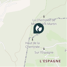
Plaatsbepaling
Land:
France
Regio :
Auvergne-Rhône-Alpes
Departement/Provincie :
Isère
Gemeente :
Voreppe
Locatie:
Unknown
Plaatsbepaling
45.27935 / 5.66925
Datum van aanmaak :
2018-04-09 12:14:59.017
Laatste wijziging
2018-04-09 12:14:59.017
(0 Bericht)
Opmerkingen
Gelieve in te loggen om een commentaar of een beoordeling achter te laten
POI's in de buurt
tracegps
GCW1C2
VOREPPE
tracegps
GCW1C2
VOREPPE
tracegps
GCW1C2
VOREPPE
tracegps
GCW1C2
VOREPPE
tracegps
GCW1C2
VOREPPE
tracegps
GCW1C2
VOREPPE
tracegps
GCW1C2
VOREPPE
tracegps
GCW1C2
VOREPPE
Sluiten
Mijn abonnementen