Tocht Stappen Cépet - Cepet Villaries - Photo
 tracegps
tracegps

Gebruiker

© OpenStreetMap contributors
Lengte
Lengte
14,9 km
Max. hoogte
Max. hoogte
193 m
Positief hoogteverschil
145 m
Km-Effort
Km-Effort  
16,8 km
Min. hoogte
Min. hoogte
120 m
Negatief hoogteverschil
143 m
Boucle
Boucle
Ja
Datum van aanmaak :
2014-12-10 00:00:00.0
Laatste wijziging :
2014-12-10 00:00:00.0

(0 Bericht)

Stappen
Stappen
4h00
Moeilijkheid : Medium

Scan deze QR-code om de tocht te openen in de SityTrail-applicatie

Gratisgps-wandelapplicatie

Logo SityTrail SityTrail

IGN / Geografische instituten

SityTrail uit de App Store downloaden SityTrail uit Google Play downloaden

Logo SityTrail SityTrail World

De wereld gaat voor u open

SityTrail uit de App Store downloaden SityTrail uit Google Play downloaden SityTrail op Huawei AppGallery downloaden

Over ons

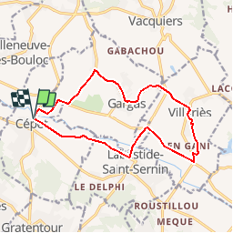
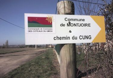
Tocht Stappen van 14,9 km beschikbaar op Occitanië, Haute-Garonne, Cépet. Deze tocht wordt voorgesteld door tracegps.

Beschrijving

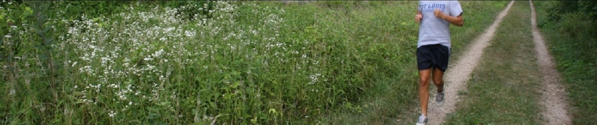
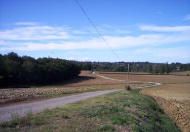
Effort tranquille pour les runners, la fin est douce !

Hoogteprofiel

Foto's

Plaatsbepaling

Land:
France
Regio :
Occitanië
Departement/Provincie :
Haute-Garonne
Gemeente :
Cépet
Locatie:
Unknown
Vertrek:(Dec)
Vertrek:(UTM)
373847 ; 4845452 (31T) N.

Wandeltochten in de omgeving

Tocht Stappen Villariès - De Villariès à Vacquiers - Photo
Stappen
tracegps

Stappen

Medium
(1)
Villariès, Occitanië, Haute-Garonne, France
11,5 km | 13,4 km-effort
3h 0min
Ja
Tocht Mountainbike Gargas - VTT dans le Frontonnais entre Gargas, Vacquiers et Montjoire - Photo
Mountainbike
tracegps

Mountainbike

Medium
(1)
Gargas, Occitanië, Haute-Garonne, France
29 km | 35 km-effort
2h 30min
Ja
Tocht Lopen Villariès - De Villariès à Vacquiers - Photo
Lopen
tracegps

Lopen

Medium
Villariès, Occitanië, Haute-Garonne, France
11,5 km | 13,4 km-effort
1h 15min
Ja
Tocht Mountainbike Bouloc - Randonnée VTT entre vignes et bois de Bouloc à Fronton - Photo
Mountainbike
tracegps

Mountainbike

Medium
Bouloc, Occitanië, Haute-Garonne, France
22 km | 25 km-effort
2h 0min
Ja
Tocht Lopen Labastide-Saint-Sernin - Le Bois de Lespasié au dessus de Labastide Saint Sernin - Photo
Lopen
tracegps

Lopen

Medium
Labastide-Saint-Sernin, Occitanië, Haute-Garonne, France
6,5 km | 7,5 km-effort
40min
Ja
Tocht Stappen Labastide-Saint-Sernin - Le Bois de Lespasié au dessus de Labastide Saint Sernin - Photo
Stappen
tracegps

Stappen

Medium
(1)
Labastide-Saint-Sernin, Occitanië, Haute-Garonne, France
6,5 km | 7,5 km-effort
1h 49min
Ja
Tocht Lopen Vacquiers - De Vacquiers à la Verrière - Photo
Lopen
tracegps

Lopen

Gemakkelijk
Vacquiers, Occitanië, Haute-Garonne, France
10,8 km | 13 km-effort
1h 0min
Ja
Tocht Lopen Villeneuve-lès-Bouloc - Villeneuve les Bouloc Vacquiers - Photo
Lopen
tracegps

Lopen

Moeilijk
Villeneuve-lès-Bouloc, Occitanië, Haute-Garonne, France
16,6 km | 19,4 km-effort
1h 30min
Ja
Tocht Stappen Villeneuve-lès-Bouloc - Villeneuve les Bouloc Vacquiers - Photo
Stappen
tracegps

Stappen

Medium
Villeneuve-lès-Bouloc, Occitanië, Haute-Garonne, France
16,6 km | 19,4 km-effort
3h 10min
Ja


Sluiten
Mijn abonnementen