Tocht Mountainbike Fontenilles - Fontenilles à Lias - Photo
 tracegps
tracegps

Gebruiker

© OpenStreetMap contributors
Lengte
Lengte
13,7 km
Max. hoogte
Max. hoogte
305 m
Positief hoogteverschil
203 m
Km-Effort
Km-Effort  
16,4 km
Min. hoogte
Min. hoogte
201 m
Negatief hoogteverschil
202 m
Boucle
Boucle
Ja
Datum van aanmaak :
2014-12-10 00:00:00.0
Laatste wijziging :
2014-12-10 00:00:00.0

(0 Bericht)

Mountainbike
Mountainbike
1h00
Moeilijkheid : Medium

Scan deze QR-code om de tocht te openen in de SityTrail-applicatie

Gratisgps-wandelapplicatie

Logo SityTrail SityTrail

IGN / Geografische instituten

SityTrail uit de App Store downloaden SityTrail uit Google Play downloaden

Logo SityTrail SityTrail World

De wereld gaat voor u open

SityTrail uit de App Store downloaden SityTrail uit Google Play downloaden SityTrail op Huawei AppGallery downloaden

Over ons

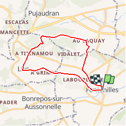
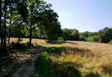
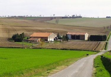
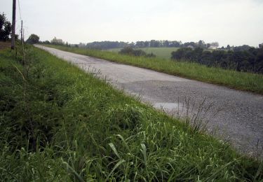
Tocht Mountainbike van 13,7 km beschikbaar op Occitanië, Haute-Garonne, Fontenilles. Deze tocht wordt voorgesteld door tracegps.

Beschrijving

Chemins et petites routes mélées pour ce tour très agréable en passant par le Bois des Arramous

Hoogteprofiel

Foto's

Plaatsbepaling

Land:
France
Regio :
Occitanië
Departement/Provincie :
Haute-Garonne
Gemeente :
Fontenilles
Locatie:
Unknown
Vertrek:(Dec)
Vertrek:(UTM)
353904 ; 4823789 (31T) N.

Wandeltochten in de omgeving

Tocht Stappen Saiguède - Raide de Saiguède - Photo
Stappen
tracegps

Stappen

Moeilijk
(1)
Saiguède, Occitanië, Haute-Garonne, France
19 km | 23 km-effort
4h 0min
Ja
Tocht Te voet Pujaudran - Circuit de la Forêt de Lartus - Photo
Te voet
PRO

Te voet

Gemakkelijk
Pujaudran, Occitanië, Gers, France
9,7 km | 12,4 km-effort
2h 49min
Ja
Tocht Lopen Pujaudran - Trois étoiles à Pujaudran - Photo
Lopen
tracegps

Lopen

Moeilijk
Pujaudran, Occitanië, Gers, France
18,9 km | 23 km-effort
2h 0min
Ja
Tocht Stappen Pujaudran - Trois étoiles à Pujaudran - Photo
Stappen
tracegps

Stappen

Moeilijk
Pujaudran, Occitanië, Gers, France
18,9 km | 23 km-effort
3h 49min
Ja
Tocht Stappen Pujaudran - De Tellère près de la forêt de Bouconne à Lias - Photo
Stappen
tracegps

Stappen

Medium
Pujaudran, Occitanië, Gers, France
15,3 km | 19,6 km-effort
4h 15min
Ja
Tocht Lopen Fontenilles - Fontenilles à Lias - Photo
Lopen
tracegps

Lopen

Moeilijk
Fontenilles, Occitanië, Haute-Garonne, France
13,7 km | 16,4 km-effort
1h 19min
Ja
Tocht Lopen Fontenilles - De Fontenilles à Saiguède - Photo
Lopen
tracegps

Lopen

Moeilijk
Fontenilles, Occitanië, Haute-Garonne, France
16,2 km | 19,5 km-effort
1h 30min
Ja
Tocht Lopen Saiguède - Raide de Saiguède - Photo
Lopen
tracegps

Lopen

Zeer moeilijk
Saiguède, Occitanië, Haute-Garonne, France
19 km | 23 km-effort
2h 0min
Ja
Tocht Mountainbike Fonsorbes - Balade VTT - Photo
Mountainbike
Rouzier

Mountainbike

Gemakkelijk
Fonsorbes, Occitanië, Haute-Garonne, France
25 km | 27 km-effort
2h 8min
Ja


Sluiten
Mijn abonnementen