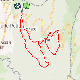
![](/images/other/stat-length.png)
![Tocht Sneeuwschoenen Arvière-en-Valromey - Le Roc Passin 1425m, depuis Montclair - Virieu-le-Petit - Photo](https://media.geolcdn.com/t/1900/400/ext.pjpeg?maxdim=2&url=https%3A%2F%2Fservices.sitytrail.com%2FGeolivesWS%2FDownloadMedia.ashx%3FTrailID%3D103028%26Media%3D4610_1.jpg)
Le Roc Passin 1425m, depuis Montclair - Virieu-le-Petit
tracegps
Gebruiker
![Lengte](/images/other/stat-length.png)
![Max. hoogte](https://static1.geolcdn.com/siteimages/upload/files/1508320355ic_sort_altitude_max_24dp.png)
![Positief hoogteverschil](https://static1.geolcdn.com/siteimages/upload/files/1508320355ic_sort_den_pos_24dp.png)
![Km-Effort](/images/other/stat-length.png)
![Min. hoogte](https://static1.geolcdn.com/siteimages/upload/files/1508320355ic_sort_altitude_min_24dp.png)
![Negatief hoogteverschil](https://static1.geolcdn.com/siteimages/upload/files/1508320355ic_sort_den_neg_24dp.png)
![Boucle](https://static1.geolcdn.com/siteimages/upload/files/16400158638029165_repeat_loop_refresh_sync_direction_icon.png)
![Sneeuwschoenen](https://static1.geolcdn.com/sitytour/trail-icons/504.png)
4h00
Moeilijkheid : Medium
![Scan deze QR-code om de tocht te openen in de SityTrail-applicatie](https://capi.geolives.com/qq0zvz2zws4bq2lad0pu/sitytour/trails/103028/qr.png?size=200)
Gratisgps-wandelapplicatie
Over ons
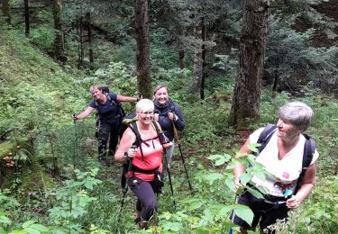
Tocht Sneeuwschoenen van 10,1 km beschikbaar op Auvergne-Rhône-Alpes, Ain, Arvière-en-Valromey. Deze tocht wordt voorgesteld door tracegps.
Beschrijving
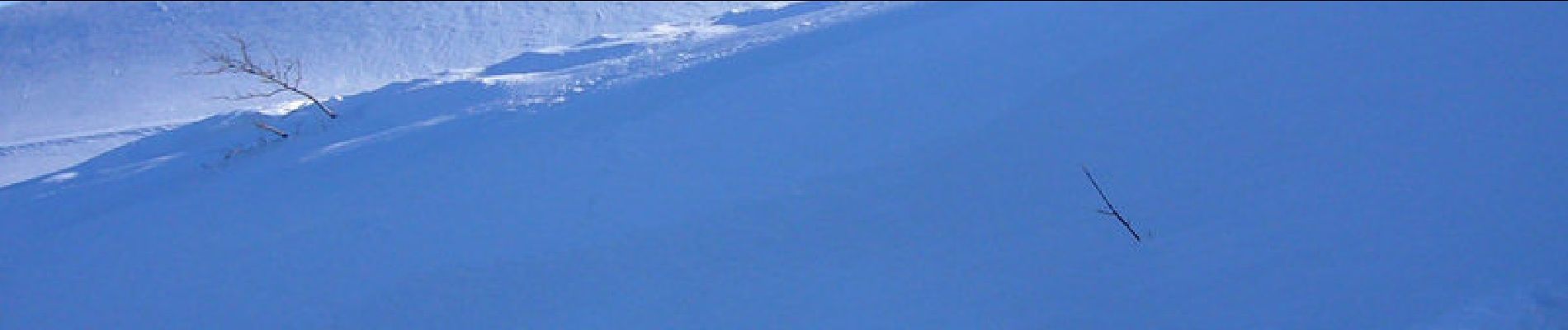
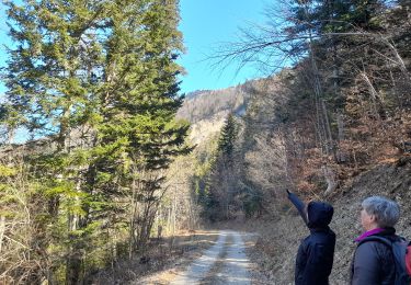
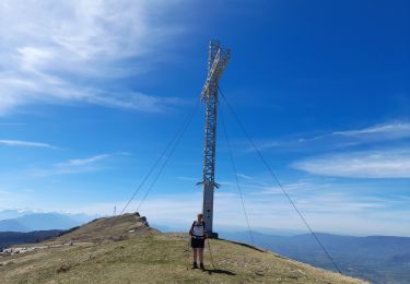
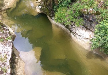
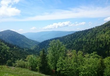
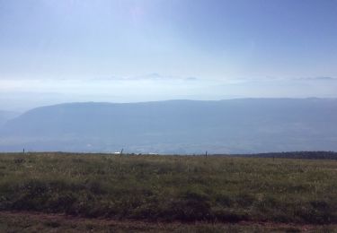
Randonnée en raquettes. Découvrir les pistes forestières au dessus de Virieu-le-Petit qui donnent accès à la montagne du Grand Colombier motivait cette sortie hivernale. De Montclair, par la Grange de Fivole, les pistes et bons chemins jusqu'à Fromentel, permettent de rattraper le circuit des crêtes du Grand Colombier, déjà décrit. Le sentier d'été permet d'atteindre le Creux de la Roche par un passage exposé avant de monter directement sur le Roc Passin. Sous le sommet, dévaler une combe agréable conduit sur la route enneigée pour revenir à Fromentel. De là, d’anciennes pistes forestières permettent de descendre facilement jusqu'au point de départ. Description complète sur sentier-nature.com : Le Roc Passin 1425m, depuis Montclair - Virieu-le-Petit Avertissement : En randonnée, à pieds ou en raquettes, pour ne pas s'égarer à travers un paysage enneigé, carte 1/25000e, boussole et altimètre sont très utiles, surtout par temps de brouillard La randonnée en montagne l'hiver, à pieds, en raquettes, à ski est une activité dangereuse qui nécessite une grande autonomie et l'acceptation d'un degré de risque adapté aux capacités de chacun. Prendre connaissance du terrain, des conditions météorologiques et des risques d'avalanches est nécessaire avant de partir.
Plaatsbepaling
Opmerkingen
Wandeltochten in de omgeving
![Tocht Stappen Corbonod - GRAND COLOMBIER: SUR LYAND - CHARBEMENES - CHALET D'ARVIERES - Photo](https://media.geolcdn.com/t/375/260/ext.jpg?maxdim=2&url=https%3A%2F%2Fmedia.geolcdn.com%2Ff%2F23de9000-aeb2-412c-a056-3c3ba2ac6100.jpg)
![Stappen Stappen](https://static1.geolcdn.com/sitytour/trail-icons/101.png)
Stappen
![](/images/other/stat-length.png)
![](https://static1.geolcdn.com/siteimages/upload/files/16400158638029165_repeat_loop_refresh_sync_direction_icon.png)
![Tocht Stappen Arvière-en-Valromey - SUR LYAND NORD via corniche & balcon Valromey et GR9 - Photo](https://media.geolcdn.com/t/375/260/ext.jpg?maxdim=2&url=https%3A%2F%2Fmedia.geolcdn.com%2Ff%2F191d3346-6b07-4690-a9f2-9794339a2cee.jpg)
![Stappen Stappen](https://static1.geolcdn.com/sitytour/trail-icons/101.png)
Stappen
![](/images/other/stat-length.png)
![](https://static1.geolcdn.com/siteimages/upload/files/16400158638029165_repeat_loop_refresh_sync_direction_icon.png)
![Tocht Stappen Corbonod - GRAND COLOMBIER: SUR LYAND - CHARBEMENES par les crêtes - COLOMBIER - RETOUR PAR VALLON D'ARVIERES - Photo](https://media.geolcdn.com/t/375/260/ext.jpg?maxdim=2&url=https%3A%2F%2Fmedia.geolcdn.com%2Ff%2Fb12dfb88-143c-4b4b-96de-73aa15f6023a.jpg)
![Stappen Stappen](https://static1.geolcdn.com/sitytour/trail-icons/101.png)
Stappen
![](/images/other/stat-length.png)
![](https://static1.geolcdn.com/siteimages/upload/files/16400158638029165_repeat_loop_refresh_sync_direction_icon.png)
![Tocht Stappen Artemare - cascade de cerveyrieu - Photo](https://media.geolcdn.com/t/375/260/ext.jpg?maxdim=2&url=https%3A%2F%2Fmedia.geolcdn.com%2Ff%2F1fba5c6d-151e-4091-a127-1969b57d4eed.jpg)
![Stappen Stappen](https://static1.geolcdn.com/sitytour/trail-icons/101.png)
Stappen
![](/images/other/stat-length.png)
![](https://static1.geolcdn.com/siteimages/upload/files/16400158638029165_repeat_loop_refresh_sync_direction_icon.png)
![Tocht Stappen Arvière-en-Valromey - Chalet d'Arvières - Photo](https://media.geolcdn.com/t/375/260/ext.jpg?maxdim=2&url=https%3A%2F%2Fmedia.geolcdn.com%2Ff%2Fe14fe59e-874f-470f-857a-067bdc964819.jpg)
![Stappen Stappen](https://static1.geolcdn.com/sitytour/trail-icons/101.png)
Stappen
![](/images/other/stat-length.png)
![](https://static1.geolcdn.com/siteimages/upload/files/16400158638029165_repeat_loop_refresh_sync_direction_icon.png)
![Tocht Stappen Arvière-en-Valromey - GR 9 - Étape 13 - Chalet d’Arvières - Chanaz - Photo](https://media.geolcdn.com/t/375/260/ext.jpg?maxdim=2&url=https%3A%2F%2Fmedia.geolcdn.com%2Ff%2Fe124169d-20c4-4d49-b21c-03de29e41215.jpg)
![Stappen Stappen](https://static1.geolcdn.com/sitytour/trail-icons/101.png)
Stappen
![](/images/other/stat-length.png)
![](https://static1.geolcdn.com/siteimages/upload/files/16400158638029165_repeat_loop_refresh_sync_direction_icon.png)
![Tocht Stappen Corbonod - combe merlin - Photo](https://media.geolcdn.com/t/375/260/ext.jpg?maxdim=2&url=https%3A%2F%2Fservices.sitytrail.com%2FGeolivesWS%2FDownloadMedia.ashx%3FTrailID%3D1046732%26Media%3Dfix__20180926124253.jpg)
![Stappen Stappen](https://static1.geolcdn.com/sitytour/trail-icons/101.png)
Stappen
![](/images/other/stat-length.png)
![](https://static1.geolcdn.com/siteimages/upload/files/16400158638029165_repeat_loop_refresh_sync_direction_icon.png)
![Tocht Stappen Arvière-en-Valromey - GTJ 13 Chalet d'Arviere/Culoz - Photo](https://media.geolcdn.com/t/375/260/ext.jpg?maxdim=2&url=https%3A%2F%2Fmedia.geolcdn.com%2Ff%2F95e569a8-40e4-4cb8-99dd-166dae94e18d.jpg)
![Stappen Stappen](https://static1.geolcdn.com/sitytour/trail-icons/101.png)
Stappen
![](/images/other/stat-length.png)
![](https://static1.geolcdn.com/siteimages/upload/files/16400158638029165_repeat_loop_refresh_sync_direction_icon.png)
![Tocht Stappen Corbonod - GRAND COLOMBIER: SUR LYAND - CHARBEMENES PAR LES CRETES - ARVIERES par la](https://media.geolcdn.com/t/375/260/ext.jpg?maxdim=2&url=https%3A%2F%2Fmedia.geolcdn.com%2Ff%2F4a3e8824-294b-4b75-91bc-ea999110708b.jpg)
![Stappen Stappen](https://static1.geolcdn.com/sitytour/trail-icons/101.png)
Stappen
![](/images/other/stat-length.png)
![](https://static1.geolcdn.com/siteimages/upload/files/16400158638029165_repeat_loop_refresh_sync_direction_icon.png)