Tocht Stappen Eaux-Bonnes - Le Pic Sanctus 2482m depuis Gourette - Photo

Le Pic Sanctus 2482m depuis Gourette

 tracegps
tracegps

Gebruiker

© OpenStreetMap contributors
Lengte
Lengte
11,4 km
Max. hoogte
Max. hoogte
2466 m
Positief hoogteverschil
1104 m
Km-Effort
Km-Effort  
26 km
Min. hoogte
Min. hoogte
1359 m
Negatief hoogteverschil
1104 m
Boucle
Boucle
Ja
Datum van aanmaak :
2014-12-10 00:00:00.0
Laatste wijziging :
2014-12-10 00:00:00.0

(1 Bericht)

Stappen
Stappen
6h00
Moeilijkheid : Moeilijk

Scan deze QR-code om de tocht te openen in de SityTrail-applicatie

Gratisgps-wandelapplicatie

Logo SityTrail SityTrail

IGN / Geografische instituten

SityTrail uit de App Store downloaden SityTrail uit Google Play downloaden

Logo SityTrail SityTrail World

De wereld gaat voor u open

SityTrail uit de App Store downloaden SityTrail uit Google Play downloaden SityTrail op Huawei AppGallery downloaden

Over ons

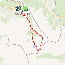
Tocht Stappen van 11,4 km beschikbaar op Nieuw-Aquitanië, Pyrénées-Atlantiques, Eaux-Bonnes. Deze tocht wordt voorgesteld door tracegps.

Beschrijving

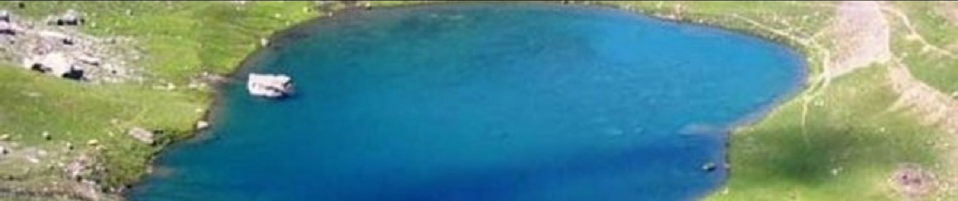
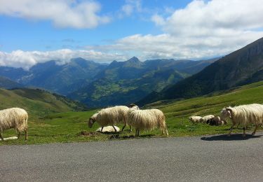
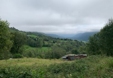
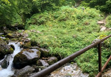
Le Pic Sanctus 2482m depuis Gourette (1346m). Ce sommet modeste, facile, est en fait le prétexte à un intéressement circuit par les petits lacs de Louesque et le grand lac d'Uzious. Dans un massif essentiellement calcaire, il est surprenant de trouver, même en fin d'été, des plans d'eau pleins à ras bord! D’autres indications, photos et panoramiques sur le site « Les Pyrénées vues par Mariano ».

Hoogteprofiel

Foto's

Plaatsbepaling

Land:
France
Regio :
Nieuw-Aquitanië
Departement/Provincie :
Pyrénées-Atlantiques
Gemeente :
Eaux-Bonnes
Locatie:
Unknown
Vertrek:(Dec)
Vertrek:(UTM)
717535 ; 4759563 (30T) N.

Opmerkingen

Gelieve in te loggen om een commentaar of een beoordeling achter te laten


Tres belle rando Merci Mariano........


Wandeltochten in de omgeving

Tocht Te voet Arbéost - SityTrail - Arbeost le tour des quartiers d'Arbeost fait - Photo
Te voet
GUIDE
marmotte65

Te voet

Gemakkelijk
(1)
Arbéost, Occitanië, Hautes-Pyrénées, France
6,7 km | 12,3 km-effort
Onbekend
Ja
Tocht Te voet Eaux-Bonnes - La promenade horizontale - Photo
Te voet
PRO

Te voet

Gemakkelijk
Eaux-Bonnes, Nieuw-Aquitanië, Pyrénées-Atlantiques, France
3,5 km | 5,3 km-effort
1h 12min
Ja
Tocht Te voet Eaux-Bonnes - Les thermes - Photo
Te voet
PRO

Te voet

Gemakkelijk
Eaux-Bonnes, Nieuw-Aquitanië, Pyrénées-Atlantiques, France
3,6 km | 5,9 km-effort
1h 20min
Ja
Tocht Te voet Béost - Les crêtes d’Andreyt - Photo
Te voet
PRO

Te voet

Gemakkelijk
Béost, Nieuw-Aquitanië, Pyrénées-Atlantiques, France
9,6 km | 14,7 km-effort
3h 20min
Ja
Tocht Te voet Eaux-Bonnes - Le Lac d'Anglas - Photo
Te voet
PRO

Te voet

Gemakkelijk
Eaux-Bonnes, Nieuw-Aquitanië, Pyrénées-Atlantiques, France
3,6 km | 10,6 km-effort
2h 24min
Neen
Tocht Stappen Eaux-Bonnes - GOURETTE Terra aventura - Photo
Stappen
GUIDE
marmotte65

Stappen

Medium
Eaux-Bonnes, Nieuw-Aquitanië, Pyrénées-Atlantiques, France
5 km | 9,1 km-effort
2h 4min
Ja
Tocht Stappen Béost - crête d'adreyt - Photo
Stappen
JJ Albert

Stappen

Gemakkelijk
Béost, Nieuw-Aquitanië, Pyrénées-Atlantiques, France
9,4 km | 15 km-effort
3h 16min
Ja
Tocht Stappen Eaux-Bonnes - GR 10 - 17ème étape : Gourette - com de Tortes - Arrens - Photo
Stappen
LEGUE

Stappen

Medium
Eaux-Bonnes, Nieuw-Aquitanië, Pyrénées-Atlantiques, France
14,4 km | 27 km-effort
4h 28min
Neen
Tocht Stappen Laruns - GR 10 - 16ème étape : les Cabanes de Cézy - col de l’Hourquette D’Arre - Gourette - Photo
Stappen
LEGUE

Stappen

Zeer moeilijk
Laruns, Nieuw-Aquitanië, Pyrénées-Atlantiques, France
15 km | 28 km-effort
3h 59min
Neen


Sluiten
Mijn abonnementen