Tocht Stappen Martigues -  Le Cap Couronne - Photo
 tracegps
tracegps

Gebruiker

© OpenStreetMap contributors
Lengte
Lengte
21 km
Max. hoogte
Max. hoogte
148 m
Positief hoogteverschil
255 m
Km-Effort
Km-Effort  
24 km
Min. hoogte
Min. hoogte
0 m
Negatief hoogteverschil
257 m
Boucle
Boucle
Ja
Datum van aanmaak :
2014-12-10 00:00:00.0
Laatste wijziging :
2014-12-10 00:00:00.0

(0 Bericht)

Stappen
Stappen
4h30
Moeilijkheid : Moeilijk

Scan deze QR-code om de tocht te openen in de SityTrail-applicatie

Gratisgps-wandelapplicatie

Logo SityTrail SityTrail

IGN / Geografische instituten

SityTrail uit de App Store downloaden SityTrail uit Google Play downloaden

Logo SityTrail SityTrail World

De wereld gaat voor u open

SityTrail uit de App Store downloaden SityTrail uit Google Play downloaden SityTrail op Huawei AppGallery downloaden

Over ons

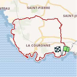
Tocht Stappen van 21 km beschikbaar op Provence-Alpes-Côte d'Azur, Bouches-du-Rhône, Martigues. Deze tocht wordt voorgesteld door tracegps.

Beschrijving

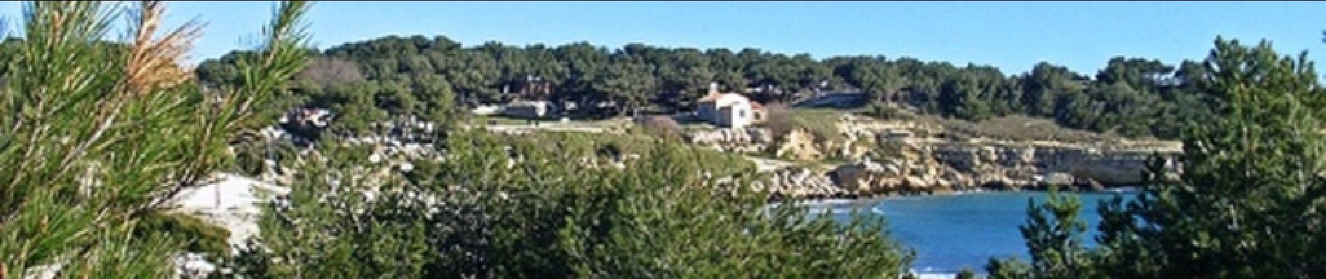
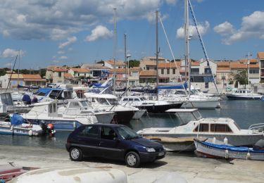
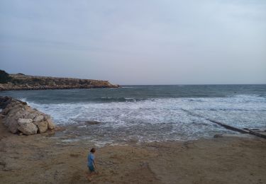
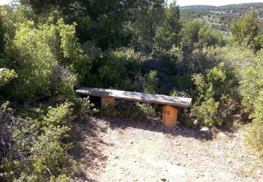
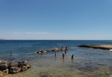
Vous pourrez vous garer au niveau du départ sur le port des Tamaris ou sur le parking situé à coté. La première partie est un chemin dégagé puis qui passe dans un sous-bois donc ombragé. Lorsque vous rejoindrez la cote vous suivrez la mer le long du GR. Vous passerez à coté de la centrale électrique de Martigues-Ponteau vous aurez alors une vue sur le golfe de Fos et des bateaux en attente de déchargement. Vous pourrez ensuite profiter de vues magnifiques sur la cote bleue, les ports de Carro, des Tamaris, de belles plages, des vestiges de carrières dont le début de l'exploitation date du 3ième siècle avant JC, vues sur Martigues mais aussi sur la rade de Marseille. Retrouvez d’autres informations sur le site de Rando Loisirs à Carnoux en Provence.

Hoogteprofiel

Foto's

Plaatsbepaling

Land:
France
Regio :
Provence-Alpes-Côte d'Azur
Departement/Provincie :
Bouches-du-Rhône
Gemeente :
Martigues
Locatie:
Unknown
Vertrek:(Dec)
Vertrek:(UTM)
668643 ; 4799580 (31T) N.

Wandeltochten in de omgeving

Tocht Stappen Martigues - PF-La Côte bleue - Cap Couronne - Photo
Stappen
MicDul

Stappen

Heel gemakkelijk
(2)
Martigues, Provence-Alpes-Côte d'Azur, Bouches-du-Rhône, France
21 km | 24 km-effort
5h 18min
Ja
Tocht Stappen Martigues - Cap couronne  - Photo
Stappen
GUIDE
nadinebondoux

Stappen

Medium
Martigues, Provence-Alpes-Côte d'Azur, Bouches-du-Rhône, France
21 km | 25 km-effort
5h 17min
Ja
Tocht Te voet Martigues - Sentier du littoral Martégal - Photo
Te voet
PRO

Te voet

Gemakkelijk
Martigues, Provence-Alpes-Côte d'Azur, Bouches-du-Rhône, France
10,4 km | 11,5 km-effort
2h 36min
Neen
Tocht Te voet Martigues - Les carrières de pierre de La Couronne - Photo
Te voet
PRO

Te voet

Gemakkelijk
Martigues, Provence-Alpes-Côte d'Azur, Bouches-du-Rhône, France
3,1 km | 3,4 km-effort
45min
Neen
Tocht Te voet Martigues - Boucle de Boumandariel - Photo
Te voet
PRO

Te voet

Gemakkelijk
Martigues, Provence-Alpes-Côte d'Azur, Bouches-du-Rhône, France
5,8 km | 6,6 km-effort
1h 30min
Ja
Tocht Te voet Martigues - Sentier botanique de la plaine de Carro - Photo
Te voet
PRO

Te voet

Gemakkelijk
Martigues, Provence-Alpes-Côte d'Azur, Bouches-du-Rhône, France
3,9 km | 4,3 km-effort
58min
Ja
Tocht Te voet Martigues - Le Cap Couronne - Photo
Te voet
PRO

Te voet

Medium
Martigues, Provence-Alpes-Côte d'Azur, Bouches-du-Rhône, France
20 km | 24 km-effort
5h 22min
Neen
Tocht Te voet Sausset-les-Pins - Mer et Pinéde Valapoux - Photo
Te voet
PRO

Te voet

Gemakkelijk
Sausset-les-Pins, Provence-Alpes-Côte d'Azur, Bouches-du-Rhône, France
6,6 km | 7,9 km-effort
1h 47min
Ja
Tocht Te voet Sausset-les-Pins - Grand Vallat - Littoral - Photo
Te voet
PRO

Te voet

Gemakkelijk
Sausset-les-Pins, Provence-Alpes-Côte d'Azur, Bouches-du-Rhône, France
4,9 km | 5,9 km-effort
1h 20min
Ja


Sluiten
Mijn abonnementen