Tocht Mountainbike Tollevast - Tollevastaise 2009 35km - Photo

Tollevastaise 2009 35km

 tracegps
tracegps

Gebruiker

© OpenStreetMap contributors
Lengte
Lengte
34 km
Max. hoogte
Max. hoogte
149 m
Positief hoogteverschil
501 m
Km-Effort
Km-Effort  
41 km
Min. hoogte
Min. hoogte
42 m
Negatief hoogteverschil
512 m
Boucle
Boucle
Ja
Datum van aanmaak :
2014-12-10 00:00:00.0
Laatste wijziging :
2014-12-10 00:00:00.0

(0 Bericht)

Mountainbike
Mountainbike
2h00
Moeilijkheid : Moeilijk

Scan deze QR-code om de tocht te openen in de SityTrail-applicatie

Gratisgps-wandelapplicatie

Logo SityTrail SityTrail

IGN / Geografische instituten

SityTrail uit de App Store downloaden SityTrail uit Google Play downloaden

Logo SityTrail SityTrail World

De wereld gaat voor u open

SityTrail uit de App Store downloaden SityTrail uit Google Play downloaden SityTrail op Huawei AppGallery downloaden

Over ons

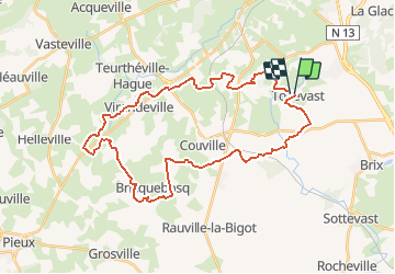
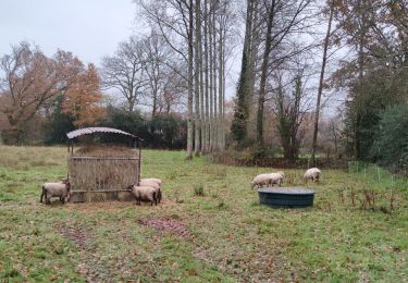
Tocht Mountainbike van 34 km beschikbaar op Normandië, Manche, Tollevast. Deze tocht wordt voorgesteld door tracegps.

Beschrijving

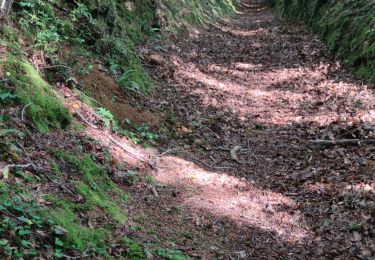
Rando Tollevastaise 2009. La trace concerne la rando de 35km. Le circuit ne présente aucune difficulté particulière. Néanmoins, la pluie tombée en abondance tout au long de la semaine, a transformé le sol en glaise assez collante. Vous avez la possibilité de faire le parcours en famille mais de préférence en saison sèche (si ca existe en Normandie ;))

Hoogteprofiel

Plaatsbepaling

Land:
France
Regio :
Normandië
Departement/Provincie :
Manche
Gemeente :
Tollevast
Locatie:
Unknown
Vertrek:(Dec)
Vertrek:(UTM)
599192 ; 5492218 (30U) N.

Wandeltochten in de omgeving

Tocht Stappen Cherbourg-en-Cotentin - La Glacerie  - Photo
Stappen
PatRando

Stappen

Gemakkelijk
Cherbourg-en-Cotentin, Normandië, Manche, France
6,6 km | 8,7 km-effort
1h 26min
Ja
Tocht Stappen Brix - Brix - Photo
Stappen
PatRando

Stappen

Medium
Brix, Normandië, Manche, France
11,4 km | 14,3 km-effort
2h 30min
Ja
Tocht Mountainbike Tollevast - La Tollevastaise 2013 - Photo
Mountainbike
tracegps

Mountainbike

Medium
Tollevast, Normandië, Manche, France
53 km | 66 km-effort
3h 0min
Ja
Tocht Stappen Tollevast - Tollevast - Photo
Stappen
PatRando

Stappen

Medium
Tollevast, Normandië, Manche, France
9,1 km | 11,1 km-effort
1h 58min
Ja
Tocht Mountainbike Saint-Martin-le-Gréard - La Royale - Saint Martin le Gréard - Photo
Mountainbike
tracegps

Mountainbike

Medium
Saint-Martin-le-Gréard, Normandië, Manche, France
21 km | 26 km-effort
2h 0min
Ja
Tocht Mountainbike Tollevast - Tollevastaise 2012 - 50 km - Photo
Mountainbike
tracegps

Mountainbike

Medium
Tollevast, Normandië, Manche, France
49 km | 60 km-effort
2h 30min
Neen
Tocht Mountainbike Tollevast - Tollevastaise 2011 - 50 km - Photo
Mountainbike
tracegps

Mountainbike

Moeilijk
Tollevast, Normandië, Manche, France
52 km | 62 km-effort
3h 0min
Ja
Tocht Mountainbike Cherbourg-en-Cotentin - La Glacerie - Maupertus sur Mer - Photo
Mountainbike
tracegps

Mountainbike

Moeilijk
Cherbourg-en-Cotentin, Normandië, Manche, France
36 km | 43 km-effort
3h 15min
Ja
Tocht Mountainbike Cherbourg-en-Cotentin - Glacerie village gravel - Photo
Mountainbike
ves

Mountainbike

Zeer moeilijk
Cherbourg-en-Cotentin, Normandië, Manche, France
41 km | 50 km-effort
3h 28min
Ja


Sluiten
Mijn abonnementen