Tocht Fiets Bruz - Bruz - Goven - StThurial - Breal sous Monfort 37km - Photo

Bruz - Goven - StThurial - Breal sous Monfort 37km

 tracegps
tracegps

Gebruiker

© OpenStreetMap contributors
Lengte
Lengte
39 km
Max. hoogte
Max. hoogte
117 m
Positief hoogteverschil
355 m
Km-Effort
Km-Effort  
44 km
Min. hoogte
Min. hoogte
15 m
Negatief hoogteverschil
356 m
Boucle
Boucle
Ja
Datum van aanmaak :
2014-12-10 00:00:00.0
Laatste wijziging :
2014-12-10 00:00:00.0

(0 Bericht)

Fiets
Fiets
1h30
Moeilijkheid : Medium

Scan deze QR-code om de tocht te openen in de SityTrail-applicatie

Gratisgps-wandelapplicatie

Logo SityTrail SityTrail

IGN / Geografische instituten

SityTrail uit de App Store downloaden SityTrail uit Google Play downloaden

Logo SityTrail SityTrail World

De wereld gaat voor u open

SityTrail uit de App Store downloaden SityTrail uit Google Play downloaden SityTrail op Huawei AppGallery downloaden

Over ons

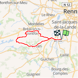
Tocht Fiets van 39 km beschikbaar op Bretagne, Ille-et-Vilaine, Bruz. Deze tocht wordt voorgesteld door tracegps.

Beschrijving

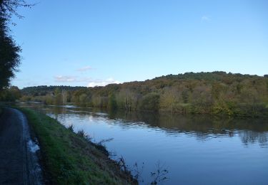
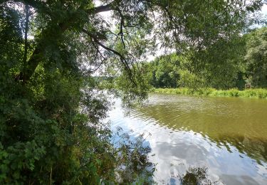
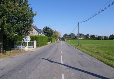
Boucle au départ de Bruz. Itinéraire super agréable et très roulant, idéal pour un travail en fréquence de jambes. Passages dans la campagne bretonne, petites routes sympas. Pas de difficulté technique, quelques faux plats montants. Revêtement très correct. Itinéraire peu fréquenté et superbe sous le soleil.

Hoogteprofiel

Plaatsbepaling

Land:
France
Regio :
Bretagne
Departement/Provincie :
Ille-et-Vilaine
Gemeente :
Bruz
Locatie:
Unknown
Vertrek:(Dec)
Vertrek:(UTM)
594383 ; 5319810 (30U) N.

Wandeltochten in de omgeving

Tocht Mountainbike Pont-Péan - Le long de la Vilaine - Pont Péan - Photo
Mountainbike
tracegps

Mountainbike

Moeilijk
(1)
Pont-Péan, Bretagne, Ille-et-Vilaine, France
35 km | 41 km-effort
2h 15min
Ja
Tocht Stappen Pont-Péan - Randonnée autour de Pont-Péan - Photo
Stappen
tracegps

Stappen

Medium
(1)
Pont-Péan, Bretagne, Ille-et-Vilaine, France
7,9 km | 8,5 km-effort
2h 0min
Ja
Tocht Te voet Laillé - Laillé la Chapelle - Photo
Te voet
PRO

Te voet

Gemakkelijk
Laillé, Bretagne, Ille-et-Vilaine, France
13,2 km | 15,6 km-effort
3h 33min
Ja
Tocht Te voet Guichen - Les landes du Boël - Photo
Te voet
PRO

Te voet

Gemakkelijk
Guichen, Bretagne, Ille-et-Vilaine, France
5,2 km | 6,1 km-effort
1h 23min
Ja
Tocht Te voet Guichen - Les bords de Vilaine - Photo
Te voet
PRO

Te voet

Gemakkelijk
Guichen, Bretagne, Ille-et-Vilaine, France
6,9 km | 8,4 km-effort
1h 54min
Ja
Tocht Te voet Guichen - Pont-Réan Le Boël - Photo
Te voet
PRO

Te voet

Gemakkelijk
Guichen, Bretagne, Ille-et-Vilaine, France
9,3 km | 11,5 km-effort
2h 37min
Ja
Tocht Stappen Laillé - Laillé, Roche qui chome - Photo
Stappen
nolsim

Stappen

Heel gemakkelijk
Laillé, Bretagne, Ille-et-Vilaine, France
11,4 km | 13,1 km-effort
2h 40min
Ja
Tocht Te voet Orgères - Circuit des deux Monts et du Télégraphe - Photo
Te voet
PRO

Te voet

Gemakkelijk
Orgères, Bretagne, Ille-et-Vilaine, France
6,2 km | 7,4 km-effort
1h 40min
Ja
Tocht Stappen Bruz -  Boucle Le Boël - gare de Laillé - Photo
Stappen
ilur56

Stappen

Medium
Bruz, Bretagne, Ille-et-Vilaine, France
8,4 km | 10 km-effort
2h 22min
Ja


Sluiten
Mijn abonnementen