Tocht Stappen Pierrefonds - Forêt de Pierrefonds - Photo

Forêt de Pierrefonds

 tracegps
tracegps

Gebruiker

© OpenStreetMap contributors
Lengte
Lengte
20 km
Max. hoogte
Max. hoogte
143 m
Positief hoogteverschil
291 m
Km-Effort
Km-Effort  
24 km
Min. hoogte
Min. hoogte
59 m
Negatief hoogteverschil
288 m
Boucle
Boucle
Ja
Datum van aanmaak :
2014-12-10 00:00:00.0
Laatste wijziging :
2014-12-10 00:00:00.0

(0 Bericht)

Stappen
Stappen
5h00
Moeilijkheid : Medium

Scan deze QR-code om de tocht te openen in de SityTrail-applicatie

Gratisgps-wandelapplicatie

Logo SityTrail SityTrail

IGN / Geografische instituten

SityTrail uit de App Store downloaden SityTrail uit Google Play downloaden

Logo SityTrail SityTrail World

De wereld gaat voor u open

SityTrail uit de App Store downloaden SityTrail uit Google Play downloaden SityTrail op Huawei AppGallery downloaden

Over ons

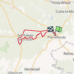
Tocht Stappen van 20 km beschikbaar op Hauts-de-France, Oise, Pierrefonds. Deze tocht wordt voorgesteld door tracegps.

Beschrijving

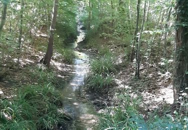
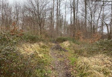
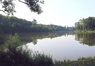
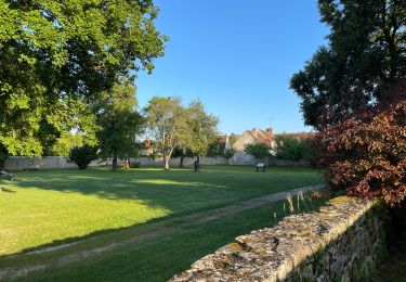
Rando dans la forêt de Compiègne. Départ et arrivée au château de Pierrefonds ( parking). Petite grimpette au départ pour avoir une belle vue , puis ensuite forêt, forêt , forêt... Longue , très longue ligne droite terminale sur la piste cyclable pour finir.

Hoogteprofiel

Plaatsbepaling

Land:
France
Regio :
Hauts-de-France
Departement/Provincie :
Oise
Gemeente :
Pierrefonds
Locatie:
Unknown
Vertrek:(Dec)
Vertrek:(UTM)
498134 ; 5466309 (31U) N.

Wandeltochten in de omgeving

Tocht Te voet Pierrefonds - Le Voliard - Photo
Te voet
PRO

Te voet

Gemakkelijk
(1)
Pierrefonds, Hauts-de-France, Oise, France
5,2 km | 6,4 km-effort
1h 27min
Neen
Tocht Stappen Pierrefonds - Rando couscous ATPC ARVAL 4/2/2024 - Photo
Stappen
pascha

Stappen

Medium
(1)
Pierrefonds, Hauts-de-France, Oise, France
9,6 km | 11,9 km-effort
2h 42min
Ja
Tocht Stappen Saint-Jean-aux-Bois - SAINT JEAN AUX BOIS, le village et les bois - Photo
Stappen
jeannine grandjean

Stappen

Gemakkelijk
Saint-Jean-aux-Bois, Hauts-de-France, Oise, France
4,6 km | 5,2 km-effort
1h 11min
Ja
Tocht Stappen Vieux-Moulin - Rando douce Vieux moulin 14/8/2022 - Photo
Stappen
pascha

Stappen

Medium
(1)
Vieux-Moulin, Hauts-de-France, Oise, France
8,7 km | 10,1 km-effort
2h 14min
Ja
Tocht Stappen Vieux-Moulin - Gorges du Han - ATPC ARVAL - Photo
Stappen
pascha

Stappen

Heel gemakkelijk
(1)
Vieux-Moulin, Hauts-de-France, Oise, France
13,2 km | 16 km-effort
2h 42min
Ja
Tocht Stappen Saint-Jean-aux-Bois - Saint Jean au Bois 13,4 km - Photo
Stappen
GUIDE
rvapeldo

Stappen

Gemakkelijk
Saint-Jean-aux-Bois, Hauts-de-France, Oise, France
13,4 km | 16,3 km-effort
3h 51min
Ja
Tocht Te voet Trosly-Breuil - Le Mont-Collet - Photo
Te voet
PRO

Te voet

Gemakkelijk
Trosly-Breuil, Hauts-de-France, Oise, France
4,9 km | 6,6 km-effort
1h 29min
Ja
Tocht Stappen Saint-Jean-aux-Bois - en Forêt de Compiègne_39_Saint-Jean-aux-Bois_Mont d'Arcy - Photo
Stappen

Stappen

Zeer moeilijk
Saint-Jean-aux-Bois, Hauts-de-France, Oise, France
17,9 km | 21 km-effort
5h 38min
Ja
Tocht Stappen Vieux-Moulin - Gorges du Han  - Photo
Stappen
pascha

Stappen

Heel gemakkelijk
(1)
Vieux-Moulin, Hauts-de-France, Oise, France
11,5 km | 13,8 km-effort
2h 42min
Ja


Sluiten
Mijn abonnementen