Le Montcalm - Auzat
tracegps
Gebruiker
Lengte
16,7 km
Max. hoogte
3070 m
Positief hoogteverschil
1900 m
Km-Effort
42 km
Min. hoogte
1185 m
Negatief hoogteverschil
1947 m
Boucle
Neen
Datum van aanmaak :
2014-12-10 00:00:00.0
Laatste wijziging :
2014-12-10 00:00:00.0
11h00
Moeilijkheid : Moeilijk
Gratisgps-wandelapplicatie
Over ons
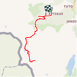
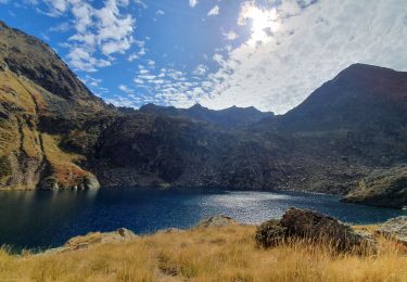
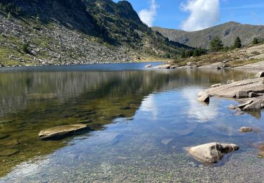
Tocht Stappen van 16,7 km beschikbaar op Occitanië, Ariège, Auzat. Deze tocht wordt voorgesteld door tracegps.
Beschrijving
Pour info, le Montcalm, c'est: 7h: départ 9h: étang sourd (eau) 10h: refuge (eau) 11h: étang du Montcalm 14h: sommet casse-croûte (30mn) 18h30 retour L'artigue
Plaatsbepaling
Land:
France
Regio :
Occitanië
Departement/Provincie :
Ariège
Gemeente :
Auzat
Locatie:
Unknown
Vertrek:(Dec)
Vertrek:(UTM)
370370 ; 4729753 (31T) N.
Opmerkingen
Wandeltochten in de omgeving
171006.2 EnCours
Stappen
Heel gemakkelijk
Auzat,
Occitanië,
Ariège,
France
8,7 km | 13,5 km-effort
3h 45min
Ja
171004 EnCours
Stappen
Heel gemakkelijk
Auzat,
Occitanië,
Ariège,
France
12,3 km | 24 km-effort
7h 30min
Ja
SVG 171002
Stappen
Heel gemakkelijk
Auzat,
Occitanië,
Ariège,
France
4 km | 6,3 km-effort
2h 8min
Ja
171002 EnCours
Stappen
Heel gemakkelijk
Auzat,
Occitanië,
Ariège,
France
4 km | 6,3 km-effort
2h 0min
Ja
L'étang de Montestaure par la vallée de l'Artigue
Stappen
Zeer moeilijk
Auzat,
Occitanië,
Ariège,
France
12,4 km | 28 km-effort
6h 30min
Ja
De Marc à l'Artigue
Te voet
Gemakkelijk
Auzat,
Occitanië,
Ariège,
France
5 km | 8 km-effort
1h 49min
Ja
Randonnée vers le lac de Bassies
Noords wandelen
Moeilijk
Auzat,
Occitanië,
Ariège,
France
5,4 km | 11,7 km-effort
4h 20min
Ja