Tocht Stappen Saint-Quentin - La pâturelle - Photo
 tracegps
tracegps

Gebruiker

© OpenStreetMap contributors
Lengte
Lengte
14,6 km
Max. hoogte
Max. hoogte
118 m
Positief hoogteverschil
142 m
Km-Effort
Km-Effort  
16,4 km
Min. hoogte
Min. hoogte
70 m
Negatief hoogteverschil
141 m
Boucle
Boucle
Ja
Datum van aanmaak :
2014-12-10 00:00:00.0
Laatste wijziging :
2014-12-10 00:00:00.0

(0 Bericht)

Stappen
Stappen
4h00
Moeilijkheid : Zeer moeilijk

Scan deze QR-code om de tocht te openen in de SityTrail-applicatie

Gratisgps-wandelapplicatie

Logo SityTrail SityTrail

IGN / Geografische instituten

SityTrail uit de App Store downloaden SityTrail uit Google Play downloaden

Logo SityTrail SityTrail World

De wereld gaat voor u open

SityTrail uit de App Store downloaden SityTrail uit Google Play downloaden SityTrail op Huawei AppGallery downloaden

Over ons

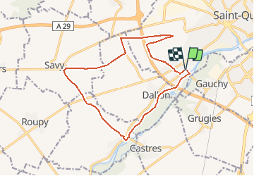
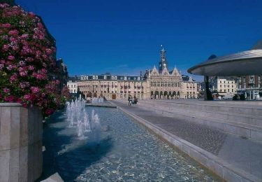
Tocht Stappen van 14,6 km beschikbaar op Hauts-de-France, Aisne, Saint-Quentin. Deze tocht wordt voorgesteld door tracegps.

Beschrijving

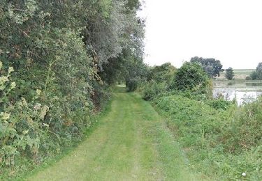
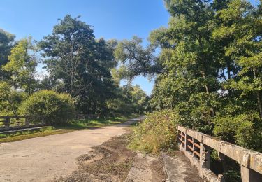
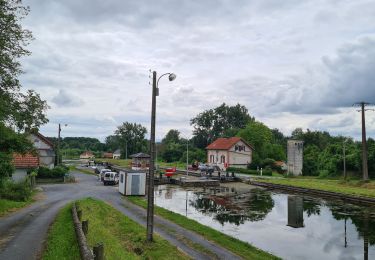
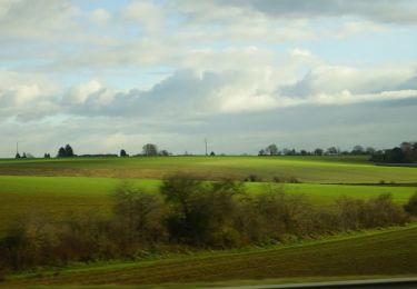
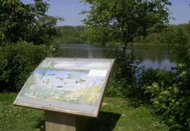
Entre les marais de la Somme qu'elle suit longuement et la campagne vermandoise, cette grande boucle offre des paysages variés et se coule dans des micro-vallées aux noms évocateurs : vallée à l'Avoine, vallée des Cerisiers, des Noyers ou du bois d'Artois. Après Fontaine-lès-Clercs et son écluse souvent animée par le passage des bateaux, on quitte la Somme pour les chemins creux de la Pâturelle. Toutes les infos sont ICI

Hoogteprofiel

Foto's

Plaatsbepaling

Land:
France
Regio :
Hauts-de-France
Departement/Provincie :
Aisne
Gemeente :
Saint-Quentin
Locatie:
Unknown
Vertrek:(Dec)
Vertrek:(UTM)
518531 ; 5519662 (31U) N.

Wandeltochten in de omgeving

Tocht Mountainbike Holnon - Les sentiers vermandois - Holnon - Photo
Mountainbike
tracegps

Mountainbike

Medium
(1)
Holnon, Hauts-de-France, Aisne, France
26 km | 30 km-effort
2h 19min
Ja
Tocht Mountainbike Castres - Parcours fontaines les clercs - Photo
Mountainbike
alainwald

Mountainbike

Gemakkelijk
Castres, Hauts-de-France, Aisne, France
52 km | 57 km-effort
4h 14min
Ja
Tocht Mountainbike Dallon - pays de ham - Photo
Mountainbike
alainwald

Mountainbike

Heel gemakkelijk
Dallon, Hauts-de-France, Aisne, France
56 km | 61 km-effort
4h 21min
Ja
Tocht Stappen Saint-Quentin - Le marais d'Isle - Photo
Stappen

Stappen

Heel gemakkelijk
Saint-Quentin, Hauts-de-France, Aisne, France
5,4 km | 6 km-effort
Onbekend
Ja
Tocht Stappen Saint-Quentin - Parc d'isle - Photo
Stappen
JJDOLLE

Stappen

Heel gemakkelijk
Saint-Quentin, Hauts-de-France, Aisne, France
5,9 km | 6,5 km-effort
1h 40min
Ja
Tocht Stappen Saint-Quentin - Du canal au chemin de fer - Saint-Quentin - Photo
Stappen
tracegps

Stappen

Medium
Saint-Quentin, Hauts-de-France, Aisne, France
7,2 km | 8,3 km-effort
2h 0min
Ja
Tocht Stappen Harly - Le grand Culot - Photo
Stappen
tracegps

Stappen

Medium
Harly, Hauts-de-France, Aisne, France
10 km | 11,4 km-effort
2h 30min
Ja
Tocht Stappen Saint-Quentin - Le marais d'Isle - Photo
Stappen
tracegps

Stappen

Gemakkelijk
Saint-Quentin, Hauts-de-France, Aisne, France
5,4 km | 6 km-effort
1h 30min
Ja
Tocht Stappen Saint-Quentin - Du canal au chemin de fer - Photo
Stappen
tracegps

Stappen

Medium
Saint-Quentin, Hauts-de-France, Aisne, France
7,2 km | 8,3 km-effort
2h 0min
Ja


Sluiten
Mijn abonnementen