Tocht Stappen Montaut - Lestelle Bétharram les Bastides - Photo

Lestelle Bétharram les Bastides

 tracegps
tracegps

Gebruiker

© OpenStreetMap contributors
Lengte
Lengte
11,8 km
Max. hoogte
Max. hoogte
424 m
Positief hoogteverschil
296 m
Km-Effort
Km-Effort  
15,7 km
Min. hoogte
Min. hoogte
296 m
Negatief hoogteverschil
295 m
Boucle
Boucle
Ja
Datum van aanmaak :
2014-12-10 00:00:00.0
Laatste wijziging :
2014-12-10 00:00:00.0

(0 Bericht)

Stappen
Stappen
4h00
Moeilijkheid : Medium

Scan deze QR-code om de tocht te openen in de SityTrail-applicatie

Gratisgps-wandelapplicatie

Logo SityTrail SityTrail

IGN / Geografische instituten

SityTrail uit de App Store downloaden SityTrail uit Google Play downloaden

Logo SityTrail SityTrail World

De wereld gaat voor u open

SityTrail uit de App Store downloaden SityTrail uit Google Play downloaden SityTrail op Huawei AppGallery downloaden

Over ons

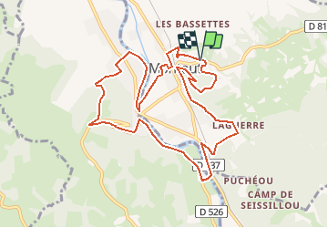
Tocht Stappen van 11,8 km beschikbaar op Nieuw-Aquitanië, Pyrénées-Atlantiques, Montaut. Deze tocht wordt voorgesteld door tracegps.

Beschrijving

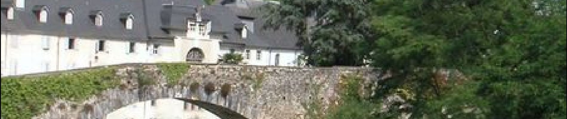
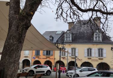
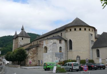
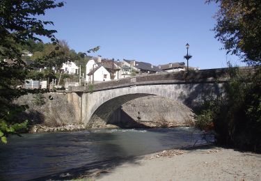
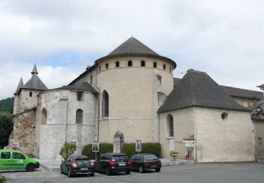
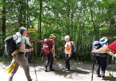
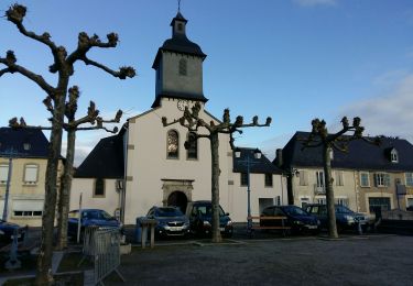
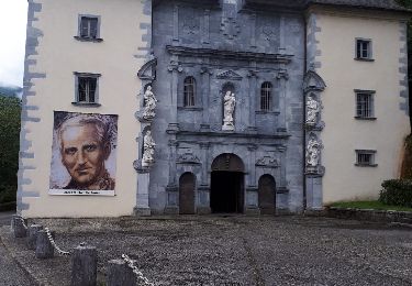
Lestelle Bétharram les Bastides Cette randonnée facile prend de la hauteur en passant sur les collines qui dominent le gave de Pau. Ne manquez pas de faire un détour pour visiter les villages de Lestelle et Montaut qui sont d’anciennes bastides. Téléchargez la Fiche de la randonnée au format pdf!

Hoogteprofiel

Foto's

Plaatsbepaling

Land:
France
Regio :
Nieuw-Aquitanië
Departement/Provincie :
Pyrénées-Atlantiques
Gemeente :
Montaut
Locatie:
Unknown
Vertrek:(Dec)
Vertrek:(UTM)
728135 ; 4779159 (30T) N.

Wandeltochten in de omgeving

Tocht Te voet Saint-Pé-de-Bigorre - SAINT PE DE BIGORRE Le grand tour de saint pe
Te voet
GUIDE
marmotte65

Te voet

Gemakkelijk
Saint-Pé-de-Bigorre, Occitanië, Hautes-Pyrénées, France
9,8 km | 13,6 km-effort
3h 5min
Ja
Tocht Te voet Saint-Pé-de-Bigorre - Le Plateau du Mousqué - Photo
Te voet
PRO

Te voet

Gemakkelijk
Saint-Pé-de-Bigorre, Occitanië, Hautes-Pyrénées, France
5,1 km | 7,8 km-effort
1h 45min
Ja
Tocht Te voet Saint-Pé-de-Bigorre - Lengous et Montagnou - Photo
Te voet
PRO

Te voet

Gemakkelijk
Saint-Pé-de-Bigorre, Occitanië, Hautes-Pyrénées, France
5,3 km | 7,4 km-effort
1h 40min
Ja
Tocht Te voet Saint-Pé-de-Bigorre - Les Coteaux de Saint-Pé - Photo
Te voet
PRO

Te voet

Gemakkelijk
Saint-Pé-de-Bigorre, Occitanië, Hautes-Pyrénées, France
9,2 km | 12,2 km-effort
2h 46min
Ja
Tocht Stappen Lestelle-Bétharram - 2023 10 10 CHEMIN du PIÉMONT PYRÉNÉEN - 18ème étape : Lestelle-Bétharram - Asson - Bruges - Mifaget - Ste Colome - Arudy - Photo
Stappen
LEGUE

Stappen

Medium
Lestelle-Bétharram, Nieuw-Aquitanië, Pyrénées-Atlantiques, France
28 km | 36 km-effort
6h 9min
Neen
Tocht Stappen Asson - ASSON Igon Touyas de Capsus
Stappen
GUIDE
marmotte65

Stappen

Moeilijk
Asson, Nieuw-Aquitanië, Pyrénées-Atlantiques, France
13 km | 16,3 km-effort
4h 5min
Ja
Tocht Te voet Saint-Pé-de-Bigorre - Le sentier du Bénac - Photo
Te voet
PRO

Te voet

Gemakkelijk
Saint-Pé-de-Bigorre, Occitanië, Hautes-Pyrénées, France
8,1 km | 14,3 km-effort
3h 14min
Ja
Tocht Stappen Lestelle-Bétharram - LESTELLE BETHARRAM entre amis - Photo
Stappen
GUIDE
marmotte65

Stappen

Heel gemakkelijk
Lestelle-Bétharram, Nieuw-Aquitanië, Pyrénées-Atlantiques, France
9,5 km | 12,5 km-effort
2h 29min
Ja
Tocht Stappen Lestelle-Bétharram - grottes - Photo
Stappen
pilgrim08

Stappen

Medium
Lestelle-Bétharram, Nieuw-Aquitanië, Pyrénées-Atlantiques, France
11 km | 14 km-effort
2h 14min
Ja


Sluiten
Mijn abonnementen