Tocht Mountainbike Lessay - La lande de Lessay  - Photo

La lande de Lessay

 tracegps
tracegps

Gebruiker

© OpenStreetMap contributors
Lengte
Lengte
29 km
Max. hoogte
Max. hoogte
43 m
Positief hoogteverschil
203 m
Km-Effort
Km-Effort  
31 km
Min. hoogte
Min. hoogte
2 m
Negatief hoogteverschil
203 m
Boucle
Boucle
Ja
Datum van aanmaak :
2014-12-10 00:00:00.0
Laatste wijziging :
2014-12-10 00:00:00.0

(3 Bericht)

Mountainbike
Mountainbike
2h30
Moeilijkheid : Medium

Scan deze QR-code om de tocht te openen in de SityTrail-applicatie

Gratisgps-wandelapplicatie

Logo SityTrail SityTrail

IGN / Geografische instituten

SityTrail uit de App Store downloaden SityTrail uit Google Play downloaden

Logo SityTrail SityTrail World

De wereld gaat voor u open

SityTrail uit de App Store downloaden SityTrail uit Google Play downloaden SityTrail op Huawei AppGallery downloaden

Over ons

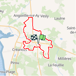
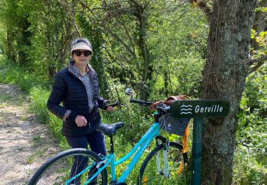
Tocht Mountainbike van 29 km beschikbaar op Normandië, Manche, Lessay. Deze tocht wordt voorgesteld door tracegps.

Beschrijving

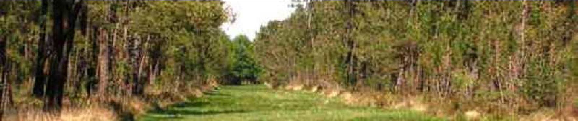
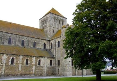
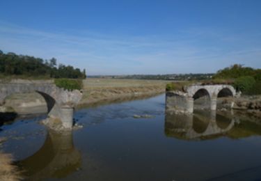
Vous saviez que Lindbergh était venu à Lessay ? Peut-être avait-il été attiré par l’extraordinaire patrimoine environnemental des alentours… Les landes d’abord, domaine réservé des bruyères et des ajoncs, qui ont toujours impressionné les esprits par leur âpreté. Puis le vaste estuaire du havre de Saint-Germain-sur-Ay, un des plus sauvages de la côte avec salicorne et lavande de mer, où l’on peut observer courlis ou huîtriers pie. Plus de détails sur le circuit (balisage, difficulté…), les points remarquables à proximité et téléchargements sur Manche Tourisme – Loisirs Randonnée GPS.

Hoogteprofiel

Foto's

POI's

POI Lessay - 00_DEPART_ET_CPIE - Photo
tracegps
POI Lessay - 02_LANDES_DE_LESSAY - Photo
tracegps
POI Lessay - 03_LINDBERGH - Photo
tracegps
LESSAY 
POI Lessay - 04_FORET_PISSOT - Photo
tracegps
POI Lessay - 05_VOIE_VERTE - Photo
tracegps
POI Lessay - 06_HAVRE_ST_GERMAIN - Photo
tracegps
POI Lessay - 07_GARDE - Photo
tracegps
LESSAY 

Plaatsbepaling

Land:
France
Regio :
Normandië
Departement/Provincie :
Manche
Gemeente :
Lessay
Locatie:
Lessay
Vertrek:(Dec)
Vertrek:(UTM)
607716 ; 5451841 (30U) N.

Opmerkingen

Gelieve in te loggen om een commentaar of een beoordeling achter te laten


J'adore ce circuit autour de Lessay... Très varié.


Wandeltochten in de omgeving

Tocht Stappen Lessay - De l'Abbaye au bois du Pissot - Lessay - Photo
Stappen
tracegps

Stappen

Medium
(1)
Lessay, Normandië, Manche, France
14,5 km | 16,3 km-effort
3h 30min
Ja
Tocht Stappen Lessay - Les chemins de Saint Michel - Lessay - Granville - Photo
Stappen
tracegps

Stappen

Medium
Lessay, Normandië, Manche, France
78 km | 88 km-effort
Onbekend
Neen
Tocht Wegfiets Lessay - Velo Lessay la Haie du Puits - Photo
Wegfiets
FOUCAULT

Wegfiets

Lessay, Normandië, Manche, France
21 km | 22 km-effort
1h 55min
Ja
Tocht Stappen Millières - Lac f - Photo
Stappen
Yvon59

Stappen

Medium
Millières, Normandië, Manche, France
8,2 km | 8,9 km-effort
2h 55min
Ja
Tocht Wegfiets Vesly - COTENTIN  1 - Photo
Wegfiets
UDGI54

Wegfiets

Zeer moeilijk
Vesly, Normandië, Manche, France
258 km | 292 km-effort
17h 40min
Neen
Tocht Fietstoerisme Vesly - TR DU COTENTIN 250K - Photo
Fietstoerisme
UDGI54

Fietstoerisme

Heel gemakkelijk
Vesly, Normandië, Manche, France
240 km | 271 km-effort
Onbekend
Ja
Tocht Stappen Saint-Germain-sur-Ay - Tour du cotentin étape 10 faite  - Photo
Stappen
dblix

Stappen

Zeer moeilijk
Saint-Germain-sur-Ay, Normandië, Manche, France
19,8 km | 21 km-effort
3h 55min
Neen
Tocht sport Lessay - des-rives-de-l-ay-aux-landes-de-lessay 2 - Photo
sport
FOUCAULT

sport

Heel gemakkelijk
Lessay, Normandië, Manche, France
12,5 km | 13,5 km-effort
Onbekend
Neen
Tocht Elektrische fiets Lessay - 50 2022 04 17 Lessay - boucle les vents de huppelande - Photo
Elektrische fiets
OLYMP42

Elektrische fiets

Gemakkelijk
Lessay, Normandië, Manche, France
29 km | 33 km-effort
2h 3min
Ja


Sluiten
Mijn abonnementen