Tocht Stappen Saint-Laurent-en-Gâtines - Saint Laurent en Gâtine 23, 5km - Photo
 dporcher
dporcher

Gebruiker

© OpenStreetMap contributors
Lengte
Lengte
23 km
Max. hoogte
Max. hoogte
176 m
Positief hoogteverschil
246 m
Km-Effort
Km-Effort  
27 km
Min. hoogte
Min. hoogte
122 m
Negatief hoogteverschil
246 m
Boucle
Boucle
Ja
Datum van aanmaak :
2019-05-06 15:22:12.879
Laatste wijziging :
2019-05-06 15:22:12.879

(0 Bericht)

Stappen
Stappen
4h28
Moeilijkheid : Gemakkelijk

Scan deze QR-code om de tocht te openen in de SityTrail-applicatie

Gratisgps-wandelapplicatie

Logo SityTrail SityTrail

IGN / Geografische instituten

SityTrail uit de App Store downloaden SityTrail uit Google Play downloaden

Logo SityTrail SityTrail World

De wereld gaat voor u open

SityTrail uit de App Store downloaden SityTrail uit Google Play downloaden SityTrail op Huawei AppGallery downloaden

Over ons

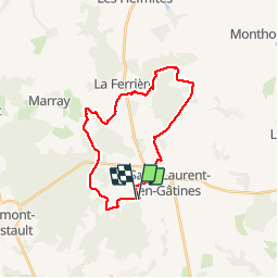
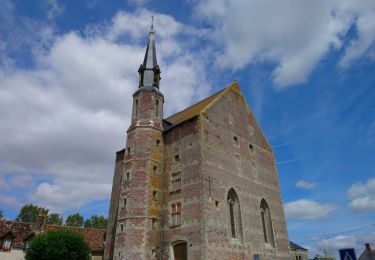
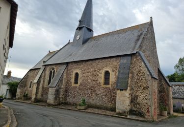
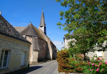
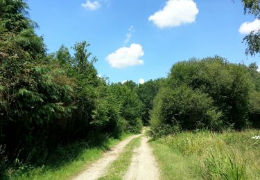
Tocht Stappen van 23 km beschikbaar op Centre-Val de Loire, Indre-et-Loire, Saint-Laurent-en-Gâtines. Deze tocht wordt voorgesteld door dporcher.

Beschrijving

Bois et plaines

Hoogteprofiel

Plaatsbepaling

Land:
France
Regio :
Centre-Val de Loire
Departement/Provincie :
Indre-et-Loire
Gemeente :
Saint-Laurent-en-Gâtines
Locatie:
Unknown
Vertrek:(Dec)
Vertrek:(UTM)
331230 ; 5271930 (31T) N.

Wandeltochten in de omgeving

Tocht Stappen Saint-Laurent-en-Gâtines - Saint-Laurent-en-Gâtines - variante du PR Chemin de Chenusson - 10.2km 90m 2h25 - 2023 07 30 - Photo
Stappen
Orcal37

Stappen

Gemakkelijk
Saint-Laurent-en-Gâtines, Centre-Val de Loire, Indre-et-Loire, France
10,3 km | 11,5 km-effort
2h 25min
Ja
Tocht Stappen Saint-Laurent-en-Gâtines - Saint-Laurent-en-Gatines - Photo
Stappen
guydu41

Stappen

Moeilijk
Saint-Laurent-en-Gâtines, Centre-Val de Loire, Indre-et-Loire, France
13,1 km | 14,9 km-effort
3h 23min
Ja
Tocht Stappen Marray - Marray - Les versants de la Dême - Photo
Stappen
guydu41

Stappen

Moeilijk
Marray, Centre-Val de Loire, Indre-et-Loire, France
12,8 km | 15,2 km-effort
3h 27min
Ja
Tocht Stappen Monthodon - Monthodon Le Sentier - Photo
Stappen
guydu41

Stappen

Medium
Monthodon, Centre-Val de Loire, Indre-et-Loire, France
8,5 km | 9,5 km-effort
2h 9min
Ja
Tocht Stappen Saint-Laurent-en-Gâtines - Saint-Laurent-en-Gâtines - Circuit jaune avec variante le Sentier - 18.7km 120m 4h30 - 2022 05 01 - Photo
Stappen
Orcal37

Stappen

Gemakkelijk
Saint-Laurent-en-Gâtines, Centre-Val de Loire, Indre-et-Loire, France
18,7 km | 20 km-effort
4h 30min
Ja
Tocht Stappen Nouzilly - Nouzilly - Circuit des Orchidées - 22.4km 375m 5h10 - 2022 04 10 - Photo
Stappen
Orcal37

Stappen

Medium
Nouzilly, Centre-Val de Loire, Indre-et-Loire, France
22 km | 27 km-effort
5h 10min
Ja
Tocht Stappen Marray - Marray - 2 boucles - 19.2km 245m 5h05 (30mn) - 2021 06 09 - Photo
Stappen
Orcal37

Stappen

Medium
Marray, Centre-Val de Loire, Indre-et-Loire, France
19,2 km | 22 km-effort
5h 5min
Ja
Tocht Stappen Monthodon - Monthodon - et Le Sentier - 26.7km 230m 6h00 - 2018 07 15 - public - Photo
Stappen
Orcal37

Stappen

Gemakkelijk
Monthodon, Centre-Val de Loire, Indre-et-Loire, France
27 km | 30 km-effort
5h 45min
Ja
Tocht Stappen Nouzilly - 2021.11.07-10,5km-Nouzilly - Photo
Stappen
Martinjeanclaude

Stappen

Medium
Nouzilly, Centre-Val de Loire, Indre-et-Loire, France
10,1 km | 12,4 km-effort
2h 43min
Ja


Sluiten
Mijn abonnementen