Tocht Sneeuwschoenen Artigue - Le Pic de Bacanère - Photo

Le Pic de Bacanère

 tracegps
tracegps

Gebruiker

© OpenStreetMap contributors
Lengte
Lengte
12,5 km
Max. hoogte
Max. hoogte
2190 m
Positief hoogteverschil
989 m
Km-Effort
Km-Effort  
26 km
Min. hoogte
Min. hoogte
1220 m
Negatief hoogteverschil
986 m
Boucle
Boucle
Ja
Datum van aanmaak :
2014-12-10 00:00:00.0
Laatste wijziging :
2014-12-10 00:00:00.0

(0 Bericht)

Sneeuwschoenen
Sneeuwschoenen
6h00
Moeilijkheid : Medium

Scan deze QR-code om de tocht te openen in de SityTrail-applicatie

Gratisgps-wandelapplicatie

Logo SityTrail SityTrail

IGN / Geografische instituten

SityTrail uit de App Store downloaden SityTrail uit Google Play downloaden

Logo SityTrail SityTrail World

De wereld gaat voor u open

SityTrail uit de App Store downloaden SityTrail uit Google Play downloaden SityTrail op Huawei AppGallery downloaden

Over ons

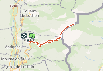
Tocht Sneeuwschoenen van 12,5 km beschikbaar op Occitanië, Haute-Garonne, Artigue. Deze tocht wordt voorgesteld door tracegps.

Beschrijving

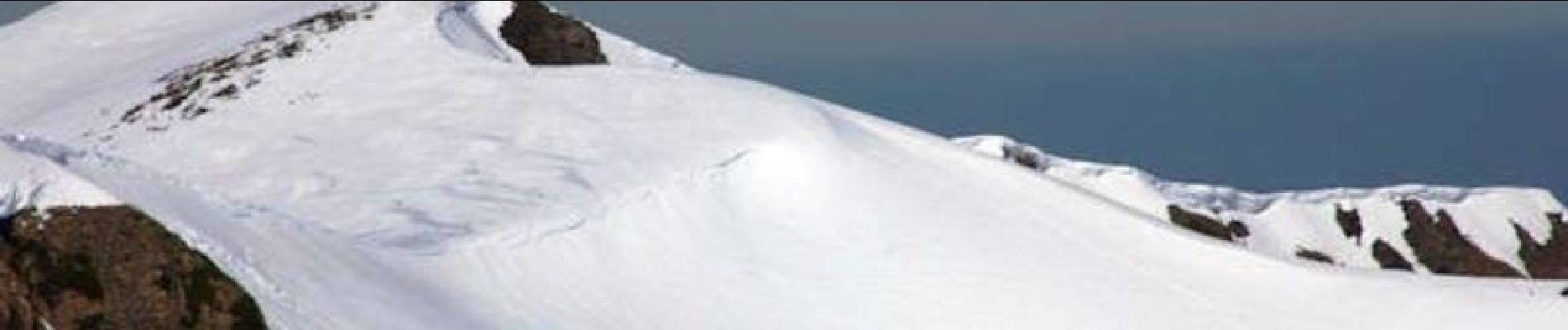
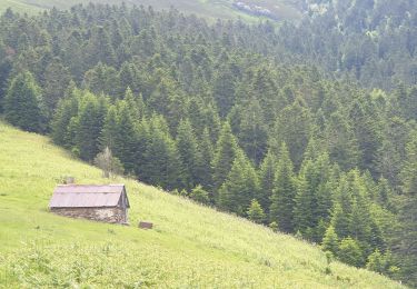
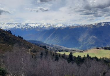
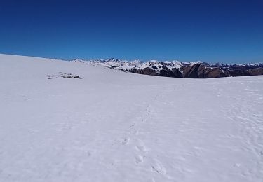
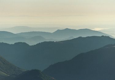
Une randonnée raquette au Pic de Bacanère au dessus de Bagnères de Luchon en passant par la cabane de Saunères, les crêtes de Serrat de Créspès, le Pla de Montmajou et le Col des Taons.

Hoogteprofiel

Foto's

Plaatsbepaling

Land:
France
Regio :
Occitanië
Departement/Provincie :
Haute-Garonne
Gemeente :
Artigue
Locatie:
Unknown
Vertrek:(Dec)
Vertrek:(UTM)
305408 ; 4744686 (31T) N.

Wandeltochten in de omgeving

Tocht Sneeuwschoenen Juzet-de-Luchon - JUZET - PAS DE LA COMBE (LABACH) - Photo
Sneeuwschoenen
Marcocroco

Sneeuwschoenen

Medium
(1)
Juzet-de-Luchon, Occitanië, Haute-Garonne, France
7,1 km | 12,5 km-effort
2h 33min
Ja
Tocht Stappen Saccourvielle - Cap de Salières en boucle depuis Saccourvielle - Photo
Stappen
GUIDE
lhomme.ph

Stappen

Medium
Saccourvielle, Occitanië, Haute-Garonne, France
12,1 km | 24 km-effort
6h 23min
Ja
Tocht Stappen Baren - mail de la Pique 01 2018 - Photo
Stappen
chrisgps

Stappen

Heel gemakkelijk
(1)
Baren, Occitanië, Haute-Garonne, France
7,6 km | 19,1 km-effort
4h 55min
Ja
Tocht Stappen Bagnères-de-Luchon - GR 10 - 3 - Photo
Stappen
loic09

Stappen

Medium
(2)
Bagnères-de-Luchon, Occitanië, Haute-Garonne, France
250 km | 489 km-effort
89h 8min
Neen
Tocht Stappen Artigue - ARTIGUE - Gouaux de Luchon - chemin forestier - Photo
Stappen
josy31

Stappen

Medium
(1)
Artigue, Occitanië, Haute-Garonne, France
13,7 km | 23 km-effort
3h 21min
Ja
Tocht Stappen Artigue - Artigue par la cabane du plan Bosc et la cabane de Saunères - Photo
Stappen
swp648

Stappen

Moeilijk
Artigue, Occitanië, Haute-Garonne, France
10,5 km | 18,3 km-effort
4h 10min
Ja
Tocht Stappen Baren - Mail de la Pique depuis Baren - Photo
Stappen
GUIDE
lhomme.ph

Stappen

Moeilijk
Baren, Occitanië, Haute-Garonne, France
9,8 km | 23 km-effort
6h 43min
Ja
Tocht Stappen Artigue - 2022-02-26 Artigue - cabane de peyrehitte - mont Majou -  luchonais - Photo
Stappen
jacq58

Stappen

Moeilijk
Artigue, Occitanië, Haute-Garonne, France
12 km | 22 km-effort
3h 33min
Ja
Tocht Te voet Artigue - Pic de Bacanère - Photo
Te voet
PRO

Te voet

Gemakkelijk
Artigue, Occitanië, Haute-Garonne, France
8,3 km | 18,3 km-effort
4h 9min
Neen


Sluiten
Mijn abonnementen