Tocht Fiets Estissac - Circuit d'Etissac - Photo

Circuit d'Etissac

 tracegps
tracegps

Gebruiker

© OpenStreetMap contributors
Lengte
Lengte
25 km
Max. hoogte
Max. hoogte
252 m
Positief hoogteverschil
199 m
Km-Effort
Km-Effort  
27 km
Min. hoogte
Min. hoogte
131 m
Negatief hoogteverschil
199 m
Boucle
Boucle
Ja
Datum van aanmaak :
2014-12-10 00:00:00.0
Laatste wijziging :
2014-12-10 00:00:00.0

(0 Bericht)

Fiets
Fiets
1h30
Moeilijkheid : Gemakkelijk

Scan deze QR-code om de tocht te openen in de SityTrail-applicatie

Gratisgps-wandelapplicatie

Logo SityTrail SityTrail

IGN / Geografische instituten

SityTrail uit de App Store downloaden SityTrail uit Google Play downloaden

Logo SityTrail SityTrail World

De wereld gaat voor u open

SityTrail uit de App Store downloaden SityTrail uit Google Play downloaden SityTrail op Huawei AppGallery downloaden

Over ons

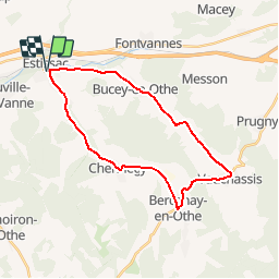
Tocht Fiets van 25 km beschikbaar op Grand Est, Aube, Estissac. Deze tocht wordt voorgesteld door tracegps.

Beschrijving

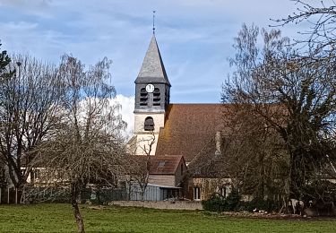
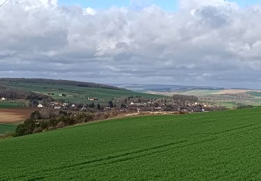
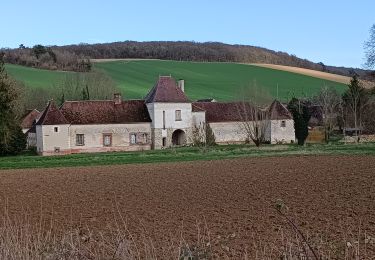
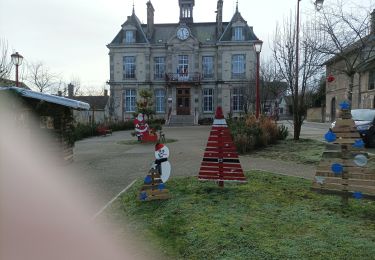
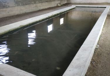
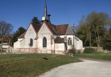
Circuit proposé par l'office de Tourisme du Pays d'Othe, vallée de la Vanne et le Cyclo Club Othéen. Départ place de la mairie d'Etissac. La halle d'Estissac fut dressée durant la première partie du XVIIIème siècle en tant qu'élément du domaine seigneurial. Elle sert d'abri au pressoir et sert également de lieu de marché à grains et de foires. La municipalité l'achète en 1801. Un marché s'y tient le dimanche matin depuis le XXème siècle. Retrouvez le circuit a télécharger sur le site de l'office de tourisme du Pays d'Othe, vallée de la Vanne.

Hoogteprofiel

Foto's

Plaatsbepaling

Land:
France
Regio :
Grand Est
Departement/Provincie :
Aube
Gemeente :
Estissac
Locatie:
Unknown
Vertrek:(Dec)
Vertrek:(UTM)
559986 ; 5346232 (31U) N.

Wandeltochten in de omgeving

Tocht Stappen Bucey-en-Othe - Au dessus de BUCEY EN OTHE  - Photo
Stappen
FPortier

Stappen

Medium
Bucey-en-Othe, Grand Est, Aube, France
9 km | 11,1 km-effort
2h 44min
Ja
Tocht Stappen Bucey-en-Othe - Bucey en Othe - Photo
Stappen
FPortier

Stappen

Moeilijk
Bucey-en-Othe, Grand Est, Aube, France
10 km | 12,6 km-effort
3h 0min
Ja
Tocht Stappen Chennegy - Randonnée à Chennegy - Photo
Stappen
FPortier

Stappen

Moeilijk
Chennegy, Grand Est, Aube, France
10,6 km | 12,4 km-effort
3h 5min
Ja
Tocht Stappen Bucey-en-Othe - Balade autour de Bicey - Photo
Stappen
FPortier

Stappen

Moeilijk
Bucey-en-Othe, Grand Est, Aube, France
9,6 km | 12,5 km-effort
2h 50min
Ja
Tocht Stappen Bucey-en-Othe - Bucey en Othe - Photo
Stappen
FPortier

Stappen

Medium
Bucey-en-Othe, Grand Est, Aube, France
6,7 km | 8,6 km-effort
1h 46min
Ja
Tocht Stappen Estissac - Randonnée Bucey 01 août, 2023 - Photo
Stappen
FPortier

Stappen

Medium
Estissac, Grand Est, Aube, France
8,3 km | 9,4 km-effort
2h 13min
Ja
Tocht Stappen Estissac - Randonnée Club - Photo
Stappen
FPortier

Stappen

Medium
Estissac, Grand Est, Aube, France
8,7 km | 11 km-effort
2h 34min
Neen
Tocht Stappen Bucey-en-Othe - Au dessus de Bucey et Messon - Photo
Stappen
FPortier

Stappen

Medium
Bucey-en-Othe, Grand Est, Aube, France
10,9 km | 13,5 km-effort
2h 47min
Ja
Tocht Stappen Bucey-en-Othe - Bucey en Othe - Photo
Stappen
FPortier

Stappen

Medium
Bucey-en-Othe, Grand Est, Aube, France
9,7 km | 11,9 km-effort
2h 17min
Ja


Sluiten
Mijn abonnementen