Tocht Stappen Pavie - Autour de Pavie - Photo

Autour de Pavie

 tracegps
tracegps

Gebruiker

© OpenStreetMap contributors
Lengte
Lengte
7,5 km
Max. hoogte
Max. hoogte
250 m
Positief hoogteverschil
134 m
Km-Effort
Km-Effort  
9,3 km
Min. hoogte
Min. hoogte
137 m
Negatief hoogteverschil
136 m
Boucle
Boucle
Ja
Datum van aanmaak :
2014-12-10 00:00:00.0
Laatste wijziging :
2014-12-10 00:00:00.0

(0 Bericht)

Stappen
Stappen
2h00
Moeilijkheid : Medium

Scan deze QR-code om de tocht te openen in de SityTrail-applicatie

Gratisgps-wandelapplicatie

Logo SityTrail SityTrail

IGN / Geografische instituten

SityTrail uit de App Store downloaden SityTrail uit Google Play downloaden

Logo SityTrail SityTrail World

De wereld gaat voor u open

SityTrail uit de App Store downloaden SityTrail uit Google Play downloaden SityTrail op Huawei AppGallery downloaden

Over ons

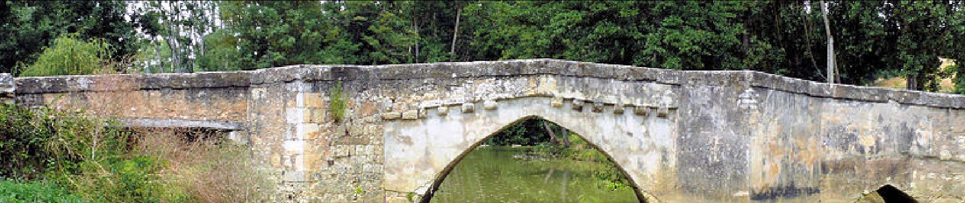
Tocht Stappen van 7,5 km beschikbaar op Occitanië, Gers, Pavie. Deze tocht wordt voorgesteld door tracegps.

Beschrijving

Jolie balade autour du Gers.

Hoogteprofiel

Foto's

POI's

POI Pavie - 001 - Photo
tracegps
PAVIE 
POI Pavie - 002 - Photo
tracegps
PAVIE 
POI Pavie - 003 - Photo
tracegps
PAVIE 
POI Pavie - 004 - Photo
tracegps
PAVIE 
POI Pavie - 005 - Photo
tracegps
PAVIE 
POI Pavie - 006 - Photo
tracegps
PAVIE 
POI Pavie - 007 - Photo
tracegps
PAVIE 
POI Pavie - 008 - Photo
tracegps
PAVIE 
POI Pavie - 009 - Photo
tracegps
PAVIE 
POI Pavie - 010 - Photo
tracegps
PAVIE 
POI Pavie - 011 - Photo
tracegps
PAVIE 
POI Pavie - 012 - Photo
tracegps
PAVIE 
POI Pavie - 013 - Photo
tracegps
PAVIE 
POI Pavie - 014 - Photo
tracegps
PAVIE 
POI Pavie - 015 - Photo
tracegps
PAVIE 
POI Pavie - 016 - Photo
tracegps
PAVIE 
POI Pavie - 017 - Photo
tracegps
PAVIE 
POI Pavie - 018 - Photo
tracegps
PAVIE 
POI Pavie - 019 - Photo
tracegps
PAVIE 
POI Pavie - 020 - Photo
tracegps
PAVIE 
POI Pavie - 021 - Photo
tracegps
PAVIE 
POI Pavie - 022 - Photo
tracegps
PAVIE 

Plaatsbepaling

Land:
France
Regio :
Occitanië
Departement/Provincie :
Gers
Gemeente :
Pavie
Locatie:
Unknown
Vertrek:(Dec)
Vertrek:(UTM)
305909 ; 4831454 (31T) N.

Wandeltochten in de omgeving

Tocht Fietstoerisme Auch - B - Auch - Coeurs de Gascogne - Photo
Fietstoerisme
potofe

Fietstoerisme

Medium
Auch, Occitanië, Gers, France
129 km | 155 km-effort
Onbekend
Ja
Tocht Stappen Pavie - Pavie PR2 - Photo
Stappen
lataboge

Stappen

Gemakkelijk
Pavie, Occitanië, Gers, France
9,8 km | 11,9 km-effort
Onbekend
Ja
Tocht Stappen Pavie - Pavie  - Photo
Stappen
Pascal Bernaud

Stappen

Medium
Pavie, Occitanië, Gers, France
6,3 km | 7,6 km-effort
1h 48min
Ja
Tocht Stappen Pavie - Pavie Auterive  - Photo
Stappen
Pascal Bernaud

Stappen

Medium
Pavie, Occitanië, Gers, France
7 km | 8,4 km-effort
2h 8min
Ja
Tocht Stappen Pavie - Pavie - Photo
Stappen
Pascal Bernaud

Stappen

Moeilijk
Pavie, Occitanië, Gers, France
10,8 km | 14,1 km-effort
3h 4min
Ja
Tocht Stappen Montégut - Étape 2 - Photo
Stappen
Camsity

Stappen

Heel gemakkelijk
Montégut, Occitanië, Gers, France
27 km | 33 km-effort
22h 0min
Neen
Tocht Stappen Auch - 05.05.17 Auch  Montesquiou - Photo
Stappen
donda

Stappen

Zeer moeilijk
Auch, Occitanië, Gers, France
31 km | 39 km-effort
8h 29min
Neen
Tocht Stappen Auch - S-J-AUCH-L''ISLE de NOE - Photo
Stappen
CANON2

Stappen

Medium
Auch, Occitanië, Gers, France
24 km | 30 km-effort
6h 18min
Neen
Tocht Stappen Auch - auch1 - Photo
Stappen
phil 26

Stappen

Heel gemakkelijk
Auch, Occitanië, Gers, France
1,3 km | 1,8 km-effort
25min
Neen


Sluiten
Mijn abonnementen