


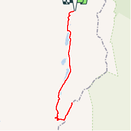

11,1 km | 14,2 km-effort


Gebruiker


Gratisgps-wandelapplicatie
 SityTrail
IGN / Geografische instituten
SityTrail World
De wereld gaat voor u open
Tocht Stappen van 14,5 km beschikbaar op Onbekend, County Kerry, Kenmare Municipal District. Deze tocht wordt voorgesteld door zezette52.
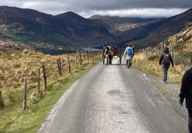
réalisé avec Sarah - le 30/07/12
Stappen

Mountainbike