Tocht Mountainbike Trespoux-Rassiels - Circuit ouest de Trespoux Rassiels - Photo

Circuit ouest de Trespoux Rassiels

 tracegps
tracegps

Gebruiker

© OpenStreetMap contributors
Lengte
Lengte
38 km
Max. hoogte
Max. hoogte
337 m
Positief hoogteverschil
957 m
Km-Effort
Km-Effort  
51 km
Min. hoogte
Min. hoogte
129 m
Negatief hoogteverschil
956 m
Boucle
Boucle
Ja
Datum van aanmaak :
2014-12-10 00:00:00.0
Laatste wijziging :
2014-12-10 00:00:00.0

(0 Bericht)

Mountainbike
Mountainbike
4h15
Moeilijkheid : Zeer moeilijk

Scan deze QR-code om de tocht te openen in de SityTrail-applicatie

Gratisgps-wandelapplicatie

Logo SityTrail SityTrail

IGN / Geografische instituten

SityTrail uit de App Store downloaden SityTrail uit Google Play downloaden

Logo SityTrail SityTrail World

De wereld gaat voor u open

SityTrail uit de App Store downloaden SityTrail uit Google Play downloaden SityTrail op Huawei AppGallery downloaden

Over ons

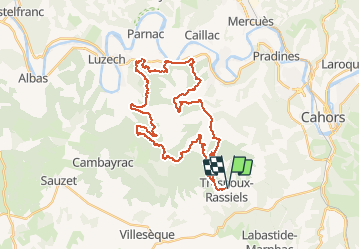
Tocht Mountainbike van 38 km beschikbaar op Occitanië, Lot, Trespoux-Rassiels. Deze tocht wordt voorgesteld door tracegps.

Beschrijving

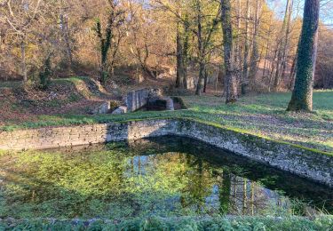
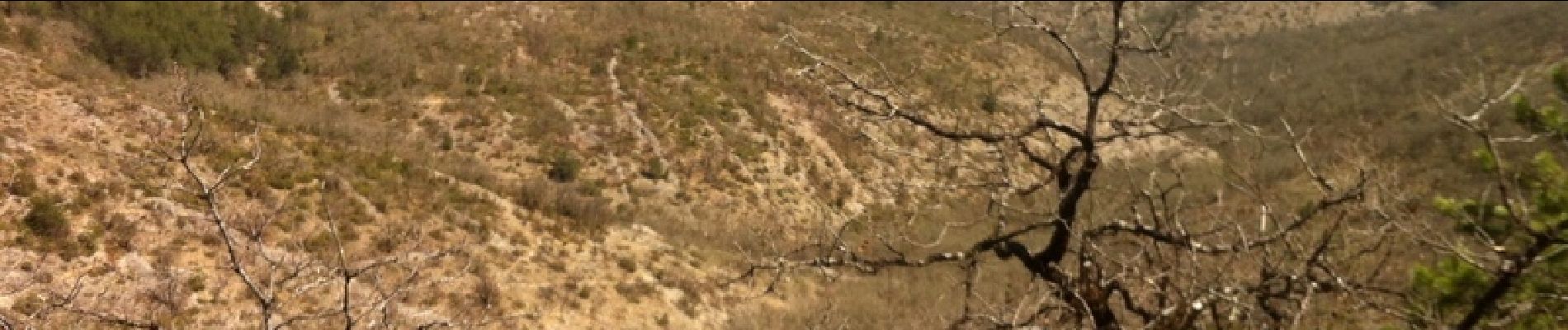
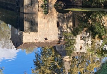
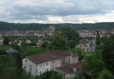
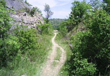
Départ de la salle des fêtes de Trespoux. Prendre la direction à l'opposé de Cahors. Puis suivre la trace car il n'existe aucun balisage. Circuit se pratiquant sur des tous petits chemins techniques qui demandent une bonne expérience du VTT et une bonne condition physique. Passage dans des vignes, à l'extrémité du circuit. Sentiers avec beaucoup de traversée de pierriers qui se situent dans des bois de chênes avec de nombreux single track. Beaux paysages typiques du Quercy sur ce circuit avec vue sur des hauteurs. Bon courage !

Hoogteprofiel

Foto's

Plaatsbepaling

Land:
France
Regio :
Occitanië
Departement/Provincie :
Lot
Gemeente :
Trespoux-Rassiels
Locatie:
Unknown
Vertrek:(Dec)
Vertrek:(UTM)
370299 ; 4919147 (31T) N.

Wandeltochten in de omgeving

Tocht Mountainbike Cahors - Cahors-La Rozière 2005 - Photo
Mountainbike
tracegps

Mountainbike

Zeer moeilijk
(1)
Cahors, Occitanië, Lot, France
62 km | 81 km-effort
5h 0min
Ja
Tocht Stappen Pradines - Cahors les Durands 7km - Photo
Stappen
PariseJL

Stappen

Gemakkelijk
(1)
Pradines, Occitanië, Lot, France
7,1 km | 9,3 km-effort
2h 13min
Ja
Tocht Stappen Cahors - Croix magne  - Photo
Stappen
GUIDE
antignacs

Stappen

Heel gemakkelijk
Cahors, Occitanië, Lot, France
5,2 km | 7,2 km-effort
1h 20min
Neen
Tocht Stappen Labastide-Marnhac - Mon Compostelle huitième étape - Photo
Stappen
Ardeiserois

Stappen

Moeilijk
Labastide-Marnhac, Occitanië, Lot, France
51 km | 65 km-effort
10h 40min
Neen
Tocht Lopen Cahors - Cahors, le Lot, le causse, la vieille ville - Photo
Lopen
tracegps

Lopen

Medium
Cahors, Occitanië, Lot, France
7,3 km | 10 km-effort
45min
Ja
Tocht Stappen Cahors - Cahors, le Lot, le causse, la vieille ville - Photo
Stappen
tracegps

Stappen

Medium
Cahors, Occitanië, Lot, France
7,3 km | 10 km-effort
1h 30min
Ja
Tocht Mountainbike Cahors - Raid Cahors La Rozière 2006 - Photo
Mountainbike
tracegps

Mountainbike

Zeer moeilijk
Cahors, Occitanië, Lot, France
59 km | 78 km-effort
4h 40min
Ja
Tocht Stappen Labastide-Marnhac - Cluzel au temps des bleuets  - Photo
Stappen
GUIDE
antignacs

Stappen

Heel gemakkelijk
Labastide-Marnhac, Occitanië, Lot, France
10,2 km | 11,7 km-effort
2h 9min
Ja
Tocht Stappen Labastide-Marnhac - Cluzel 3 - Photo
Stappen
GUIDE
antignacs

Stappen

Medium
Labastide-Marnhac, Occitanië, Lot, France
8,4 km | 10 km-effort
1h 40min
Ja


Sluiten
Mijn abonnementen