Tocht Stappen Champniers - La randonnée sandwich entre la LGV et la RN10 - Photo

La randonnée sandwich entre la LGV et la RN10

 alainjoseph6
alainjoseph6

Gebruiker

© OpenStreetMap contributors
Lengte
Lengte
7,7 km
Max. hoogte
Max. hoogte
109 m
Positief hoogteverschil
152 m
Km-Effort
Km-Effort  
9,7 km
Min. hoogte
Min. hoogte
40 m
Negatief hoogteverschil
150 m
Boucle
Boucle
Ja
Datum van aanmaak :
2019-03-07 14:13:19.625
Laatste wijziging :
2019-03-07 17:55:50.133

(0 Bericht)

Stappen
Stappen
2h25
Moeilijkheid : Heel gemakkelijk

Scan deze QR-code om de tocht te openen in de SityTrail-applicatie

Gratisgps-wandelapplicatie

Logo SityTrail SityTrail

IGN / Geografische instituten

SityTrail uit de App Store downloaden SityTrail uit Google Play downloaden

Logo SityTrail SityTrail World

De wereld gaat voor u open

SityTrail uit de App Store downloaden SityTrail uit Google Play downloaden SityTrail op Huawei AppGallery downloaden

Over ons

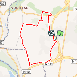
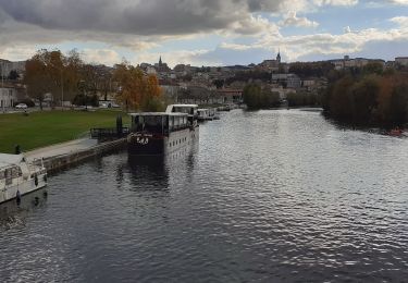
Tocht Stappen van 7,7 km beschikbaar op Nieuw-Aquitanië, Charente, Champniers. Deze tocht wordt voorgesteld door alainjoseph6.

Beschrijving

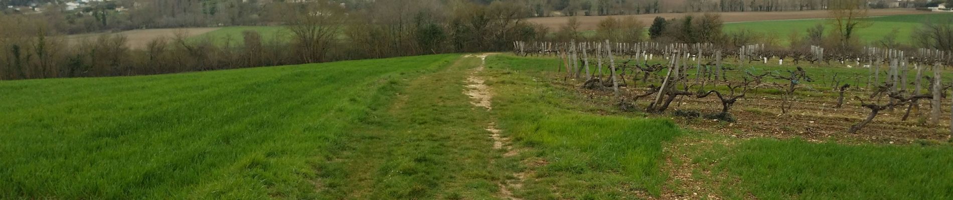
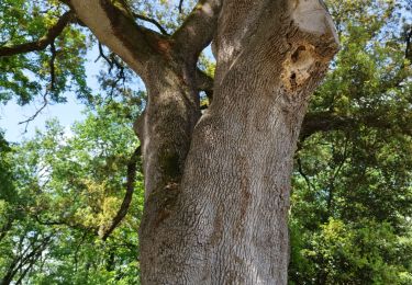
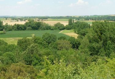
C'est une randonnée surprise, qui fait découvrir une superbe campagne aux portes D'ANGOULÊME.
A faire.

Hoogteprofiel

Foto's

Plaatsbepaling

Land:
France
Regio :
Nieuw-Aquitanië
Departement/Provincie :
Charente
Gemeente :
Champniers
Locatie:
Unknown
Vertrek:(UTM)
280269 ; 5064959 (31T) N.

Wandeltochten in de omgeving

Tocht Stappen Magnac-sur-Touvre - La balade d'Antornac - Photo
Stappen
alainjoseph6

Stappen

Medium
Magnac-sur-Touvre, Nieuw-Aquitanië, Charente, France
8,1 km | 9,7 km-effort
3h 50min
Neen
Tocht Mountainbike Champniers - La Chignolle 50 - Champniers - Photo
Mountainbike
tracegps

Mountainbike

Moeilijk
Champniers, Nieuw-Aquitanië, Charente, France
50 km | 61 km-effort
3h 0min
Ja
Tocht Stappen Angoulême - St cybard ==》angoulemz A/R - Photo
Stappen
xaliad

Stappen

Medium
Angoulême, Nieuw-Aquitanië, Charente, France
5,6 km | 6,9 km-effort
1h 29min
Ja
Tocht Stappen Saint-Yrieix-sur-Charente - St iriex - Photo
Stappen
rouquie

Stappen

Medium
Saint-Yrieix-sur-Charente, Nieuw-Aquitanië, Charente, France
10,2 km | 11,7 km-effort
2h 31min
Ja
Tocht Stappen Vindelle - vindelle - Photo
Stappen
thierry16

Stappen

Medium
Vindelle, Nieuw-Aquitanië, Charente, France
10,5 km | 11,7 km-effort
2h 27min
Ja
Tocht Stappen Magnac-sur-Touvre - magnac - Photo
Stappen
sy!

Stappen

Heel gemakkelijk
Magnac-sur-Touvre, Nieuw-Aquitanië, Charente, France
8,7 km | 10,6 km-effort
2h 0min
Ja
Tocht Noords wandelen Saint-Yrieix-sur-Charente - fleac boucle2 - Photo
Noords wandelen
Ballot.daniel

Noords wandelen

Heel gemakkelijk
Saint-Yrieix-sur-Charente, Nieuw-Aquitanië, Charente, France
5,7 km | 6,5 km-effort
1h 10min
Ja
Tocht Noords wandelen Saint-Yrieix-sur-Charente - fleac 8 - Photo
Noords wandelen
Ballot.daniel

Noords wandelen

Gemakkelijk
Saint-Yrieix-sur-Charente, Nieuw-Aquitanië, Charente, France
8,3 km | 10,2 km-effort
1h 50min
Ja
Tocht Stappen Saint-Yrieix-sur-Charente - chauuseloup/Fleac - Photo
Stappen
Ballot.daniel

Stappen

Heel gemakkelijk
Saint-Yrieix-sur-Charente, Nieuw-Aquitanië, Charente, France
8,1 km | 9,6 km-effort
2h 0min
Ja


Sluiten
Mijn abonnementen