


8,4 km | 10,9 km-effort


Randonnez sur et autour des GR ® wallons (Sentiers de Grande Randonnée). PRO


Gratisgps-wandelapplicatie
 SityTrail
IGN / Geografische instituten
SityTrail World
De wereld gaat voor u open
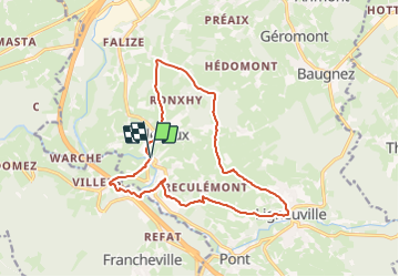
Tocht Stappen van 14,2 km beschikbaar op Wallonië, Luik, Malmedy. Deze tocht wordt voorgesteld door GR Rando.
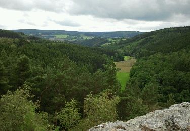
Sur les hauteurs dominant la haute vallée de l’Amblève et la Warche
Bellevaux – Ligneuville – Xhurdebise – Bellevaux
Cartographie et documentation :
Comme seule une très petite partie de la randonnée est balisée, je vous recommande d’emporter avec vous la carte IGN 1 : 20 000, 50/5-6 « Stavelot – Malmedy ». Si vous souhaitez, pour une raison ou une autre, écourter la balade, elle pourrait vous venir à point.
Topo-guide du GR 56 « Canton de l’Est et du Parc naturel Hautes Fagnes – Nord-Eifel ».
Où se désaltérer et se restaurer :
Ni Beaumont, ni Bellevaux n’offrent de possibilité dans cette optique. Vous pouvez retourner à Thirimont ou faire un petit saut jusqu’à Stavelot aux charmes et attraits multiples. Malmedy n’est pas loin non plus.
Infos touristiques :
Syndicat d’Initiative de Stavelot : www.stavelot.be
L’abbaye de Stavelot : www.abbayedestavelot.be
Le Musée de la principauté de Stavelot – Malmedy


Stappen
Stappen

Stappen
Stappen
Stappen

Te voet
Rolschaatsen
Stappen
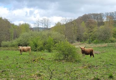
Splendide randonnée offrant de belles vues à 360°