Tocht Stappen Le Lac-d'Issarlès - Tour du lac d'Issarlès - Photo
© OpenStreetMap contributors
Lengte
Lengte
3,9 km
Max. hoogte
Max. hoogte
1030 m
Positief hoogteverschil
82 m
Km-Effort
Km-Effort  
5 km
Min. hoogte
Min. hoogte
992 m
Negatief hoogteverschil
83 m
Boucle
Boucle
Ja
Datum van aanmaak :
2019-06-25 14:07:37.242
Laatste wijziging :
2019-06-25 15:20:48.23

(0 Bericht)

Stappen
Stappen
1h11
Moeilijkheid : Gemakkelijk

Scan deze QR-code om de tocht te openen in de SityTrail-applicatie

Gratisgps-wandelapplicatie

Logo SityTrail SityTrail

IGN / Geografische instituten

SityTrail uit de App Store downloaden SityTrail uit Google Play downloaden

Logo SityTrail SityTrail World

De wereld gaat voor u open

SityTrail uit de App Store downloaden SityTrail uit Google Play downloaden SityTrail op Huawei AppGallery downloaden

Over ons

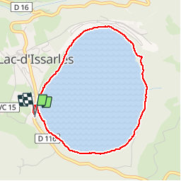
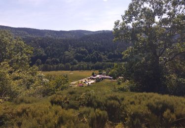
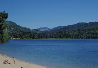
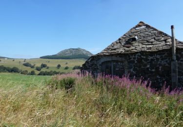
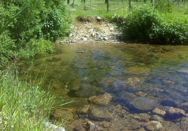
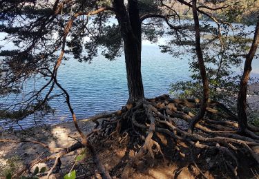
Tocht Stappen van 3,9 km beschikbaar op Auvergne-Rhône-Alpes, Ardèche, Le Lac-d'Issarlès. Deze tocht wordt voorgesteld door Randonneur-Berlaquin.

Hoogteprofiel

Foto's

Plaatsbepaling

Land:
France
Regio :
Auvergne-Rhône-Alpes
Departement/Provincie :
Ardèche
Gemeente :
Le Lac-d'Issarlès
Locatie:
Unknown
Vertrek:(UTM)
584067 ; 4963015 (31T) N.

Wandeltochten in de omgeving

Tocht Stappen Le Lac-d'Issarlès - Grand tour lac d'Issarlès - Photo
Stappen
GUIDE
nadinebondoux

Stappen

Medium
Le Lac-d'Issarlès, Auvergne-Rhône-Alpes, Ardèche, France
10,3 km | 15,5 km-effort
3h 37min
Ja
Tocht Wegfiets Le Lac-d'Issarlès - col de Mezilhac et le Gerbier de jonc - Photo
Wegfiets
nadd73

Wegfiets

Medium
Le Lac-d'Issarlès, Auvergne-Rhône-Alpes, Ardèche, France
72 km | 91 km-effort
2h 57min
Ja
Tocht Lopen Le Lac-d'Issarlès - lac d'issarles et plus - Photo
Lopen
nadd73

Lopen

Medium
Le Lac-d'Issarlès, Auvergne-Rhône-Alpes, Ardèche, France
16,8 km | 25 km-effort
2h 26min
Ja
Tocht Te voet Le Lac-d'Issarlès - Le tour du Lac - Photo
Te voet
PRO

Te voet

Gemakkelijk
Le Lac-d'Issarlès, Auvergne-Rhône-Alpes, Ardèche, France
3,6 km | 4,6 km-effort
1h 2min
Ja
Tocht Mountainbike Le Béage - Par les Sucs de Montfol et de la Lauzière - Le Béage - Photo
Mountainbike
tracegps

Mountainbike

Moeilijk
Le Béage, Auvergne-Rhône-Alpes, Ardèche, France
19,5 km | 27 km-effort
3h 0min
Ja
Tocht Stappen Le Béage - Par les Sucs de Montfol et de la Lauzière - Le Béage - Photo
Stappen
tracegps

Stappen

Moeilijk
Le Béage, Auvergne-Rhône-Alpes, Ardèche, France
19,5 km | 27 km-effort
5h 30min
Ja
Tocht Stappen Le Béage - Tour de ouf du Montfol - Le Béage - Photo
Stappen
tracegps

Stappen

Moeilijk
Le Béage, Auvergne-Rhône-Alpes, Ardèche, France
12 km | 16,9 km-effort
3h 30min
Ja
Tocht Stappen Le Lac-d'Issarlès - Lac d'Issarlès - Photo
Stappen
Vanessa68

Stappen

Medium
Le Lac-d'Issarlès, Auvergne-Rhône-Alpes, Ardèche, France
6,2 km | 8,9 km-effort
2h 0min
Neen
Tocht Stappen Le Lac-d'Issarlès - issarles - Photo
Stappen
Ptitjack30

Stappen

Heel gemakkelijk
Le Lac-d'Issarlès, Auvergne-Rhône-Alpes, Ardèche, France
4,4 km | 5,7 km-effort
1h 16min
Ja


Sluiten
Mijn abonnementen