Tocht Mountainbike La Chapelle-Saint-Laurent - 2013-10-20 - La Chapelle St Laurent - Photo

2013-10-20 - La Chapelle St Laurent

 cagouille79
cagouille79

Gebruiker

© OpenStreetMap contributors
Lengte
Lengte
29 km
Max. hoogte
Max. hoogte
229 m
Positief hoogteverschil
344 m
Km-Effort
Km-Effort  
34 km
Min. hoogte
Min. hoogte
158 m
Negatief hoogteverschil
340 m
Boucle
Boucle
Ja
Datum van aanmaak :
2014-12-10 00:00:00.0
Laatste wijziging :
2014-12-10 00:00:00.0

(0 Bericht)

Mountainbike
Mountainbike
2h15
Moeilijkheid : Gemakkelijk

Scan deze QR-code om de tocht te openen in de SityTrail-applicatie

Gratisgps-wandelapplicatie

Logo SityTrail SityTrail

IGN / Geografische instituten

SityTrail uit de App Store downloaden SityTrail uit Google Play downloaden

Logo SityTrail SityTrail World

De wereld gaat voor u open

SityTrail uit de App Store downloaden SityTrail uit Google Play downloaden SityTrail op Huawei AppGallery downloaden

Over ons

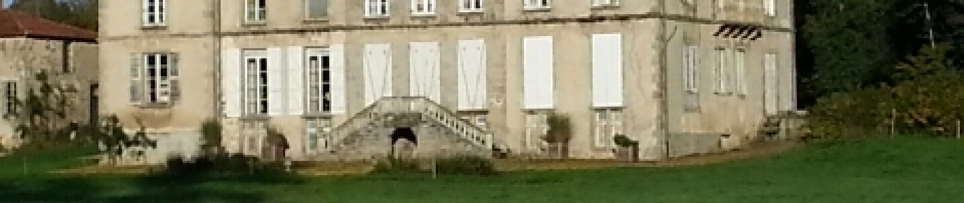
Tocht Mountainbike van 29 km beschikbaar op Nieuw-Aquitanië, Deux-Sèvres, La Chapelle-Saint-Laurent. Deze tocht wordt voorgesteld door cagouille79.

Beschrijving

Journée organisée par le club local.
Bonne journée.

Hoogteprofiel

Foto's

Plaatsbepaling

Land:
France
Regio :
Nieuw-Aquitanië
Departement/Provincie :
Deux-Sèvres
Gemeente :
La Chapelle-Saint-Laurent
Locatie:
Unknown
Vertrek:(Dec)
Vertrek:(UTM)
692738 ; 5180218 (30T) N.

Wandeltochten in de omgeving

Tocht Stappen Moncoutant-sur-Sèvre - rando du 12-04-2021 - Photo
Stappen
dudu79

Stappen

Moeilijk
(1)
Moncoutant-sur-Sèvre, Nieuw-Aquitanië, Deux-Sèvres, France
13,2 km | 15 km-effort
2h 41min
Ja
Tocht Stappen Moncoutant-sur-Sèvre - randonnée du 22-04-2021 - Photo
Stappen
dudu79

Stappen

Medium
Moncoutant-sur-Sèvre, Nieuw-Aquitanië, Deux-Sèvres, France
7,3 km | 8,1 km-effort
1h 42min
Ja
Tocht Motor Boismé - moto - Photo
Motor
cagouille79

Motor

Medium
Boismé, Nieuw-Aquitanië, Deux-Sèvres, France
44 km | 52 km-effort
2h 59min
Ja
Tocht Stappen Chanteloup - Départ Chanteloup +-14km - Photo
Stappen
dudu79

Stappen

Moeilijk
Chanteloup, Nieuw-Aquitanië, Deux-Sèvres, France
14 km | 15,9 km-effort
3h 36min
Ja
Tocht Te voet Chanteloup - circuit 6,55km - Photo
Te voet
dudu79

Te voet

Gemakkelijk
Chanteloup, Nieuw-Aquitanië, Deux-Sèvres, France
6,6 km | 7,4 km-effort
1h 40min
Ja
Tocht Stappen La Chapelle-Saint-Laurent - 79 LA CHAPELLE SAINT LAURENT entre les étangs de l'Olivette et des Mothes - Photo
Stappen
maioy

Stappen

Medium
La Chapelle-Saint-Laurent, Nieuw-Aquitanië, Deux-Sèvres, France
8,1 km | 9,2 km-effort
2h 2min
Ja


Sluiten
Mijn abonnementen