Tocht Stappen Basse-Pointe - Boucle Habitations  Gradis et  Hackaert - Photo

Boucle Habitations Gradis et Hackaert

 Lamartiniere
Lamartiniere

Gebruiker GUIDE

© OpenStreetMap contributors
Lengte
Lengte
10,8 km
Max. hoogte
Max. hoogte
495 m
Positief hoogteverschil
438 m
Km-Effort
Km-Effort  
16,7 km
Min. hoogte
Min. hoogte
54 m
Negatief hoogteverschil
438 m
Boucle
Boucle
Ja
Datum van aanmaak :
2020-02-12 11:03:24.921
Laatste wijziging :
2020-02-21 13:51:04.027

(0 Bericht)

Stappen
Stappen
3h15
Moeilijkheid : Medium

Scan deze QR-code om de tocht te openen in de SityTrail-applicatie

Gratisgps-wandelapplicatie

Logo SityTrail SityTrail

IGN / Geografische instituten

SityTrail uit de App Store downloaden SityTrail uit Google Play downloaden

Logo SityTrail SityTrail World

De wereld gaat voor u open

SityTrail uit de App Store downloaden SityTrail uit Google Play downloaden SityTrail op Huawei AppGallery downloaden

Over ons

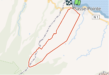
Tocht Stappen van 10,8 km beschikbaar op Martinique, Onbekend, Basse-Pointe. Deze tocht wordt voorgesteld door Lamartiniere.

Beschrijving

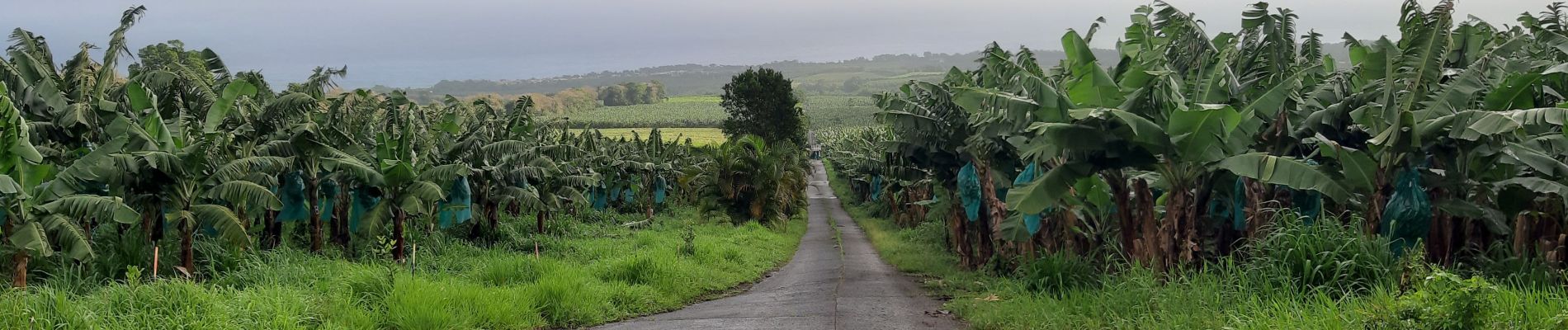
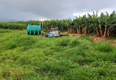
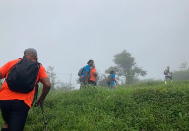
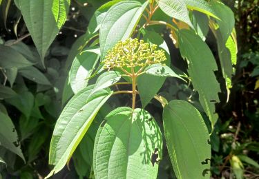
Cette randonnée nécessite deux autorisations  de passages pour les habitations Gradis et Hackaert.  Surtout,  éviter  de randonner  en semaine pour ne pas perturber l'activité de ces exploitations agricoles. Très belle montée vers le bois Leyritz  à  partir du centre commercial d'AKR.  Descente sur  traces  composées de pierre ponce à partir de Savane du Potiche sur la Commune de Macouba,  sans oublier le quartier Hauteur Bourdon.  Au niveau du champ de canne,  passage  à gué de la rivière Hackaert pour revenir sur le secteur de  Basse-Pointe,  en l'occurrence sur  le Gros-Morne.  Grande descente vers le centre Cial d'AKR pour l'arrivée. Très belle rando constituée de   larges panoramas sur les  secteurs environnants,  les contreforts de la montagne  Pelée puis les   cultures  variées. Vestiges de l'habitation Hackaert.

Hoogteprofiel

Foto's

Plaatsbepaling

Land:
France
Regio :
Martinique
Departement/Provincie :
Onbekend
Gemeente :
Basse-Pointe
Locatie:
Unknown
Vertrek:(UTM)
702126 ; 1644581 (20P) N.

Wandeltochten in de omgeving

Tocht Stappen Basse-Pointe - Exploitations agricoles en boucle N°1 - Photo
Stappen
GUIDE
Lamartiniere

Stappen

Medium
Basse-Pointe, Martinique, Onbekend, France
13,2 km | 16,5 km-effort
4h 0min
Ja
Tocht Stappen Basse-Pointe - Boucle de chalvet, Pécoule vers Chalvet. - Photo
Stappen
GUIDE
GabyG

Stappen

Medium
Basse-Pointe, Martinique, Onbekend, France
6,5 km | 7,8 km-effort
3h 2min
Ja
Tocht Stappen L'Ajoupa-Bouillon - Défi 2022 étoile - Photo
Stappen
GUIDE
manuelPerez

Stappen

L'Ajoupa-Bouillon, Martinique, Onbekend, France
9,1 km | 15,6 km-effort
3h 33min
Neen
Tocht Stappen Basse-Pointe - Grande Boucle sur Basse pointe. - Photo
Stappen
GUIDE
GabyG

Stappen

Zeer moeilijk
Basse-Pointe, Martinique, Onbekend, France
14,1 km | 17,6 km-effort
4h 55min
Ja
Tocht Stappen Basse-Pointe - Stèle Anse  Chalvet - Boulodrome Basse-Pointe  - Photo
Stappen
GUIDE
Lamartiniere

Stappen

Medium
Basse-Pointe, Martinique, Onbekend, France
3,3 km | 4,1 km-effort
2h 57min
Neen
Tocht Stappen Basse-Pointe - Rondes des Habitations - Photo
Stappen
GUIDE
Lamartiniere

Stappen

Medium
Basse-Pointe, Martinique, Onbekend, France
9,9 km | 12,5 km-effort
3h 45min
Ja
Tocht Stappen Le Lorrain -  Rando des quartiers,  Le Lorrain. - Photo
Stappen
GUIDE
Lamartiniere

Stappen

Medium
Le Lorrain, Martinique, Onbekend, France
6,2 km | 8,5 km-effort
1h 55min
Ja
Tocht Stappen Basse-Pointe - Rondes Habitations boucle - Photo
Stappen
GUIDE
Lamartiniere

Stappen

Moeilijk
Basse-Pointe, Martinique, Onbekend, France
12,7 km | 15,9 km-effort
4h 0min
Ja
Tocht Stappen Macouba - Eglise de Macouba - Hbt Bijou D10. - Photo
Stappen
GUIDE
Lamartiniere

Stappen

Medium
Macouba, Martinique, Onbekend, France
6,2 km | 8,3 km-effort
1h 40min
Neen


Sluiten
Mijn abonnementen