Tocht Mountainbike Cavagnac - chauffour/oeil de la doue - Photo

chauffour/oeil de la doue

 fesseneric
fesseneric

Gebruiker

© OpenStreetMap contributors
Lengte
Lengte
26 km
Max. hoogte
Max. hoogte
260 m
Positief hoogteverschil
438 m
Km-Effort
Km-Effort  
31 km
Min. hoogte
Min. hoogte
124 m
Negatief hoogteverschil
436 m
Boucle
Boucle
Ja
Datum van aanmaak :
2019-06-12 09:55:36.15
Laatste wijziging :
2019-06-12 09:55:36.958

(0 Bericht)

Mountainbike
Mountainbike
2h04
Moeilijkheid : Medium

Scan deze QR-code om de tocht te openen in de SityTrail-applicatie

Gratisgps-wandelapplicatie

Logo SityTrail SityTrail

IGN / Geografische instituten

SityTrail uit de App Store downloaden SityTrail uit Google Play downloaden

Logo SityTrail SityTrail World

De wereld gaat voor u open

SityTrail uit de App Store downloaden SityTrail uit Google Play downloaden SityTrail op Huawei AppGallery downloaden

Over ons

Tocht Mountainbike van 26 km beschikbaar op Occitanië, Lot, Cavagnac. Deze tocht wordt voorgesteld door fesseneric.

Beschrijving

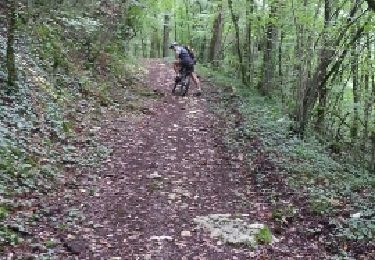
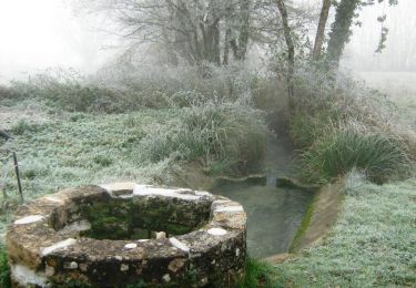
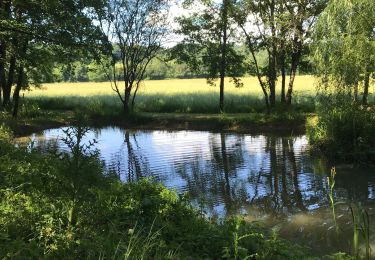
Départ du stade,vers Aubiac,monter sur Costebille, continuer sur le moulin de Paunac,à Murel, rester sur le chemin(si peu d'eau, visite possible du trou de l'oeil) et retour par chemins non empruntés à l'aller.
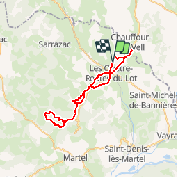
Hoogteprofiel

POI's

POI Chauffour-sur-Vell - Départ/arrivée - Photo
fesseneric
CHAUFFOUR-SUR-VELL 

Plaatsbepaling

Land:
France
Regio :
Occitanië
Departement/Provincie :
Lot
Gemeente :
Cavagnac
Locatie:
Unknown
Vertrek:(Dec)
Vertrek:(UTM)
393364 ; 4984287 (31T) N.

Opmerkingen

Gelieve in te loggen om een commentaar of een beoordeling achter te laten


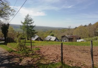
Une rando très sympa sur le causse corrézien avec une belle descente sur le chemin du retour!


Wandeltochten in de omgeving

Tocht Mountainbike Chauffour-sur-Vell - Le bois de l'empire - Photo
Mountainbike
sdroneau

Mountainbike

Moeilijk
(1)
Chauffour-sur-Vell, Nieuw-Aquitanië, Corrèze, France
26 km | 34 km-effort
3h 0min
Ja
Tocht Mountainbike Chauffour-sur-Vell - Aux confins du Quercy - Chauffour sur Vell - Pays de la vallée de la Dordogne Corrézienne  - Photo
Mountainbike
tracegps

Mountainbike

Medium
(1)
Chauffour-sur-Vell, Nieuw-Aquitanië, Corrèze, France
15,5 km | 18,7 km-effort
1h 19min
Ja
Tocht Mountainbike Meyssac - Boucle de Meyssac à Beynat   - Photo
Mountainbike
Gpoujade

Mountainbike

Moeilijk
(1)
Meyssac, Nieuw-Aquitanië, Corrèze, France
40 km | 53 km-effort
3h 0min
Ja
Tocht Mountainbike Chauffour-sur-Vell - 2019-12-28_17h26m41_L'Hôpital(32km) - Photo
Mountainbike
Gpoujade

Mountainbike

Moeilijk
(1)
Chauffour-sur-Vell, Nieuw-Aquitanië, Corrèze, France
32 km | 41 km-effort
2h 48min
Ja
Tocht Mountainbike Chauffour-sur-Vell - curemonte/Collonges:la boucle verte - Photo
Mountainbike
fesseneric

Mountainbike

Medium
(1)
Chauffour-sur-Vell, Nieuw-Aquitanië, Corrèze, France
31 km | 39 km-effort
2h 31min
Ja
Tocht Mountainbike Meyssac - Sortie du 6 juin 2021 - Photo
Mountainbike
Gpoujade

Mountainbike

Moeilijk
(1)
Meyssac, Nieuw-Aquitanië, Corrèze, France
27 km | 35 km-effort
2h 34min
Ja
Tocht Mountainbike Meyssac - Meyssac 30 - Photo
Mountainbike
Gpoujade

Mountainbike

Moeilijk
(1)
Meyssac, Nieuw-Aquitanië, Corrèze, France
29 km | 37 km-effort
1h 50min
Ja
Tocht Mountainbike Meyssac - 2020-10-09_21h28m24_collonges-turenne-chaise du diable - Photo
Mountainbike
Gpoujade

Mountainbike

Zeer moeilijk
Meyssac, Nieuw-Aquitanië, Corrèze, France
46 km | 62 km-effort
4h 35min
Ja
Tocht Stappen Cavagnac - Cavagnac nature - Photo
Stappen
Gaillard Isabelle

Stappen

Cavagnac, Occitanië, Lot, France
6,2 km | 7,8 km-effort
1h 29min
Ja


Sluiten
Mijn abonnementen