Tocht Stappen Belforêt-en-Perche - 2-La Perrièe_Saint Germain-de-la-Coudre - Photo

2-La Perrièe_Saint Germain-de-la-Coudre

 jeanad
jeanad

Gebruiker

© OpenStreetMap contributors
Lengte
Lengte
28 km
Max. hoogte
Max. hoogte
239 m
Positief hoogteverschil
453 m
Km-Effort
Km-Effort  
34 km
Min. hoogte
Min. hoogte
109 m
Negatief hoogteverschil
530 m
Boucle
Boucle
Neen
Datum van aanmaak :
2020-07-14 12:04:36.026
Laatste wijziging :
2020-07-14 12:04:36.026

(0 Bericht)

Stappen
Stappen
--
Moeilijkheid : Onbekend

Scan deze QR-code om de tocht te openen in de SityTrail-applicatie

Gratisgps-wandelapplicatie

Logo SityTrail SityTrail

IGN / Geografische instituten

SityTrail uit de App Store downloaden SityTrail uit Google Play downloaden

Logo SityTrail SityTrail World

De wereld gaat voor u open

SityTrail uit de App Store downloaden SityTrail uit Google Play downloaden SityTrail op Huawei AppGallery downloaden

Over ons

Tocht Stappen van 28 km beschikbaar op Normandië, Orne, Belforêt-en-Perche. Deze tocht wordt voorgesteld door jeanad.

Beschrijving

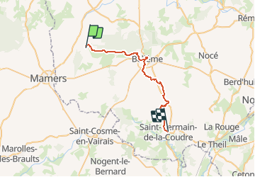
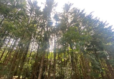
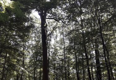
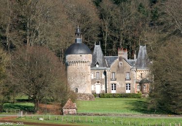
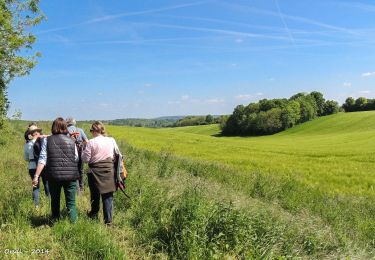
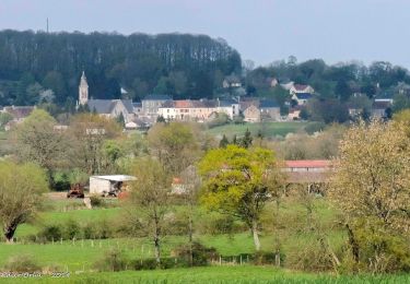
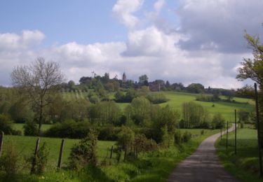
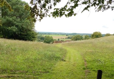
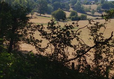
Cette randonnée, septième étape d’un circuit de huit jours et de 220km, le Tour des Collines du Perche, proposé par Itinéraires Ruraux, vous fera longer la forêt de Bellême jusqu’à atteindre l’un des fleurons du Perche ornais, Bellême, que vous ne manquerez pas de visiter. Puis la trace reprend une direction sud pour passer à La-Chapelle-Souëf puis St Germain de la Coudre. Un autre chemin, entre la Perrière et St Germain, via Vaunoise, vous est aussi proposé (voir le parcours sur ce même site).
L'ensemble des étapes du Tour des Collines du perche (disponibles sur ce même site) :
1 : Nogent le Rotrou Rémalard
2 : Rémalard - Moutiers au Perche
3 : Moutiers au Perche - La Ferté Vidame
4 : La Ferté Vidame - Tourouvre
5 : Tourouvre - Mortagne au Perche
6 : Mortagne au Perche - La Perrière
7 : La Perrière - Saint Germain de la coudre (deux variantes : via Vaunoise ou via Bellême)
8 : Saint Germain de la Coudre - Nogent le Rotrou

Hoogteprofiel

Plaatsbepaling

Land:
France
Regio :
Normandië
Departement/Provincie :
Orne
Gemeente :
Belforêt-en-Perche
Locatie:
Unknown
Vertrek:(Dec)
Vertrek:(UTM)
310665 ; 5362727 (31U) N.

Wandeltochten in de omgeving

Tocht Stappen Belforêt-en-Perche - La Perrière, forêt et village - Photo
Stappen
jeannine grandjean

Stappen

Moeilijk
Belforêt-en-Perche, Normandië, Orne, France
11,1 km | 13,8 km-effort
3h 8min
Ja
Tocht Stappen Belforêt-en-Perche - le chêne de l'école - Photo
Stappen
fournieralain

Stappen

Heel gemakkelijk
Belforêt-en-Perche, Normandië, Orne, France
15,7 km | 19,7 km-effort
6h 47min
Ja
Tocht Stappen Belforêt-en-Perche -  La Perrière - Saint-Germain-de-la-Coudre via Bellême (TCP) 28 km - Photo
Stappen

Stappen

Medium
Belforêt-en-Perche, Normandië, Orne, France
28 km | 35 km-effort
7h 16min
Neen
Tocht Stappen Belforêt-en-Perche - La Perrière - Saint-Germain-de-la-Coudre via Igé (TCP) 27 km - Photo
Stappen

Stappen

Gemakkelijk
Belforêt-en-Perche, Normandië, Orne, France
27 km | 33 km-effort
7h 2min
Neen
Tocht Stappen Belforêt-en-Perche - La Perrière - Mortagne-au-Perche (TCP) 29 km - Photo
Stappen

Stappen

Moeilijk
Belforêt-en-Perche, Normandië, Orne, France
29 km | 34 km-effort
7h 18min
Neen
Tocht Stappen Belforêt-en-Perche - La Perrière : village millénaire - Photo
Stappen
tracegps

Stappen

Medium
Belforêt-en-Perche, Normandië, Orne, France
11,1 km | 14 km-effort
3h 0min
Ja
Tocht Stappen Belforêt-en-Perche - la perrière par la forêt  - Photo
Stappen
Krissray

Stappen

Medium
Belforêt-en-Perche, Normandië, Orne, France
5,6 km | 7,6 km-effort
1h 45min
Ja
Tocht Stappen Belforêt-en-Perche - fourneaux gr jusqu'au ruisseau - Photo
Stappen
Krissray

Stappen

Medium
Belforêt-en-Perche, Normandië, Orne, France
5 km | 6,7 km-effort
1h 15min
Ja
Tocht Auto Belforêt-en-Perche - 2023-12-6 Bellême VduP - Photo
Auto
patrick2m

Auto

Belforêt-en-Perche, Normandië, Orne, France
47 km | 56 km-effort
2h 48min
Neen


Sluiten
Mijn abonnementen