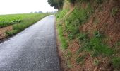

chemin de hallage et crête.

Luc Gengoux
Gebruiker

Lengte
9,8 km

Max. hoogte
104 m

Positief hoogteverschil
137 m

Km-Effort
11,6 km

Min. hoogte
5 m

Negatief hoogteverschil
138 m
Boucle
Ja
Datum van aanmaak :
2020-07-15 08:48:56.662
Laatste wijziging :
2020-07-18 10:51:35.733
2h34
Moeilijkheid : Heel gemakkelijk

Gratisgps-wandelapplicatie
Over ons
Tocht Stappen van 9,8 km beschikbaar op Hauts-de-France, Somme, Pont-Remy. Deze tocht wordt voorgesteld door Luc Gengoux.
Beschrijving
La randonnée commence le long de la somme avant de nous emmener dans les hauteurs. Le moment de vues imprenables sur la vallées.
Plaatsbepaling
Land:
France
Regio :
Hauts-de-France
Departement/Provincie :
Somme
Gemeente :
Pont-Remy
Locatie:
Unknown
Vertrek:(Dec)
Vertrek:(UTM)
421662 ; 5545155 (31U) N.
Opmerkingen
Wandeltochten in de omgeving
Le Moulin d'Eaucourt


Te voet
Gemakkelijk
Eaucourt-sur-Somme,
Hauts-de-France,
Somme,
France

5,8 km | 7,3 km-effort
1h 39min
Ja

Les Bords de Somme


Te voet
Gemakkelijk
Long,
Hauts-de-France,
Somme,
France

7,9 km | 8,4 km-effort
1h 54min
Ja

Les Hauts de Long


Te voet
Gemakkelijk
Fontaine-sur-Somme,
Hauts-de-France,
Somme,
France

9,1 km | 11 km-effort
2h 29min
Ja
le moulin d'Eaucourt


Stappen
Gemakkelijk
Eaucourt-sur-Somme,
Hauts-de-France,
Somme,
France

7,4 km | 9,1 km-effort
2h 23min
Ja
Une randonnée rythmée par les étangs.


Stappen
Heel gemakkelijk
Long,
Hauts-de-France,
Somme,
France

6,7 km | 7,1 km-effort
1h 53min
Neen
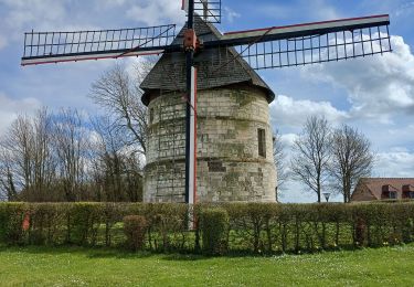
lp80_eaucourt


Stappen
Medium
Eaucourt-sur-Somme,
Hauts-de-France,
Somme,
France

7,2 km | 8,9 km-effort
2h 1min
Ja

Les Etangs et Marais de Mareuil-Caubert


Te voet
Gemakkelijk
Mareuil-Caubert,
Hauts-de-France,
Somme,
France

3,4 km | 3,6 km-effort
48min
Neen

Autour du bois de Bailleul


Te voet
Gemakkelijk
Bailleul,
Hauts-de-France,
Somme,
France

7,6 km | 9,9 km-effort
2h 14min
Neen

Les Hauts de Pont-Rémy


Te voet
Gemakkelijk
Pont-Remy,
Hauts-de-France,
Somme,
France

9,6 km | 11,4 km-effort
2h 35min
Ja


 SityTrail


