Tocht Lopen Toulouse - L1 - Photo
 Laurent-Fornt
Laurent-Fornt

Gebruiker

© OpenStreetMap contributors
Lengte
Lengte
8,8 km
Max. hoogte
Max. hoogte
211 m
Positief hoogteverschil
145 m
Km-Effort
Km-Effort  
10,7 km
Min. hoogte
Min. hoogte
139 m
Negatief hoogteverschil
141 m
Boucle
Boucle
Ja
Datum van aanmaak :
2020-07-22 05:56:16.0
Laatste wijziging :
2020-07-22 07:17:58.066

(0 Bericht)

Lopen
Lopen
1h15
Moeilijkheid : Onbekend

Scan deze QR-code om de tocht te openen in de SityTrail-applicatie

Gratisgps-wandelapplicatie

Logo SityTrail SityTrail

IGN / Geografische instituten

SityTrail uit de App Store downloaden SityTrail uit Google Play downloaden

Logo SityTrail SityTrail World

De wereld gaat voor u open

SityTrail uit de App Store downloaden SityTrail uit Google Play downloaden SityTrail op Huawei AppGallery downloaden

Over ons

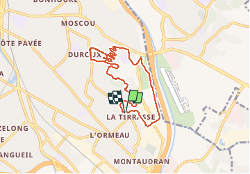
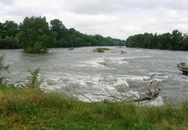
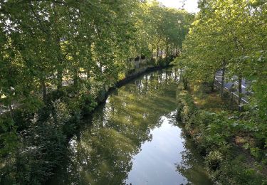
Tocht Lopen van 8,8 km beschikbaar op Occitanië, Haute-Garonne, Toulouse. Deze tocht wordt voorgesteld door Laurent-Fornt.

Hoogteprofiel

Plaatsbepaling

Land:
France
Regio :
Occitanië
Departement/Provincie :
Haute-Garonne
Gemeente :
Toulouse
Locatie:
Unknown
Vertrek:(Dec)
Vertrek:(UTM)
377888 ; 4826714 (31T) N.

Wandeltochten in de omgeving

Tocht Stappen Toulouse - De Toulouse à Bouconne par le GR653 - Photo
Stappen
tracegps

Stappen

Moeilijk
(1)
Toulouse, Occitanië, Haute-Garonne, France
21 km | 24 km-effort
5h 0min
Neen
Tocht Stappen Toulouse - Tour de Toulouse par la Garonne  - Photo
Stappen
CooolGeorges

Stappen

Medium
Toulouse, Occitanië, Haute-Garonne, France
9,3 km | 11 km-effort
2h 35min
Ja
Tocht Hybride fiets Quint-Fonsegrives - Sainte-Foy d'Aigrefeuille Teulat Gragnague - Photo
Hybride fiets
mipi31

Hybride fiets

Medium
Quint-Fonsegrives, Occitanië, Haute-Garonne, France
57 km | 69 km-effort
3h 52min
Ja
Tocht Stappen Toulouse - Toulouse - Pinsaguel  - Photo
Stappen
zazibelle

Stappen

Gemakkelijk
(1)
Toulouse, Occitanië, Haute-Garonne, France
15,6 km | 17,5 km-effort
4h 59min
Neen
Tocht Mountainbike Toulouse - La Garonne de Toulouse vers Blagnac - Photo
Mountainbike
tracegps

Mountainbike

Medium
Toulouse, Occitanië, Haute-Garonne, France
31 km | 35 km-effort
2h 0min
Ja
Tocht Stappen Toulouse - SityTrail - TT22 - Toulouse - Saouzelong - simple - Photo
Stappen

Stappen

Gemakkelijk
Toulouse, Occitanië, Haute-Garonne, France
5,8 km | 6,3 km-effort
1h 30min
Neen
Tocht Stappen Toulouse - Toulouse : le Ramier  - Photo
Stappen
richardsimopons

Stappen

Toulouse, Occitanië, Haute-Garonne, France
8 km | 9,3 km-effort
1h 46min
Neen
Tocht Hybride fiets Quint-Fonsegrives - Entre Saune  et Sausse - Photo
Hybride fiets
mipi31

Hybride fiets

Medium
Quint-Fonsegrives, Occitanië, Haute-Garonne, France
51 km | 58 km-effort
3h 17min
Ja
Tocht Stappen Ramonville-Saint-Agne - TT19 - Ramonville - Photo
Stappen

Stappen

Medium
Ramonville-Saint-Agne, Occitanië, Haute-Garonne, France
9,4 km | 10,5 km-effort
2h 21min
Neen


Sluiten
Mijn abonnementen