Tocht Stappen Stosswihr - Gaschney - Frankenthal - Hohneck - Schiessroth - Photo

Gaschney - Frankenthal - Hohneck - Schiessroth

 VacheKiri67
VacheKiri67

Gebruiker

© OpenStreetMap contributors
Lengte
Lengte
9,3 km
Max. hoogte
Max. hoogte
1351 m
Positief hoogteverschil
472 m
Km-Effort
Km-Effort  
15,6 km
Min. hoogte
Min. hoogte
982 m
Negatief hoogteverschil
472 m
Boucle
Boucle
Ja
Datum van aanmaak :
2020-09-13 08:29:47.315
Laatste wijziging :
2020-09-19 14:14:51.504

(0 Bericht)

Stappen
Stappen
3h39
Moeilijkheid : Medium

Scan deze QR-code om de tocht te openen in de SityTrail-applicatie

Gratisgps-wandelapplicatie

Logo SityTrail SityTrail

IGN / Geografische instituten

SityTrail uit de App Store downloaden SityTrail uit Google Play downloaden

Logo SityTrail SityTrail World

De wereld gaat voor u open

SityTrail uit de App Store downloaden SityTrail uit Google Play downloaden SityTrail op Huawei AppGallery downloaden

Over ons

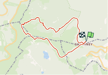
Tocht Stappen van 9,3 km beschikbaar op Grand Est, Haut-Rhin, Stosswihr. Deze tocht wordt voorgesteld door VacheKiri67.

Beschrijving

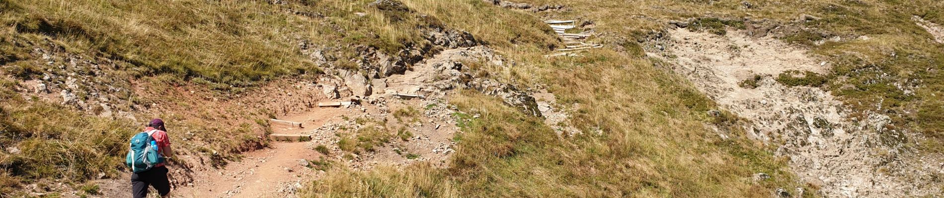
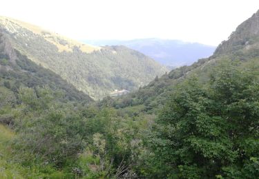
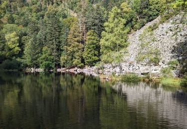
Faite le 13/09/2020. Départ : parking de la station de ski du Gaschney. Durée indiqué pour le circuit : 4h30. Bonnes chaussures indispensables. La montée du col du Falimont constitue la difficulté du parcours ( 300m) mais elle constitue aussi le grand charme de cette randonnée.

Hoogteprofiel

Foto's

40 fotos in totaal. Klik op een foto om ze allemaal in de galerij weer te geven.

Plaatsbepaling

Land:
France
Regio :
Grand Est
Departement/Provincie :
Haut-Rhin
Gemeente :
Stosswihr
Locatie:
Unknown
Vertrek:(UTM)
354505 ; 5322073 (32U) N.

Wandeltochten in de omgeving

Tocht Stappen Stosswihr - Tour du belvedere avec le passage sur les crêtes  - Photo
Stappen
ocepee

Stappen

Heel gemakkelijk
(2)
Stosswihr, Grand Est, Haut-Rhin, France
8,5 km | 0 m-effort
2h 28min
Ja
Tocht Stappen La Bresse - Kastelberg des pierres, des lacs, des panoramas magnifiques  - Photo
Stappen
Alfredy

Stappen

Moeilijk
(1)
La Bresse, Grand Est, Vogezen, France
15,1 km | 26 km-effort
6h 11min
Ja
Tocht Stappen Le Valtin - Les Hirschsteine - Photo
Stappen
VacheKiri67

Stappen

Moeilijk
(1)
Le Valtin, Grand Est, Vogezen, France
16,1 km | 25 km-effort
6h 28min
Ja
Tocht Stappen La Bresse - Du Hohneck au Kastelberg par les Spietzkoepfe et le Sentier des Névées - Photo
Stappen
tracegps

Stappen

Zeer moeilijk
(3)
La Bresse, Grand Est, Vogezen, France
7,6 km | 13,7 km-effort
3h 30min
Ja
Tocht Stappen La Bresse - Rainkopf - Mittlach - Hohneck - Photo
Stappen
tracegps

Stappen

Moeilijk
(1)
La Bresse, Grand Est, Vogezen, France
22 km | 41 km-effort
8h 0min
Ja
Tocht Sneeuwschoenen Le Valtin - raquettes  - Photo
Sneeuwschoenen
vathi54

Sneeuwschoenen

Heel gemakkelijk
(1)
Le Valtin, Grand Est, Vogezen, France
6,6 km | 9,4 km-effort
3h 8min
Neen
Tocht Mountainbike Metzeral - Sentier des Névés - Photo
Mountainbike
tracegps

Mountainbike

Zeer moeilijk
(1)
Metzeral, Grand Est, Haut-Rhin, France
33 km | 52 km-effort
6h 0min
Ja
Tocht Stappen Stosswihr - Le cirque glaciaire du Frankenthal - Sentier des Roches -Gps - Photo
Stappen
GUIDE
Desrumaux

Stappen

Moeilijk
(3)
Stosswihr, Grand Est, Haut-Rhin, France
9 km | 16,1 km-effort
4h 10min
Ja
Tocht Stappen Mittlach - 2023-09-24 Marche Mittlach 5 Lacs - Photo
Stappen
GUIDE
holtzv

Stappen

Medium
Mittlach, Grand Est, Haut-Rhin, France
25 km | 41 km-effort
9h 19min
Ja


Sluiten
Mijn abonnementen