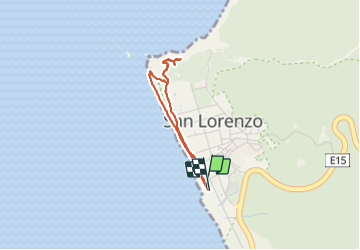
Tocht Stappen San Lorenzo - San Lorenzo - Photo
 gildascb
gildascb

Gebruiker

© OpenStreetMap contributors
Lengte
Lengte
3,8 km
Max. hoogte
Max. hoogte
88 m
Positief hoogteverschil
95 m
Km-Effort
Km-Effort  
5,1 km
Min. hoogte
Min. hoogte
0 m
Negatief hoogteverschil
95 m
Boucle
Boucle
Ja
Datum van aanmaak :
2020-10-09 21:56:06.263
Laatste wijziging :
2021-08-12 15:50:46.263

(0 Bericht)

Stappen
Stappen
1h35
Moeilijkheid : Heel gemakkelijk

Scan deze QR-code om de tocht te openen in de SityTrail-applicatie

Gratisgps-wandelapplicatie

Logo SityTrail SityTrail

IGN / Geografische instituten

SityTrail uit de App Store downloaden SityTrail uit Google Play downloaden

Logo SityTrail SityTrail World

De wereld gaat voor u open

SityTrail uit de App Store downloaden SityTrail uit Google Play downloaden SityTrail op Huawei AppGallery downloaden

Over ons

Tocht Stappen van 3,8 km beschikbaar op Manabí, Manta, San Lorenzo. Deze tocht wordt voorgesteld door gildascb.

Beschrijving

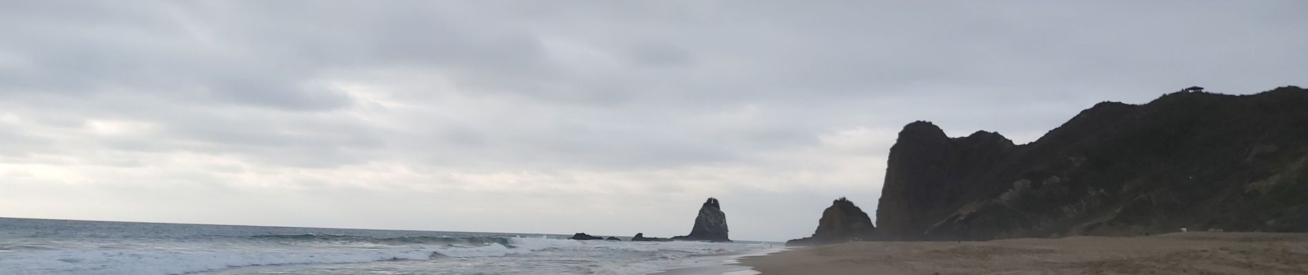
Pueblo pequeño y muy tranquilo en la costa. Un camino a lo largo de la playa le permite subir unas escaleras en un cerro que ofrece una vista espectacular sobre la playa.
Nota: Lugar de anidación de tortugas.

Hoogteprofiel

Foto's

Plaatsbepaling

Land:
Ecuador
Regio :
Manabí
Departement/Provincie :
Manta
Gemeente :
San Lorenzo
Locatie:
Unknown
Vertrek:(UTM)
510282 ; 9881769 (17M) Z.

Wandeltochten in de omgeving


Sluiten
Mijn abonnementen