Tocht Stappen Saint-Philbert-sur-Orne - Circuit des Méandres - Photo
 yannick-p
yannick-p

Gebruiker

© OpenStreetMap contributors
Lengte
Lengte
13,7 km
Max. hoogte
Max. hoogte
163 m
Positief hoogteverschil
337 m
Km-Effort
Km-Effort  
18,2 km
Min. hoogte
Min. hoogte
51 m
Negatief hoogteverschil
334 m
Boucle
Boucle
Ja
Datum van aanmaak :
2016-10-12 00:00:00.0
Laatste wijziging :
2020-11-28 15:28:56.892

(0 Bericht)

Stappen
Stappen
2h40
Moeilijkheid : Medium
Geocaching
Geocaching
5h00
Moeilijkheid : Moeilijk

Scan deze QR-code om de tocht te openen in de SityTrail-applicatie

Gratisgps-wandelapplicatie

Logo SityTrail SityTrail

IGN / Geografische instituten

SityTrail uit de App Store downloaden SityTrail uit Google Play downloaden

Logo SityTrail SityTrail World

De wereld gaat voor u open

SityTrail uit de App Store downloaden SityTrail uit Google Play downloaden SityTrail op Huawei AppGallery downloaden

Over ons

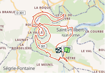
Tocht Stappen van 13,7 km beschikbaar op Normandië, Orne, Saint-Philbert-sur-Orne. Deze tocht wordt voorgesteld door yannick-p.

Beschrijving

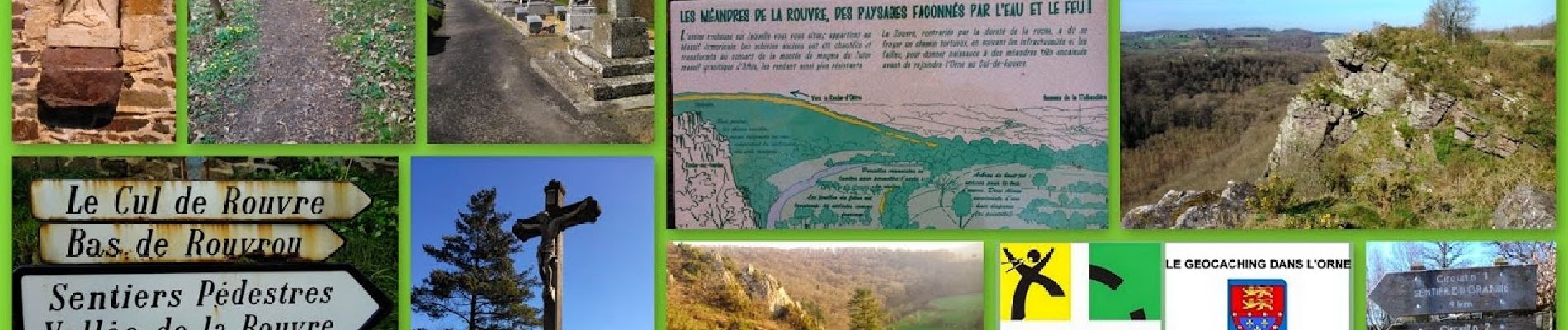
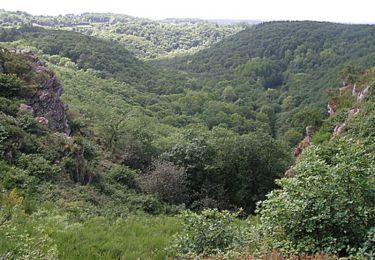
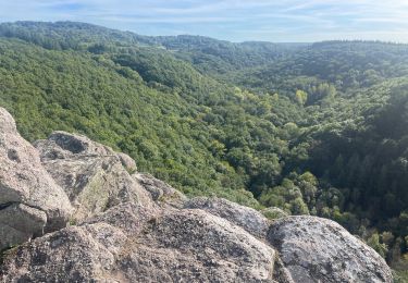
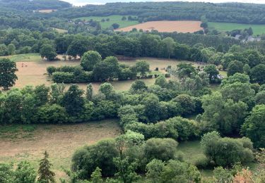
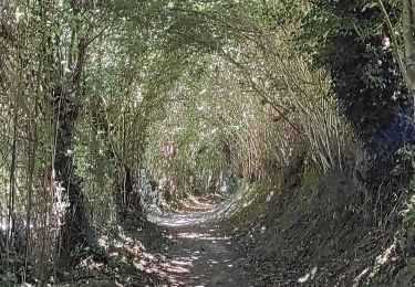
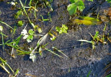
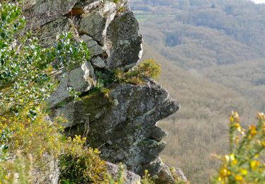
Venez découvrir les paysages époustouflants des gorges de la Rouvre et de ses méandres sur ce 2ème circuit à partir du belvédère de la Roche d'Oëtre au cœur de la Suisse Normande. En aval des gorges, cette balade de 13 kms vous révèlera ses trésors géologiques, historiques, faunistiques, floristiques et biensûr "géocachingstiques". Vous pouvez suivre le circuit que je mets en ligne avec un road book des différentes caches du parcours.

A la ?n de la période glacière, la Rouvre, large et puissante, a creusé le plateau granitique et formé les gorges que l’on connaît aujourd’hui. Bien que son lit soit plus étroit à présent, elle a conservé son caractère torrentiel.


Le circuit comprend 27 caches, dont 1 cache mystère (la Bonus) et 1 earthcache.

Bonnes recherches et bonnes découvertes !!!

https://coord.info/GC52CJ2

Hoogteprofiel

Foto's

Plaatsbepaling

Land:
France
Regio :
Normandië
Departement/Provincie :
Orne
Gemeente :
Saint-Philbert-sur-Orne
Locatie:
Unknown
Vertrek:(Dec)
Vertrek:(UTM)
692144 ; 5411820 (30U) N.

Wandeltochten in de omgeving

Tocht Mountainbike Pont-d'Ouilly - La Petite Suisse Normande 2014 - Pont-d'Ouilly - Photo
Mountainbike
tracegps

Mountainbike

Moeilijk
(1)
Pont-d'Ouilly, Normandië, Calvados, France
41 km | 54 km-effort
3h 30min
Ja
Tocht Stappen Saint-Philbert-sur-Orne - Autour des roches d'oetre - Photo
Stappen
phi14

Stappen

Gemakkelijk
(3)
Saint-Philbert-sur-Orne, Normandië, Orne, France
9,7 km | 12,4 km-effort
2h 30min
Ja
Tocht Stappen Athis-Val-de-Rouvre - Rando botanique  - Ségrie Fontaine  - Photo
Stappen
tracegps

Stappen

Medium
(2)
Athis-Val-de-Rouvre, Normandië, Orne, France
10,4 km | 13,4 km-effort
3h 40min
Ja
Tocht Stappen Saint-Philbert-sur-Orne - Roche d’oëtre sentier du Granite - Photo
Stappen
zefreefly

Stappen

Heel gemakkelijk
Saint-Philbert-sur-Orne, Normandië, Orne, France
10,1 km | 12,7 km-effort
2h 43min
Ja
Tocht Stappen Saint-Philbert-sur-Orne - Circuit des méandres  - Photo
Stappen
JLPIERSON

Stappen

Medium
Saint-Philbert-sur-Orne, Normandië, Orne, France
6,4 km | 8,4 km-effort
1h 54min
Ja
Tocht Stappen Ménil-Hubert-sur-Orne - De Rouvroy aux Roches d'Oetre par le sentier des Méandres  - Photo
Stappen
Ecureuiltrailer

Stappen

Medium
Ménil-Hubert-sur-Orne, Normandië, Orne, France
7,1 km | 9,3 km-effort
2h 1min
Ja
Tocht Te voet Athis-Val-de-Rouvre - Les Fontaines - Photo
Te voet
PRO

Te voet

Gemakkelijk
Athis-Val-de-Rouvre, Normandië, Orne, France
5,7 km | 7,3 km-effort
1h 38min
Ja
Tocht Te voet Athis-Val-de-Rouvre - Sentier du granite - Photo
Te voet
PRO

Te voet

Gemakkelijk
(1)
Athis-Val-de-Rouvre, Normandië, Orne, France
8,6 km | 11 km-effort
2h 30min
Ja
Tocht Te voet Saint-Philbert-sur-Orne - Entre Orne et Rouvre - Photo
Te voet
PRO

Te voet

Gemakkelijk
Saint-Philbert-sur-Orne, Normandië, Orne, France
7,7 km | 10,3 km-effort
2h 19min
Ja


Sluiten
Mijn abonnementen