Tocht Stappen Rogéville - ROGEVILLE - LA PETITE SUISSE PAR MAMEY ET GEZONCOURT - Photo

ROGEVILLE - LA PETITE SUISSE PAR MAMEY ET GEZONCOURT

© OpenStreetMap contributors
Lengte
Lengte
23 km
Max. hoogte
Max. hoogte
342 m
Positief hoogteverschil
464 m
Km-Effort
Km-Effort  
29 km
Min. hoogte
Min. hoogte
206 m
Negatief hoogteverschil
463 m
Boucle
Boucle
Ja
Datum van aanmaak :
2021-04-22 06:38:12.213
Laatste wijziging :
2021-04-22 15:35:37.38

(0 Bericht)

Stappen
Stappen
7h53
Moeilijkheid : Medium

Scan deze QR-code om de tocht te openen in de SityTrail-applicatie

Gratisgps-wandelapplicatie

Logo SityTrail SityTrail

IGN / Geografische instituten

SityTrail uit de App Store downloaden SityTrail uit Google Play downloaden

Logo SityTrail SityTrail World

De wereld gaat voor u open

SityTrail uit de App Store downloaden SityTrail uit Google Play downloaden SityTrail op Huawei AppGallery downloaden

Over ons

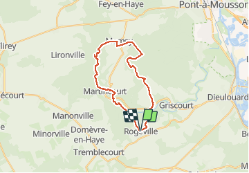
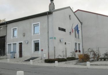
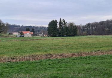
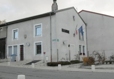
Tocht Stappen van 23 km beschikbaar op Grand Est, Meurthe-et-Moselle, Rogéville. Deze tocht wordt voorgesteld door jean-marie.parachini.

Beschrijving

randonnée à travers la Petite Suisse par les forêts de Rogeville Mamey et Gezoncourt.

Hoogteprofiel

Foto's

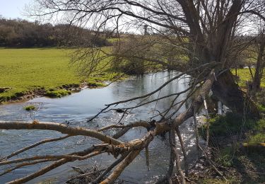
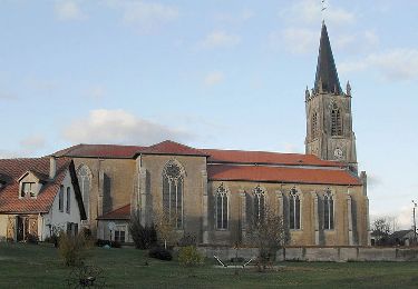
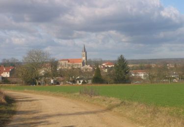
22 fotos in totaal. Klik op een foto om ze allemaal in de galerij weer te geven.

Plaatsbepaling

Land:
France
Regio :
Grand Est
Departement/Provincie :
Meurthe-et-Moselle
Gemeente :
Rogéville
Locatie:
Unknown
Vertrek:(UTM)
718802 ; 5411697 (31U) N.

Wandeltochten in de omgeving

Tocht Stappen Gézoncourt - GEZONCOURT - PETITE SUISSE LORRAINE - Photo
Stappen
jean-marie.parachini

Stappen

Heel gemakkelijk
Gézoncourt, Grand Est, Meurthe-et-Moselle, France
8,5 km | 10,3 km-effort
5h 9min
Ja
Tocht Paard Saizerais - Le Bois St Ignon - Saizerais - Photo
Paard
tracegps

Paard

Gemakkelijk
Saizerais, Grand Est, Meurthe-et-Moselle, France
6,9 km | 8 km-effort
1h 15min
Ja
Tocht Mountainbike Saizerais - Le Bois St Ignon - Saizerais - Photo
Mountainbike
tracegps

Mountainbike

Gemakkelijk
Saizerais, Grand Est, Meurthe-et-Moselle, France
6,9 km | 8 km-effort
45min
Ja
Tocht Stappen Saizerais - Le Bois St Ignon - Saizerais - Photo
Stappen
tracegps

Stappen

Gemakkelijk
Saizerais, Grand Est, Meurthe-et-Moselle, France
6,9 km | 8 km-effort
1h 45min
Ja
Tocht Paard Saizerais - La Cense St Paul - Saizerais - Photo
Paard
tracegps

Paard

Gemakkelijk
Saizerais, Grand Est, Meurthe-et-Moselle, France
6,2 km | 7,1 km-effort
1h 0min
Ja
Tocht Mountainbike Saizerais - La Cense St Paul - Saizerais - Photo
Mountainbike
tracegps

Mountainbike

Gemakkelijk
Saizerais, Grand Est, Meurthe-et-Moselle, France
6,2 km | 7,1 km-effort
30min
Ja
Tocht Stappen Saizerais - La Cense St Paul - Saizerais - Photo
Stappen
tracegps

Stappen

Gemakkelijk
Saizerais, Grand Est, Meurthe-et-Moselle, France
6,2 km | 7,1 km-effort
1h 30min
Ja
Tocht Stappen Martincourt - Martincourt - St Jean - Photo
Stappen
jean-marie.parachini

Stappen

Gemakkelijk
Martincourt, Grand Est, Meurthe-et-Moselle, France
11,9 km | 14,7 km-effort
4h 0min
Ja
Tocht Te voet Rosières-en-Haye - Circuit des 4 Vents - Photo
Te voet
PRO

Te voet

Gemakkelijk
Rosières-en-Haye, Grand Est, Meurthe-et-Moselle, France
14,1 km | 15,9 km-effort
3h 36min
Ja


Sluiten
Mijn abonnementen