Tocht Wegfiets Pont-Péan - chauteaugiron - Photo
 tagada35
tagada35

Gebruiker

© OpenStreetMap contributors
Lengte
Lengte
63 km
Max. hoogte
Max. hoogte
93 m
Positief hoogteverschil
576 m
Km-Effort
Km-Effort  
70 km
Min. hoogte
Min. hoogte
22 m
Negatief hoogteverschil
576 m
Boucle
Boucle
Neen
Datum van aanmaak :
2021-05-01 11:59:12.821
Laatste wijziging :
2021-05-03 18:17:59.89

(0 Bericht)

Wegfiets
Wegfiets
3h07
Moeilijkheid : Zeer moeilijk

Scan deze QR-code om de tocht te openen in de SityTrail-applicatie

Gratisgps-wandelapplicatie

Logo SityTrail SityTrail

IGN / Geografische instituten

SityTrail uit de App Store downloaden SityTrail uit Google Play downloaden

Logo SityTrail SityTrail World

De wereld gaat voor u open

SityTrail uit de App Store downloaden SityTrail uit Google Play downloaden SityTrail op Huawei AppGallery downloaden

Over ons

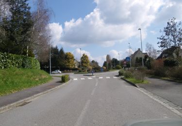
Tocht Wegfiets van 63 km beschikbaar op Bretagne, Ille-et-Vilaine, Pont-Péan. Deze tocht wordt voorgesteld door tagada35.

Beschrijving

Sortie Route.
Départ Pont péan, Orgères, St Erblon, Vern sur seiche, BOis de soeuvre, Chantepie, Cesson, Noyal sur Vilaine, Chateaugiron, St Armel, Bourgbarré, Orgères, Pont péan.
Circuit avec très peu de grandes rooutes.

Hoogteprofiel

Plaatsbepaling

Land:
France
Regio :
Bretagne
Departement/Provincie :
Ille-et-Vilaine
Gemeente :
Pont-Péan
Locatie:
Unknown
Vertrek:(UTM)
596856 ; 5317922 (30U) N.

Wandeltochten in de omgeving

Tocht Mountainbike Pont-Péan - Le long de la Vilaine - Pont Péan - Photo
Mountainbike
tracegps

Mountainbike

Moeilijk
(1)
Pont-Péan, Bretagne, Ille-et-Vilaine, France
35 km | 41 km-effort
2h 15min
Ja
Tocht Stappen Pont-Péan - Randonnée autour de Pont-Péan - Photo
Stappen
tracegps

Stappen

Medium
(1)
Pont-Péan, Bretagne, Ille-et-Vilaine, France
7,9 km | 8,5 km-effort
2h 0min
Ja
Tocht Te voet Laillé - Laillé la Chapelle - Photo
Te voet
PRO

Te voet

Gemakkelijk
Laillé, Bretagne, Ille-et-Vilaine, France
13,2 km | 15,6 km-effort
3h 33min
Ja
Tocht Te voet Guichen - Les bords de Vilaine - Photo
Te voet
PRO

Te voet

Gemakkelijk
Guichen, Bretagne, Ille-et-Vilaine, France
6,9 km | 8,4 km-effort
1h 54min
Ja
Tocht Te voet Noyal-Châtillon-sur-Seiche - Circuit de La Touche - Photo
Te voet
PRO

Te voet

Gemakkelijk
Noyal-Châtillon-sur-Seiche, Bretagne, Ille-et-Vilaine, France
9,6 km | 10,5 km-effort
2h 23min
Ja
Tocht Te voet Noyal-Châtillon-sur-Seiche - Circuit de l'Orson - Photo
Te voet
PRO

Te voet

Gemakkelijk
Noyal-Châtillon-sur-Seiche, Bretagne, Ille-et-Vilaine, France
8,2 km | 8,9 km-effort
2h 1min
Ja
Tocht Stappen Laillé - Laillé, Roche qui chome - Photo
Stappen
nolsim

Stappen

Heel gemakkelijk
Laillé, Bretagne, Ille-et-Vilaine, France
11,4 km | 13,1 km-effort
2h 40min
Ja
Tocht Te voet Orgères - Circuit d'Orgerblon - Photo
Te voet
PRO

Te voet

Gemakkelijk
Orgères, Bretagne, Ille-et-Vilaine, France
9,9 km | 10,9 km-effort
2h 28min
Neen
Tocht Te voet Orgères - Circuit des deux Monts et du Télégraphe - Photo
Te voet
PRO

Te voet

Gemakkelijk
Orgères, Bretagne, Ille-et-Vilaine, France
6,2 km | 7,4 km-effort
1h 40min
Ja


Sluiten
Mijn abonnementen