Tocht Fietstoerisme Lescar - SityTrail - 014 Final Lescar to Oloron - Photo

SityTrail - 014 Final Lescar to Oloron

 Piper.Classique
Piper.Classique

Gebruiker

© OpenStreetMap contributors
Lengte
Lengte
35 km
Max. hoogte
Max. hoogte
333 m
Positief hoogteverschil
593 m
Km-Effort
Km-Effort  
43 km
Min. hoogte
Min. hoogte
142 m
Negatief hoogteverschil
526 m
Boucle
Boucle
Neen
Datum van aanmaak :
2021-06-30 14:06:36.475
Laatste wijziging :
2021-07-11 16:00:54.263

(0 Bericht)

Fietstoerisme
Fietstoerisme
--
Moeilijkheid : Heel gemakkelijk
Elektrische fiets
Elektrische fiets
--
Moeilijkheid : Heel gemakkelijk

Scan deze QR-code om de tocht te openen in de SityTrail-applicatie

Gratisgps-wandelapplicatie

Logo SityTrail SityTrail

IGN / Geografische instituten

SityTrail uit de App Store downloaden SityTrail uit Google Play downloaden

Logo SityTrail SityTrail World

De wereld gaat voor u open

SityTrail uit de App Store downloaden SityTrail uit Google Play downloaden SityTrail op Huawei AppGallery downloaden

Over ons

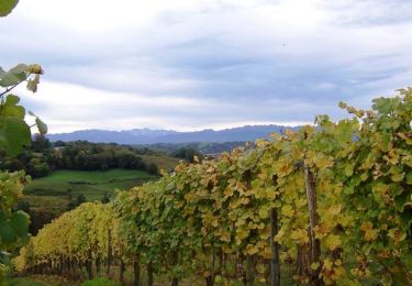
Tocht Fietstoerisme van 35 km beschikbaar op Nieuw-Aquitanië, Pyrénées-Atlantiques, Lescar. Deze tocht wordt voorgesteld door Piper.Classique.

Beschrijving

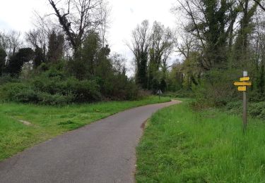
Trying to avoid the worst hills. Tested. Via Bois de Préchilon, which is a bit steep but the nicest bit of the route.

Hoogteprofiel

Plaatsbepaling

Land:
France
Regio :
Nieuw-Aquitanië
Departement/Provincie :
Pyrénées-Atlantiques
Gemeente :
Lescar
Locatie:
Unknown
Vertrek:(UTM)
707989 ; 4801026 (30T) N.

Wandeltochten in de omgeving

Tocht Te voet Lescar - Lescar du 2018-06-24 - Photo
Te voet
GUIDE
marmotte65

Te voet

Heel gemakkelijk
(1)
Lescar, Nieuw-Aquitanië, Pyrénées-Atlantiques, France
7,6 km | 8,6 km-effort
Onbekend
Ja
Tocht Stappen Laroin - Les vignes en terrasses des collines de Jurançon - Photo
Stappen
tracegps

Stappen

Moeilijk
(3)
Laroin, Nieuw-Aquitanië, Pyrénées-Atlantiques, France
19,6 km | 27 km-effort
5h 0min
Ja
Tocht Stappen Siros - SIROS Le sentier du gave M2   3143980 - Photo
Stappen
GUIDE
marmotte65

Stappen

Medium
Siros, Nieuw-Aquitanië, Pyrénées-Atlantiques, France
7,9 km | 8,5 km-effort
1h 54min
Ja
Tocht Mountainbike Aussevielle - siros labastide aussevielle - Photo
Mountainbike
moostic

Mountainbike

Gemakkelijk
(1)
Aussevielle, Nieuw-Aquitanië, Pyrénées-Atlantiques, France
15,6 km | 16,5 km-effort
1h 5min
Ja
Tocht Stappen Artiguelouve - ARTIGUELOUVE LA COMMANDE GR653 G4 - Photo
Stappen
GUIDE
marmotte65

Stappen

Medium
Artiguelouve, Nieuw-Aquitanië, Pyrénées-Atlantiques, France
8,4 km | 11 km-effort
2h 29min
Neen
Tocht Stappen Pau - GR 782 B pont du 14 juillet artiguelouve
Stappen
GUIDE
marmotte65

Stappen

Medium
Pau, Nieuw-Aquitanië, Pyrénées-Atlantiques, France
10,4 km | 11,4 km-effort
2h 38min
Neen
Tocht Stappen Billère - BILLERE   RS les villas Anglo Americaine - Photo
Stappen
GUIDE
marmotte65

Stappen

Gemakkelijk
Billère, Nieuw-Aquitanië, Pyrénées-Atlantiques, France
3,3 km | 3,8 km-effort
1h 5min
Ja
Tocht Stappen Lons - LONS RS Les vignes  3273591 - Photo
Stappen
GUIDE
marmotte65

Stappen

Gemakkelijk
Lons, Nieuw-Aquitanië, Pyrénées-Atlantiques, France
4 km | 4,8 km-effort
1h 10min
Ja
Tocht Stappen Beyrie-en-Béarn - BEYRIE en BEARN promenade autour de Beyrie 3180282 - Photo
Stappen
GUIDE
marmotte65

Stappen

Moeilijk
Beyrie-en-Béarn, Nieuw-Aquitanië, Pyrénées-Atlantiques, France
10,6 km | 13,4 km-effort
2h 59min
Ja


Sluiten
Mijn abonnementen